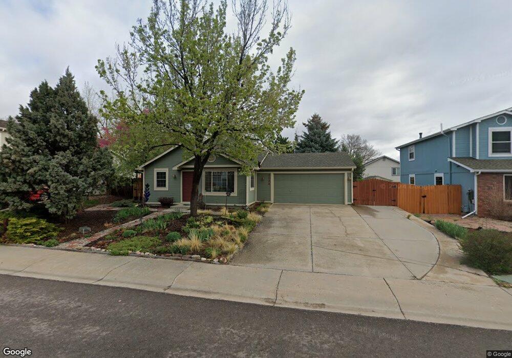
2024 Kent Ct Fort Collins, CO 80526
Rossborough NeighborhoodEstimated Value: $475,000 - $497,000
3
Beds
2
Baths
1,440
Sq Ft
$340/Sq Ft
Est. Value
About This Home
This home is located at 2024 Kent Ct, Fort Collins, CO 80526 and is currently estimated at $489,537, approximately $339 per square foot. 2024 Kent Ct is a home located in Larimer County with nearby schools including Johnson Elementary School, Webber Middle School, and Rocky Mountain High School.
Ownership History
Date
Name
Owned For
Owner Type
Purchase Details
Closed on
Jun 5, 2024
Sold by
Claeys Ann M
Bought by
Ann Claeys Trust
Current Estimated Value
Purchase Details
Closed on
Feb 14, 2003
Sold by
Tonn Jeff and Tonn Adeila
Bought by
Claeys Ann M
Home Financials for this Owner
Home Financials are based on the most recent Mortgage that was taken out on this home.
Original Mortgage
$100,000
Interest Rate
5.9%
Mortgage Type
Purchase Money Mortgage
Purchase Details
Closed on
Apr 28, 2000
Sold by
Spady Karl L
Bought by
Tonn Jeff and Tonn Adeila
Home Financials for this Owner
Home Financials are based on the most recent Mortgage that was taken out on this home.
Original Mortgage
$133,110
Interest Rate
8.21%
Mortgage Type
FHA
Purchase Details
Closed on
Dec 1, 1990
Bought by
Spady Karl L and Spady Marcia
Create a Home Valuation Report for This Property
The Home Valuation Report is an in-depth analysis detailing your home's value as well as a comparison with similar homes in the area
Home Values in the Area
Average Home Value in this Area
Purchase History
| Date | Buyer | Sale Price | Title Company |
|---|---|---|---|
| Ann Claeys Trust | -- | None Listed On Document | |
| Claeys Ann M | $179,500 | -- | |
| Tonn Jeff | $134,000 | -- | |
| Spady Karl L | $67,600 | -- |
Source: Public Records
Mortgage History
| Date | Status | Borrower | Loan Amount |
|---|---|---|---|
| Previous Owner | Claeys Ann M | $100,000 | |
| Previous Owner | Tonn Jeff | $133,110 |
Source: Public Records
Tax History Compared to Growth
Tax History
| Year | Tax Paid | Tax Assessment Tax Assessment Total Assessment is a certain percentage of the fair market value that is determined by local assessors to be the total taxable value of land and additions on the property. | Land | Improvement |
|---|---|---|---|---|
| 2025 | $2,059 | $31,838 | $2,680 | $29,158 |
| 2024 | $1,959 | $31,838 | $2,680 | $29,158 |
| 2022 | $2,172 | $23,005 | $2,780 | $20,225 |
| 2021 | $2,195 | $23,667 | $2,860 | $20,807 |
| 2020 | $2,224 | $23,774 | $2,860 | $20,914 |
| 2019 | $2,234 | $23,774 | $2,860 | $20,914 |
| 2018 | $1,877 | $20,592 | $2,880 | $17,712 |
| 2017 | $1,870 | $20,592 | $2,880 | $17,712 |
| 2016 | $1,567 | $17,170 | $3,184 | $13,986 |
| 2015 | $1,556 | $17,170 | $3,180 | $13,990 |
| 2014 | $1,413 | $15,490 | $3,180 | $12,310 |
Source: Public Records
Map
Nearby Homes
- 2 County Road 19
- 2219 Silver Oaks Dr
- 1819 Birmingham Dr
- 2025 Cheshire St
- 3622 Capitol Dr
- 3717 S Taft Hill Rd
- 3717 S Taft Hill Rd Unit 168
- 3717 S Taft Hill Rd Unit 14
- 3717 S Taft Hill Rd Unit 279
- 3717 S Taft Hill Rd Unit 6
- 3717 S Taft Hill Rd Unit 111
- 3366 Liverpool St
- 3525 Auntie Stone St Unit 8
- 1631 Enfield St
- 3136 Birmingham Dr
- 3502 Big Ben Dr Unit C
- 2415 Dalton Dr
- 3712 Mead St
- 3617 Mead St
- 1539 Corydalis Ct