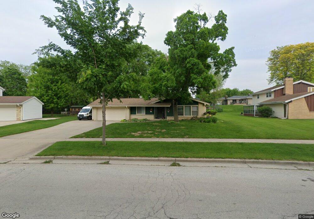
2025 Avalon Dr Waukesha, WI 53186
Estimated Value: $379,000 - $408,000
3
Beds
2
Baths
1,546
Sq Ft
$253/Sq Ft
Est. Value
About This Home
This home is located at 2025 Avalon Dr, Waukesha, WI 53186 and is currently estimated at $391,170, approximately $253 per square foot. 2025 Avalon Dr is a home located in Waukesha County with nearby schools including John F. Miller School, Banting Elementary School, and Horning Middle School.
Ownership History
Date
Name
Owned For
Owner Type
Purchase Details
Closed on
Jun 23, 2006
Sold by
Wein Linda M
Bought by
Rateike Jason M and Rateike Kimberly K
Current Estimated Value
Home Financials for this Owner
Home Financials are based on the most recent Mortgage that was taken out on this home.
Original Mortgage
$115,000
Outstanding Balance
$68,214
Interest Rate
6.73%
Mortgage Type
Purchase Money Mortgage
Estimated Equity
$322,956
Create a Home Valuation Report for This Property
The Home Valuation Report is an in-depth analysis detailing your home's value as well as a comparison with similar homes in the area
Home Values in the Area
Average Home Value in this Area
Purchase History
| Date | Buyer | Sale Price | Title Company |
|---|---|---|---|
| Rateike Jason M | $223,800 | Priority Title Corporation |
Source: Public Records
Mortgage History
| Date | Status | Borrower | Loan Amount |
|---|---|---|---|
| Open | Rateike Jason M | $115,000 |
Source: Public Records
Tax History Compared to Growth
Tax History
| Year | Tax Paid | Tax Assessment Tax Assessment Total Assessment is a certain percentage of the fair market value that is determined by local assessors to be the total taxable value of land and additions on the property. | Land | Improvement |
|---|---|---|---|---|
| 2024 | $5,170 | $347,900 | $70,200 | $277,700 |
| 2023 | $5,029 | $347,900 | $70,200 | $277,700 |
| 2022 | $4,198 | $220,000 | $65,600 | $154,400 |
| 2021 | $4,294 | $220,000 | $65,600 | $154,400 |
| 2020 | $4,153 | $220,000 | $65,600 | $154,400 |
| 2019 | $4,021 | $220,000 | $65,600 | $154,400 |
| 2018 | $3,800 | $203,700 | $56,900 | $146,800 |
| 2017 | $3,792 | $203,700 | $56,900 | $146,800 |
| 2016 | $3,668 | $185,200 | $56,900 | $128,300 |
| 2015 | $3,648 | $185,200 | $56,900 | $128,300 |
| 2014 | $3,728 | $181,600 | $56,900 | $124,700 |
| 2013 | $3,728 | $181,600 | $56,900 | $124,700 |
Source: Public Records
Map
Nearby Homes
- 2109 Melody Ln
- 1729 Stardust Dr Unit B
- 335 Kossow Rd
- 21525 Belgren Rd
- 2423 Kossow Rd
- 1415 Niagara St Unit 109
- 1080 Westbrooke Pkwy
- 1333 Niagara St
- 1112 Gertrude St
- 1116 Josephine St
- 1308 Danny St
- 1471 Cleveland Ave
- 918 Niagara St
- S17W22650 Lincoln Ave
- 1732 S Craftsman Dr
- 937 E Moreland Blvd
- 925 Harding Ave
- 1155 Gray Fox Hollow Ct
- Lt1 Davidson Rd
- 1021 Arcadian Ave
- 2021 Avalon Dr
- 2029 Avalon Dr
- 2022 Avalon Dr
- 2015 Avalon Dr
- 2001 Sunnyside Dr
- 2016 Avalon Dr
- 2000 Ramona Rd
- 1928 Ramona Rd
- 1985 Sunnyside Dr
- 1924 Ramona Rd
- 2004 Ramona Rd
- 2009 Avalon Dr
- 1977 Sunnyside Dr
- 2010 Avalon Dr
- 2010 Ramona Rd
- 1920 Ramona Rd
- 2001 Ramona Rd
- 1927 Ramona Rd
- 2005 Ramona Rd
- 2000 Sunnyside Dr