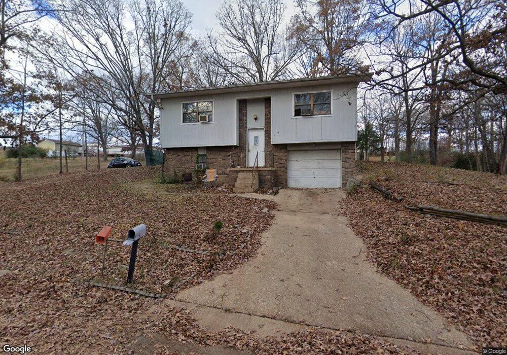
2025 Brentwood Rd Poplar Bluff, MO 63901
Estimated Value: $85,636 - $135,000
--
Bed
--
Bath
1,081
Sq Ft
$107/Sq Ft
Est. Value
About This Home
This home is located at 2025 Brentwood Rd, Poplar Bluff, MO 63901 and is currently estimated at $115,659, approximately $106 per square foot. 2025 Brentwood Rd is a home with nearby schools including Eugene Field Elementary School, Poplar Bluff Fifth & Sixth Grade Center, and Poplar Bluff Junior High School.
Ownership History
Date
Name
Owned For
Owner Type
Purchase Details
Closed on
Mar 2, 2018
Sold by
Mcdowell Jack
Bought by
Gambling Adom and Gambling Bebecca
Current Estimated Value
Purchase Details
Closed on
Aug 30, 2006
Sold by
Mccoy Dennis Wayne and Mccoy Jeana
Bought by
Gambling Adam D and Gambling Rebecca L
Home Financials for this Owner
Home Financials are based on the most recent Mortgage that was taken out on this home.
Original Mortgage
$69,750
Interest Rate
10.2%
Mortgage Type
Adjustable Rate Mortgage/ARM
Create a Home Valuation Report for This Property
The Home Valuation Report is an in-depth analysis detailing your home's value as well as a comparison with similar homes in the area
Home Values in the Area
Average Home Value in this Area
Purchase History
| Date | Buyer | Sale Price | Title Company |
|---|---|---|---|
| Gambling Adom | -- | None Available | |
| Gambling Adam D | -- | -- |
Source: Public Records
Mortgage History
| Date | Status | Borrower | Loan Amount |
|---|---|---|---|
| Previous Owner | Gambling Adam D | $69,750 |
Source: Public Records
Tax History Compared to Growth
Tax History
| Year | Tax Paid | Tax Assessment Tax Assessment Total Assessment is a certain percentage of the fair market value that is determined by local assessors to be the total taxable value of land and additions on the property. | Land | Improvement |
|---|---|---|---|---|
| 2024 | $5 | $10,400 | $0 | $0 |
| 2023 | $502 | $10,400 | $0 | $0 |
| 2022 | $487 | $10,090 | $0 | $0 |
| 2021 | $487 | $10,090 | $0 | $0 |
| 2020 | $459 | $9,380 | $0 | $0 |
| 2019 | $458 | $9,380 | $0 | $0 |
| 2018 | $458 | $9,380 | $0 | $0 |
| 2017 | -- | $9,380 | $0 | $0 |
| 2016 | -- | $9,380 | $0 | $0 |
| 2015 | -- | $9,380 | $0 | $0 |
| 2014 | -- | $8,790 | $0 | $0 |
| 2012 | $373 | $8,770 | $0 | $0 |
Source: Public Records
Map
Nearby Homes
- 2024 Glendale Rd
- 2718 Bedoll Ave
- 2801 Bedoll Ave
- 2925 Wayne Ave
- 1110 Commerce St
- 2121 Pike St
- 1039 Franklin St
- 1025 Delano St
- 1315 S 11th St
- 1000 W Victor St
- 2335 Cheshire Blvd
- 163 Fairway Dr
- 712 Nickey St
- 112 Kaylee Cir
- 912 Adam St
- 0 County Road 301
- 622 Nickey St
- 792 County Road 466
- 813 Kendall Dr
- 1905 Kentucky Ave
- 2013 Brentwood Rd
- 2043 Brentwood Rd
- 2036 Brentwood Rd
- 2012 Brentwood Rd
- 2024 Linn St
- 2006 Brentwood Rd
- 2012 Linn St
- 2042 Linn St
- 2040 Brentwood Rd
- 2002 Linn St
- 2025 Glendale Rd
- 2000 Brentwood Rd
- 2019 Glendale Rd
- 2031 Glendale Rd
- 1908 Bedoll Ave
- 2512 Bedoll Ave
- 2000 Linn St
- 2007 Glendale Rd
- 1943 Brentwood Rd