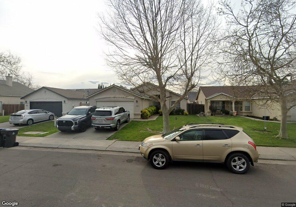
2025 Tillie Lewis Dr Stockton, CA 95206
Seaport NeighborhoodEstimated Value: $216,000 - $430,000
4
Beds
2
Baths
1,357
Sq Ft
$270/Sq Ft
Est. Value
About This Home
This home is located at 2025 Tillie Lewis Dr, Stockton, CA 95206 and is currently estimated at $366,632, approximately $270 per square foot. 2025 Tillie Lewis Dr is a home located in San Joaquin County with nearby schools including San Joaquin Elementary School, John Marshall Elementary School, and Taylor Leadership Academy.
Ownership History
Date
Name
Owned For
Owner Type
Purchase Details
Closed on
Sep 22, 2011
Sold by
Soriano Erlinda
Bought by
Soriano Roque A
Current Estimated Value
Home Financials for this Owner
Home Financials are based on the most recent Mortgage that was taken out on this home.
Original Mortgage
$105,090
Outstanding Balance
$74,027
Interest Rate
4.87%
Mortgage Type
FHA
Estimated Equity
$292,605
Purchase Details
Closed on
Jul 7, 2010
Sold by
Bac Home Loans Servicing Lp
Bought by
Flo Investments Llc
Purchase Details
Closed on
May 4, 2010
Sold by
Torres Silvia Montoya
Bought by
Bac Home Loans Servicign Lp and Countrywide Home Loans Servicing Lp
Purchase Details
Closed on
Feb 24, 2005
Sold by
Torres Salvador P
Bought by
Torres Silvia Montoya
Home Financials for this Owner
Home Financials are based on the most recent Mortgage that was taken out on this home.
Original Mortgage
$267,750
Interest Rate
6.8%
Mortgage Type
New Conventional
Purchase Details
Closed on
Sep 25, 2003
Sold by
Dang Tam
Bought by
Torres Salvador P and Torres Silvia Montoya
Home Financials for this Owner
Home Financials are based on the most recent Mortgage that was taken out on this home.
Original Mortgage
$221,523
Interest Rate
6.22%
Mortgage Type
FHA
Purchase Details
Closed on
Feb 21, 2003
Sold by
Dang Tam
Bought by
Dang Tam
Home Financials for this Owner
Home Financials are based on the most recent Mortgage that was taken out on this home.
Original Mortgage
$120,000
Interest Rate
5.85%
Purchase Details
Closed on
Dec 22, 2000
Sold by
Truong Fong
Bought by
Dong Tam
Purchase Details
Closed on
Jan 7, 1997
Sold by
R E Development Corporation
Bought by
Truong Fong
Home Financials for this Owner
Home Financials are based on the most recent Mortgage that was taken out on this home.
Original Mortgage
$77,900
Interest Rate
7.53%
Create a Home Valuation Report for This Property
The Home Valuation Report is an in-depth analysis detailing your home's value as well as a comparison with similar homes in the area
Home Values in the Area
Average Home Value in this Area
Purchase History
| Date | Buyer | Sale Price | Title Company |
|---|---|---|---|
| Soriano Roque A | -- | Fidelity National Title Co | |
| Soriano Roque A | $110,000 | Fidelity National Title Co | |
| Flo Investments Llc | $91,000 | Landsafe Title | |
| Bac Home Loans Servicign Lp | $101,250 | Landsafe Title | |
| Torres Silvia Montoya | -- | Commonwealth Title Co | |
| Torres Salvador P | $225,000 | Chicago Title Co | |
| Dang Tam | -- | Fidelity Natl Title Ins Co | |
| Dong Tam | -- | -- | |
| Truong Fong | $97,500 | Old Republic Title Company |
Source: Public Records
Mortgage History
| Date | Status | Borrower | Loan Amount |
|---|---|---|---|
| Open | Soriano Roque A | $105,090 | |
| Previous Owner | Torres Silvia Montoya | $267,750 | |
| Previous Owner | Torres Salvador P | $221,523 | |
| Previous Owner | Dang Tam | $120,000 | |
| Previous Owner | Truong Fong | $77,900 |
Source: Public Records
Tax History Compared to Growth
Tax History
| Year | Tax Paid | Tax Assessment Tax Assessment Total Assessment is a certain percentage of the fair market value that is determined by local assessors to be the total taxable value of land and additions on the property. | Land | Improvement |
|---|---|---|---|---|
| 2025 | $2,188 | $138,159 | $33,910 | $104,249 |
| 2024 | $1,757 | $135,451 | $33,246 | $102,205 |
| 2023 | $1,716 | $132,796 | $32,595 | $100,201 |
| 2022 | $1,589 | $130,193 | $31,956 | $98,237 |
| 2021 | $1,532 | $127,641 | $31,330 | $96,311 |
| 2020 | $1,559 | $126,333 | $31,009 | $95,324 |
| 2019 | $1,552 | $123,856 | $30,401 | $93,455 |
| 2018 | $1,954 | $121,428 | $29,805 | $91,623 |
| 2017 | $1,782 | $119,048 | $29,221 | $89,827 |
| 2016 | $1,786 | $116,713 | $28,648 | $88,065 |
| 2014 | $1,700 | $112,709 | $27,665 | $85,044 |
Source: Public Records
Map
Nearby Homes
- 2050 Grey Stone Dr
- 1823 Fort Hall Place
- 2128 Green River Ln
- 2650 S Fresno Ave
- 1409 Laguna Cir
- 1413 Laguna Cir
- 1156 Derrick Dr
- 1232 Denver Ave
- 2242 Port Trinity Cir
- 2215 Dune Place
- 864 W 5th St
- 1661 W Hazelton Ave
- 2402 Sailboat Ct
- 2428 Shell Ct
- 309 S Los Angeles Ave
- 348 S Los Angeles Ave
- 2079 Gordon Verner Cir
- 1765 W Sonora St
- 2625 Crestmore Cir
- 3745 Wild Rose Ln
- 2019 Tillie Lewis Dr
- 2031 Tillie Lewis Dr
- 2013 Tillie Lewis Dr
- 2037 Tillie Lewis Dr
- 2038 Grey Stone Dr
- 2064 Grey Stone Dr
- 2076 Grey Stone Dr
- 2026 Grey Stone Dr
- 2007 Tillie Lewis Dr
- 2053 Tillie Lewis Dr
- 2030 Tillie Lewis Dr
- 2044 Tillie Lewis Dr
- 2016 Tillie Lewis Dr
- 2014 Grey Stone Dr
- 2058 Tillie Lewis Dr
- 2088 Grey Stone Dr
- 2246 Wall St
- 2001 Tillie Lewis Dr
- 2106 Tillie Lewis Dr
- 2234 Wall St