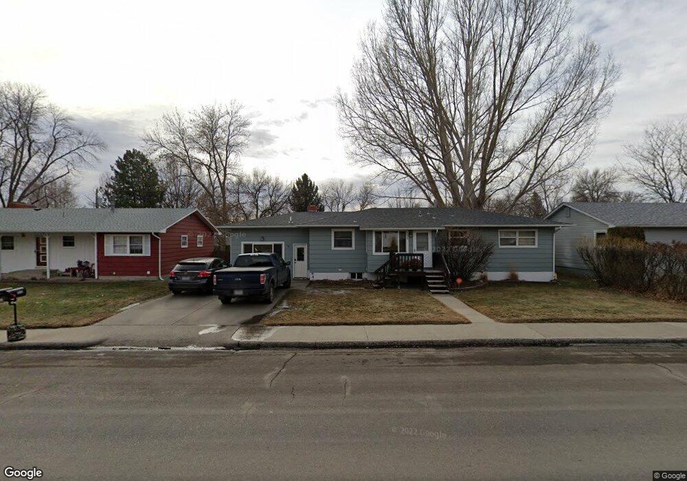
2026 Colton Blvd Billings, MT 59102
North Central Billings NeighborhoodEstimated Value: $323,000 - $378,000
4
Beds
2
Baths
1,278
Sq Ft
$277/Sq Ft
Est. Value
About This Home
This home is located at 2026 Colton Blvd, Billings, MT 59102 and is currently estimated at $354,474, approximately $277 per square foot. 2026 Colton Blvd is a home located in Yellowstone County with nearby schools including Rose Park School, Lewis & Clark Junior High School, and Billings Senior High School.
Ownership History
Date
Name
Owned For
Owner Type
Purchase Details
Closed on
Sep 11, 2025
Sold by
Allen Mandi
Bought by
Christensen Jill S
Current Estimated Value
Purchase Details
Closed on
Dec 10, 2021
Sold by
Christensen Jill S
Bought by
Allen Mandi
Purchase Details
Closed on
Dec 1, 2021
Sold by
Christensen Jill S
Bought by
Allen Mandi
Purchase Details
Closed on
Mar 23, 2007
Sold by
Cosgrove Tammy
Bought by
Christensen Curtis N and Christensen Jill S
Home Financials for this Owner
Home Financials are based on the most recent Mortgage that was taken out on this home.
Original Mortgage
$131,000
Interest Rate
6.31%
Mortgage Type
Purchase Money Mortgage
Purchase Details
Closed on
May 31, 2006
Sold by
Loran Joseph W and Loran Jean Louise
Bought by
Cosgrove Tammy
Create a Home Valuation Report for This Property
The Home Valuation Report is an in-depth analysis detailing your home's value as well as a comparison with similar homes in the area
Home Values in the Area
Average Home Value in this Area
Purchase History
| Date | Buyer | Sale Price | Title Company |
|---|---|---|---|
| Christensen Jill S | -- | None Listed On Document | |
| Allen Mandi | -- | None Available | |
| Allen Mandi | -- | None Listed On Document | |
| Christensen Curtis N | -- | None Available | |
| Cosgrove Tammy | $127,000 | None Available |
Source: Public Records
Mortgage History
| Date | Status | Borrower | Loan Amount |
|---|---|---|---|
| Previous Owner | Christensen Curtis N | $131,000 |
Source: Public Records
Tax History Compared to Growth
Tax History
| Year | Tax Paid | Tax Assessment Tax Assessment Total Assessment is a certain percentage of the fair market value that is determined by local assessors to be the total taxable value of land and additions on the property. | Land | Improvement |
|---|---|---|---|---|
| 2025 | $2,518 | $320,600 | $54,363 | $266,237 |
| 2024 | $2,518 | $258,200 | $51,699 | $206,501 |
| 2023 | $2,525 | $258,200 | $51,699 | $206,501 |
| 2022 | $2,359 | $212,100 | $0 | $0 |
| 2021 | $2,246 | $212,100 | $0 | $0 |
| 2020 | $2,246 | $203,500 | $0 | $0 |
| 2019 | $2,143 | $203,500 | $0 | $0 |
| 2018 | $2,116 | $197,500 | $0 | $0 |
| 2017 | $2,056 | $197,500 | $0 | $0 |
| 2016 | $1,910 | $185,300 | $0 | $0 |
| 2015 | $1,868 | $185,300 | $0 | $0 |
| 2014 | $1,629 | $85,224 | $0 | $0 |
Source: Public Records
Map
Nearby Homes
- 1944 Colton Blvd
- 2124 Dahlia Ln
- 2035 Avenue D
- 1833 Iris Ln
- 1607 21st St W
- 1734 Mariposa Ln
- 2414 Ivy Ln
- 2510 Terrace Dr
- 2230 Avenue C
- 2260 Avenue C
- 2618 Sunnyview Ln
- 2219 Avenue B
- 2020 Plaza Dr
- 2718 Terrace Dr
- 9 Stanford Ct
- 2030 Rimrock Rd
- 2620 Woody Dr
- 2042 Green Terrace Dr
- 2136 Green Terrace Dr
- 2060 Edgewood Dr
- 2020 Colton Blvd
- 2032 Colton Blvd
- 2025 Beverly Hill Blvd
- 2031 Beverly Hill Blvd
- 2014 Colton Blvd
- 2038 Colton Blvd
- 2021 Beverly Hill Blvd
- 2044 Colton Blvd
- 2037 Beverly Hill Blvd
- 2015 Beverly Hill Blvd
- 2025 Colton Blvd
- 2033 Colton Blvd
- 2008 Colton Blvd
- 2045 Beverly Hill Blvd
- 2117 21st St W
- 2019 Colton Blvd
- 2009 Beverly Hill Blvd
- 2131 21st St W
- 2002 Colton Blvd
- 2026 Beverly Hill Blvd