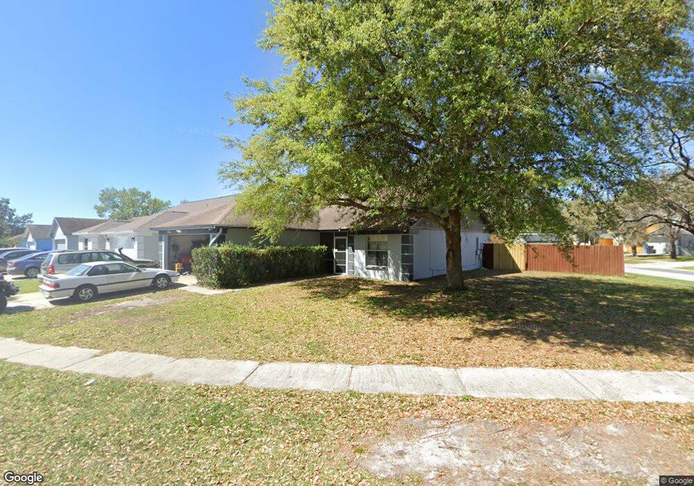
2026 Lori Ann St Brandon, FL 33510
Estimated Value: $337,406 - $360,000
3
Beds
2
Baths
1,410
Sq Ft
$247/Sq Ft
Est. Value
About This Home
This home is located at 2026 Lori Ann St, Brandon, FL 33510 and is currently estimated at $347,852, approximately $246 per square foot. 2026 Lori Ann St is a home located in Hillsborough County with nearby schools including Schmidt Elementary School, Mclane Middle School, and Armwood High School.
Ownership History
Date
Name
Owned For
Owner Type
Purchase Details
Closed on
Jun 26, 2018
Sold by
Seidman Leland G
Bought by
Seidman Leland G and Kedrowitz Roy L
Current Estimated Value
Purchase Details
Closed on
Oct 22, 2003
Sold by
Wells Calvin T and Wells Quinta
Bought by
Pecchia Carol
Home Financials for this Owner
Home Financials are based on the most recent Mortgage that was taken out on this home.
Original Mortgage
$92,800
Interest Rate
6%
Mortgage Type
Unknown
Create a Home Valuation Report for This Property
The Home Valuation Report is an in-depth analysis detailing your home's value as well as a comparison with similar homes in the area
Home Values in the Area
Average Home Value in this Area
Purchase History
| Date | Buyer | Sale Price | Title Company |
|---|---|---|---|
| Seidman Leland G | $33,500 | None Available | |
| Pecchia Carol | $116,000 | Key America Title Llc |
Source: Public Records
Mortgage History
| Date | Status | Borrower | Loan Amount |
|---|---|---|---|
| Previous Owner | Pecchia Carol | $92,800 |
Source: Public Records
Tax History Compared to Growth
Tax History
| Year | Tax Paid | Tax Assessment Tax Assessment Total Assessment is a certain percentage of the fair market value that is determined by local assessors to be the total taxable value of land and additions on the property. | Land | Improvement |
|---|---|---|---|---|
| 2024 | $1,623 | $98,502 | -- | -- |
| 2023 | $1,535 | $95,633 | $0 | $0 |
| 2022 | $1,391 | $92,848 | $0 | $0 |
| 2021 | $1,352 | $90,144 | $0 | $0 |
| 2020 | $1,274 | $88,899 | $0 | $0 |
| 2019 | $1,194 | $86,900 | $0 | $0 |
| 2018 | $1,143 | $85,280 | $0 | $0 |
| 2017 | $1,116 | $130,337 | $0 | $0 |
| 2016 | $1,083 | $81,808 | $0 | $0 |
| 2015 | $1,092 | $81,239 | $0 | $0 |
| 2014 | $1,068 | $80,594 | $0 | $0 |
| 2013 | -- | $79,403 | $0 | $0 |
Source: Public Records
Map
Nearby Homes
- 2312 Palm Ave
- 1933 Fruitridge St
- 1652 Open Field Loop
- 1621 Crossridge Dr
- 3506 High Hampton Cir
- 1615 Crossridge Dr
- 3531 High Hampton Cir
- 1608 Southcrest Ct
- 2764 Emory Sound Place
- 2760 Emory Sound Place
- 2130 Broadway View Ave
- 2138 Broadway View Ave
- 2110 Laceflower Dr
- 11433 Weldon St
- 2714 Chestnut Creek Place
- 2129 Lennox Dale Ln
- 2153 Broadway View Ave
- 1753 Open Field Loop
- 2140 Laceflower Dr
- 1614 Dusty Rose Ln
- 2024 Lori Ann St
- 1740 Brandon Trace Ave
- 1739 Brandon Trace Ave
- 1736 Brandon Trace Ave
- 1735 Brandon Trace Ave
- 1734 Brandon Trace Ave
- 1732 Brandon Trace Ave
- 2022 Lori Ann St
- 1730 Brandon Trace Ave
- 2020 Lori Ann St
- 1728 Brandon Trace Ave
- 2023 Lori Ann St
- 2021 Lori Ann St
- 2019 Lori Ann St
- 1725 Brandon Trace Ave
- 2017 Lori Ann St
- 2018 Lori Ann St
- 2015 Lori Ann St
- 1742 Brandon Trace Ave