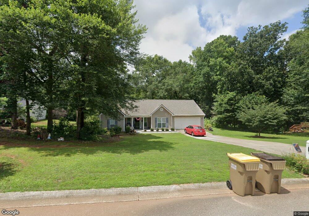
2027 Emerald Pointe Dr Winder, GA 30680
Estimated Value: $307,447 - $351,000
3
Beds
2
Baths
1,681
Sq Ft
$197/Sq Ft
Est. Value
About This Home
This home is located at 2027 Emerald Pointe Dr, Winder, GA 30680 and is currently estimated at $331,362, approximately $197 per square foot. 2027 Emerald Pointe Dr is a home located in Barrow County with nearby schools including Statham Elementary School, Bear Creek Middle School, and Winder-Barrow High School.
Ownership History
Date
Name
Owned For
Owner Type
Purchase Details
Closed on
Jun 17, 2004
Sold by
Southfork Hms Inc
Bought by
Hutchison Harold G
Current Estimated Value
Home Financials for this Owner
Home Financials are based on the most recent Mortgage that was taken out on this home.
Original Mortgage
$92,900
Outstanding Balance
$46,173
Interest Rate
6.25%
Mortgage Type
New Conventional
Estimated Equity
$285,189
Purchase Details
Closed on
Jun 18, 2002
Sold by
Davis George H
Bought by
Sierra Development Inc
Create a Home Valuation Report for This Property
The Home Valuation Report is an in-depth analysis detailing your home's value as well as a comparison with similar homes in the area
Home Values in the Area
Average Home Value in this Area
Purchase History
| Date | Buyer | Sale Price | Title Company |
|---|---|---|---|
| Hutchison Harold G | $122,900 | -- | |
| Southfork Hms Inc | $30,000 | -- | |
| Sierra Development Inc | $419,200 | -- |
Source: Public Records
Mortgage History
| Date | Status | Borrower | Loan Amount |
|---|---|---|---|
| Open | Southfork Hms Inc | $92,900 |
Source: Public Records
Tax History Compared to Growth
Tax History
| Year | Tax Paid | Tax Assessment Tax Assessment Total Assessment is a certain percentage of the fair market value that is determined by local assessors to be the total taxable value of land and additions on the property. | Land | Improvement |
|---|---|---|---|---|
| 2024 | $1,520 | $113,194 | $18,400 | $94,794 |
| 2023 | $1,134 | $113,794 | $18,400 | $95,394 |
| 2022 | $904 | $83,614 | $18,400 | $65,214 |
| 2021 | $780 | $72,599 | $16,000 | $56,599 |
| 2020 | $770 | $72,599 | $16,000 | $56,599 |
| 2019 | $675 | $61,839 | $16,000 | $45,839 |
| 2018 | $577 | $56,039 | $10,200 | $45,839 |
| 2017 | $1,233 | $42,342 | $10,200 | $32,142 |
| 2016 | $386 | $41,101 | $10,200 | $30,901 |
| 2015 | $393 | $41,438 | $10,200 | $31,238 |
| 2014 | $772 | $37,454 | $5,880 | $31,574 |
| 2013 | -- | $35,462 | $5,880 | $29,582 |
Source: Public Records
Map
Nearby Homes
- 1415 Red Oak Way
- 1642 White Oak Dr
- 1593 Highway 82
- 315 Paige Way
- 1453 Solomon Dr
- 1914 Hearthstone Ct
- 1023 Solomon Ct
- 330 Anchors Way
- 1431 Solomon Dr
- 29 Nunnally Rd SE
- 385 Finch Landing Rd
- 1295 Double Bridges Rd
- 212 Rainbow Ln
- 1212 Highway 211 NE
- 1226 Highway 211 NE
- 130 (Tract 1) Bowman Mill Rd NE
- 113 Platte St
- 130 Bowman Mill Rd NE Unit 1
- 207 Cedar Grove Church Rd
- 1206 Corkybrooke Ln
- 2029 Emerald Pointe Dr
- 2031 Emerald Pointe Dr
- 2028 Emerald Pointe Dr
- 2031 Emerald Pointe Dr Lot16a
- 2030 Emerald Pointe Dr
- 2026 Emerald Pointe Dr
- 2033 Emerald Pointe Dr
- 2032 Emerald Pointe Dr
- 2024 Emerald Pointe Dr
- 2023 Emerald Pointe Dr
- 2034 Emerald Pointe Dr
- 1601 White Oak Dr
- 2021 Emerald Pointe Dr
- 1581 Brush Creek Dr
- 1579 Brush Creek Dr
- 1577 Brush Creek Dr
- 1600 White Oak Dr
- 1603 White Oak Dr
- 1583 Brush Creek Dr Lot31
- 1575 Brush Creek Dr