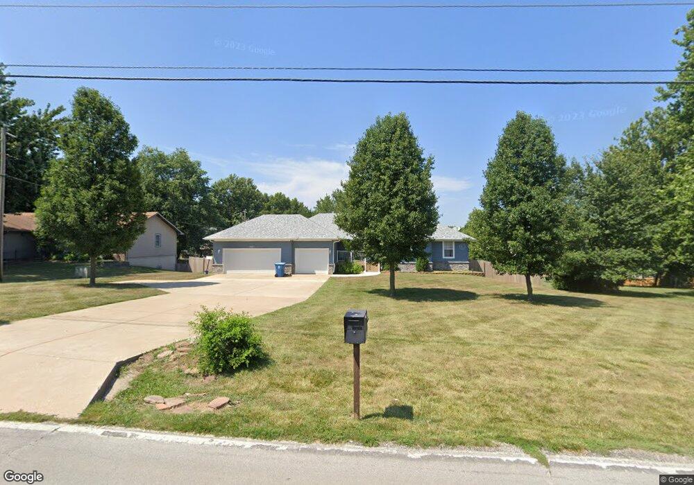
2027 W Farm Road 178 Springfield, MO 65810
Southwest Springfield NeighborhoodEstimated Value: $364,000 - $408,968
4
Beds
3
Baths
2,790
Sq Ft
$140/Sq Ft
Est. Value
About This Home
This home is located at 2027 W Farm Road 178, Springfield, MO 65810 and is currently estimated at $390,742, approximately $140 per square foot. 2027 W Farm Road 178 is a home located in Greene County with nearby schools including Gray Elementary School, Wilson's Creek Intermediate School, and Cherokee Middle School.
Ownership History
Date
Name
Owned For
Owner Type
Purchase Details
Closed on
Jul 30, 2009
Sold by
Turner Rodney and Turner Shirley
Bought by
Lowenthal Hershey Jason M and Lowenthal Hershey Jennifer M
Current Estimated Value
Home Financials for this Owner
Home Financials are based on the most recent Mortgage that was taken out on this home.
Original Mortgage
$131,600
Outstanding Balance
$86,675
Interest Rate
5.41%
Mortgage Type
New Conventional
Estimated Equity
$304,067
Purchase Details
Closed on
Oct 1, 2008
Sold by
Deutsche Bank National Trust Company
Bought by
Turner Rodney and Turner Shirley
Purchase Details
Closed on
Mar 21, 2008
Sold by
Gawron Erik and Gawron Tammy
Bought by
Deutsche Bank National Trust Co
Purchase Details
Closed on
Mar 5, 2007
Sold by
Gawron Erik
Bought by
Thomas & Pritchett Llc
Create a Home Valuation Report for This Property
The Home Valuation Report is an in-depth analysis detailing your home's value as well as a comparison with similar homes in the area
Home Values in the Area
Average Home Value in this Area
Purchase History
| Date | Buyer | Sale Price | Title Company |
|---|---|---|---|
| Lowenthal Hershey Jason M | -- | None Available | |
| Turner Rodney | -- | None Available | |
| Deutsche Bank National Trust Co | $165,750 | Mo-Kan Title Services Inc | |
| Thomas & Pritchett Llc | $1,000 | None Available |
Source: Public Records
Mortgage History
| Date | Status | Borrower | Loan Amount |
|---|---|---|---|
| Open | Lowenthal Hershey Jason M | $131,600 |
Source: Public Records
Tax History Compared to Growth
Tax History
| Year | Tax Paid | Tax Assessment Tax Assessment Total Assessment is a certain percentage of the fair market value that is determined by local assessors to be the total taxable value of land and additions on the property. | Land | Improvement |
|---|---|---|---|---|
| 2025 | $2,489 | $52,310 | $6,710 | $45,600 |
| 2024 | $2,489 | $44,940 | $6,710 | $38,230 |
| 2023 | $2,476 | $44,940 | $6,710 | $38,230 |
| 2022 | $2,122 | $39,490 | $6,710 | $32,780 |
| 2021 | $2,122 | $39,490 | $6,710 | $32,780 |
| 2020 | $2,048 | $36,140 | $6,710 | $29,430 |
| 2019 | $1,989 | $36,140 | $6,710 | $29,430 |
| 2018 | $1,842 | $33,390 | $6,710 | $26,680 |
| 2017 | $1,824 | $32,570 | $6,710 | $25,860 |
| 2016 | $1,780 | $32,570 | $6,710 | $25,860 |
| 2015 | $1,766 | $32,570 | $6,710 | $25,860 |
| 2014 | $1,706 | $31,220 | $6,710 | $24,510 |
Source: Public Records
Map
Nearby Homes
- 4983 S Burrows Ave
- 4830 S Farm Road 141
- 2033 W Willow Lakes Cove
- 4827 S Landon Ct
- 4815 S Landon Ct
- 2398 W Allen Dr
- 4824 S Landon Ct
- 2040 W Buena Vista St
- 2065 W Buena Vista St
- 4688 S Forest Ave
- 5396 S Woodfield Ave
- 5308 S Lexington Ave
- 5165 S Nettleton Ave
- 1532 W Fancrest Ln
- 4566 S Park Ave
- 5389 S Clifton Ave
- 2642 W Blakey St
- 00 W Farm Road 182
- 4640 S Leroy Ave
- 2021 W Melbourne Ct
- 2029 W Farm Road 178
- 2020 W Blakey St
- 2004 W Blakey St
- 2025 W Farm Road 178
- 5030 S Lafontaine Ave
- 2030 W Blakey St
- 1988 W Blakey St
- 5030 S La Fontaine Ave
- 2039 W Farm Road 178
- 2040 W Blakey St
- 5040 S Lafontaine Ave
- 5031 S Gray Fox Ave
- 5031 S Lafontaine Ave
- 1972 W Blakey St
- 5041 S Gray Fox Ave
- 2047 W Farm Road 178
- 1956 W Blakey St
- 2048 W Blakey St
- 4995 S Elizabeth Ave
- 2021 W Blakey St