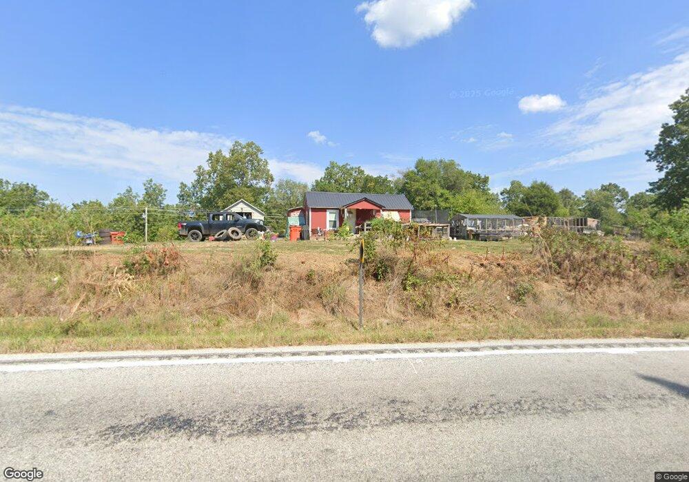
20270 State Highway 248 Aurora, MO 65605
Estimated Value: $201,000 - $320,000
2
Beds
1
Bath
1,026
Sq Ft
$254/Sq Ft
Est. Value
About This Home
This home is located at 20270 State Highway 248, Aurora, MO 65605 and is currently estimated at $260,500, approximately $253 per square foot. 20270 State Highway 248 is a home with nearby schools including Eunice Thomas Elementary School, Cassville Intermediate School, and Cassville Middle School.
Ownership History
Date
Name
Owned For
Owner Type
Purchase Details
Closed on
Feb 3, 2025
Sold by
Sos Land Llc
Bought by
Taylor Corby
Current Estimated Value
Home Financials for this Owner
Home Financials are based on the most recent Mortgage that was taken out on this home.
Original Mortgage
$100,000
Outstanding Balance
$88,521
Interest Rate
6.72%
Mortgage Type
New Conventional
Estimated Equity
$171,979
Create a Home Valuation Report for This Property
The Home Valuation Report is an in-depth analysis detailing your home's value as well as a comparison with similar homes in the area
Home Values in the Area
Average Home Value in this Area
Purchase History
| Date | Buyer | Sale Price | Title Company |
|---|---|---|---|
| Taylor Corby | -- | Barry County Abstract & Title |
Source: Public Records
Mortgage History
| Date | Status | Borrower | Loan Amount |
|---|---|---|---|
| Open | Taylor Corby | $100,000 |
Source: Public Records
Tax History Compared to Growth
Tax History
| Year | Tax Paid | Tax Assessment Tax Assessment Total Assessment is a certain percentage of the fair market value that is determined by local assessors to be the total taxable value of land and additions on the property. | Land | Improvement |
|---|---|---|---|---|
| 2025 | $215 | $5,488 | $2,044 | $3,444 |
| 2024 | $215 | $4,956 | $2,044 | $2,912 |
| 2023 | $215 | $4,956 | $2,044 | $2,912 |
| 2022 | $207 | $4,766 | $1,854 | $2,912 |
| 2021 | $141 | $4,386 | $1,474 | $2,912 |
| 2020 | $141 | $4,386 | $1,474 | $2,912 |
| 2018 | $137 | $3,227 | $1,474 | $1,753 |
| 2017 | $137 | $3,227 | $1,474 | $1,753 |
| 2016 | $177 | $4,165 | $1,284 | $2,881 |
| 2015 | -- | $4,165 | $1,284 | $2,881 |
| 2014 | -- | $4,165 | $1,284 | $2,881 |
| 2012 | -- | $0 | $0 | $0 |
Source: Public Records
Map
Nearby Homes
- 21814 State Hwy 248
- 16090 Farm Road 2130
- 000 State Highway C
- 10463 Farm Road 1182
- 14396 Farm Road 2140
- 10412 State Highway O
- 10955 State Highway 39
- 16257 Farm Road 2175
- 16478 Farm Road 1170
- 000 Farm Road 1182
- 17370 Farm Road 1150
- 14497 Farm Road 1145
- 000 State Highway 248-Tract 2
- 000 State Highway 248-Tract 1
- 0 Tbd State Highway 248-Tract 2
- 0 Tbd State Highway 248-Tract 1
- 26252 State Highway 248
- 22281 Farm Road 2180
- 25248 State Highway 76
- 000 Farm Road 1190
- 20445 State Highway 248
- 20445 State Highway 248
- 12835 Farm Road 1182
- 20488 State Highway 248
- 20655 State Highway 248
- 20509 State Highway 248
- 12835 Farm Road 1182
- 19888 State Highway 248
- 11350 Farm Road 1182
- 20723 State Highway 248
- 22805 State Highway C
- 19650 State Highway 248
- 12164 Farm Road 1182
- 19595 State Highway 248
- 12603 Farm Road 1195
- 20956 State Highway 248
- 11807 Farm Road 1182
- 21164 State Highway 248
- 21278 State Highway 248
- 17108 Farm Road 2130