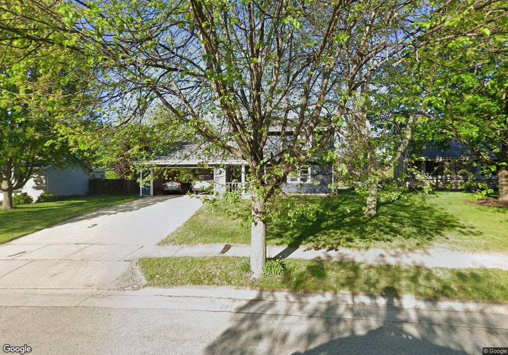
2028 Chapman Dr Waukesha, WI 53189
Estimated Value: $397,000 - $426,424
3
Beds
2
Baths
1,723
Sq Ft
$241/Sq Ft
Est. Value
About This Home
This home is located at 2028 Chapman Dr, Waukesha, WI 53189 and is currently estimated at $414,606, approximately $240 per square foot. 2028 Chapman Dr is a home located in Waukesha County with nearby schools including Prairie Elementary School, Les Paul Middle School - Central Campus, and West High School.
Ownership History
Date
Name
Owned For
Owner Type
Purchase Details
Closed on
Jun 24, 2005
Sold by
Cardinal Donald J and Cardinal Janice L
Bought by
Brown Michael J and Brown Elizabeth P
Current Estimated Value
Home Financials for this Owner
Home Financials are based on the most recent Mortgage that was taken out on this home.
Original Mortgage
$210,900
Outstanding Balance
$110,810
Interest Rate
5.86%
Mortgage Type
Fannie Mae Freddie Mac
Estimated Equity
$303,796
Purchase Details
Closed on
Sep 16, 2002
Sold by
Nelson Raymond J and Nelson Nancy E
Bought by
Cardinal Donald J and Cardinal Janice L
Home Financials for this Owner
Home Financials are based on the most recent Mortgage that was taken out on this home.
Original Mortgage
$100,000
Interest Rate
6.39%
Purchase Details
Closed on
Aug 14, 1997
Sold by
Nelson Raymond J
Bought by
Nelson Raymond J and Nelson Nancy E
Create a Home Valuation Report for This Property
The Home Valuation Report is an in-depth analysis detailing your home's value as well as a comparison with similar homes in the area
Home Values in the Area
Average Home Value in this Area
Purchase History
| Date | Buyer | Sale Price | Title Company |
|---|---|---|---|
| Brown Michael J | $235,900 | -- | |
| Cardinal Donald J | $179,000 | -- | |
| Nelson Raymond J | -- | -- |
Source: Public Records
Mortgage History
| Date | Status | Borrower | Loan Amount |
|---|---|---|---|
| Open | Brown Michael J | $210,900 | |
| Previous Owner | Cardinal Donald J | $100,000 |
Source: Public Records
Tax History Compared to Growth
Tax History
| Year | Tax Paid | Tax Assessment Tax Assessment Total Assessment is a certain percentage of the fair market value that is determined by local assessors to be the total taxable value of land and additions on the property. | Land | Improvement |
|---|---|---|---|---|
| 2024 | $5,345 | $359,200 | $91,500 | $267,700 |
| 2023 | $5,200 | $359,200 | $91,500 | $267,700 |
| 2022 | $4,701 | $245,100 | $74,400 | $170,700 |
| 2021 | $4,813 | $245,100 | $74,400 | $170,700 |
| 2020 | $4,649 | $245,100 | $74,400 | $170,700 |
| 2019 | $4,505 | $245,100 | $74,400 | $170,700 |
| 2018 | $4,134 | $220,800 | $65,700 | $155,100 |
| 2017 | $4,123 | $220,800 | $65,700 | $155,100 |
| 2016 | $3,915 | $197,100 | $63,500 | $133,600 |
| 2015 | $3,892 | $197,100 | $63,500 | $133,600 |
| 2014 | $4,059 | $197,100 | $63,500 | $133,600 |
| 2013 | $4,059 | $197,100 | $63,500 | $133,600 |
Source: Public Records
Map
Nearby Homes
- 2010 Dixie Dr
- 1722 Sycamore Dr
- 1101 Dogwood Ln
- 1706 Haymarket Rd
- 1909 Mallard Pointe Cir
- 1210 Woodbury Common Unit C
- 1203 Woodbury Common Unit D
- 1277 Market Place
- 1523 David Ln
- LtD59 White Deer Trail
- 812 Timber Ridge Ct Unit 10
- S54W25487 Pebble Brook Ct
- S54W25436 Pebble Brook Ct
- Lt6 Finch Ct
- 801 Timber Ridge Dr
- 2415 Fox River Pkwy Unit H
- 300 Darlene Dr
- 2426 Fox River Pkwy Unit G
- 1906 Marliz Dr
- 2708 Fox Hill Dr
- 2032 Chapman Dr
- 2024 Chapman Dr
- 2020 Chapman Dr
- 2036 Chapman Dr
- 2031 Chapman Dr
- 2017 Chapman Dr
- 2021 Chapman Dr
- 1920 Chapman Dr
- 2015 Chapman Dr
- 1916 Chapman Dr
- 2014 Chapman Dr
- 1121 Burr Oak Blvd
- 1125 Burr Oak Blvd
- 1924 Chapman Dr
- 1912 Chapman Dr
- 1117 Burr Oak Blvd
- 1129 Burr Oak Blvd
- 2011 Chapman Dr
- 1111 Burr Oak Blvd
- 1908 Chapman Dr