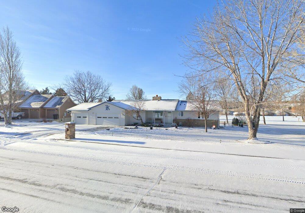
2028 St Andrews Dr Billings, MT 59105
Billings Heights NeighborhoodEstimated Value: $432,438 - $501,000
3
Beds
2
Baths
1,866
Sq Ft
$253/Sq Ft
Est. Value
About This Home
This home is located at 2028 St Andrews Dr, Billings, MT 59105 and is currently estimated at $472,110, approximately $253 per square foot. 2028 St Andrews Dr is a home located in Yellowstone County with nearby schools including Sandstone School, Castle Rock Junior High School, and Skyview High School.
Ownership History
Date
Name
Owned For
Owner Type
Purchase Details
Closed on
Dec 28, 2010
Sold by
Zaccagnini Gary
Bought by
Klein Liliana M Bergallo
Current Estimated Value
Purchase Details
Closed on
Aug 3, 2010
Sold by
Klein Fred P
Bought by
Zaccagnini Gary
Create a Home Valuation Report for This Property
The Home Valuation Report is an in-depth analysis detailing your home's value as well as a comparison with similar homes in the area
Home Values in the Area
Average Home Value in this Area
Purchase History
| Date | Buyer | Sale Price | Title Company |
|---|---|---|---|
| Klein Liliana M Bergallo | -- | None Available | |
| Zaccagnini Gary | $142,000 | First American Title Ins Co |
Source: Public Records
Tax History Compared to Growth
Tax History
| Year | Tax Paid | Tax Assessment Tax Assessment Total Assessment is a certain percentage of the fair market value that is determined by local assessors to be the total taxable value of land and additions on the property. | Land | Improvement |
|---|---|---|---|---|
| 2025 | $4,197 | $478,700 | $110,671 | $368,029 |
| 2024 | $4,197 | $428,800 | $104,310 | $324,490 |
| 2023 | $4,212 | $428,800 | $104,310 | $324,490 |
| 2022 | $2,885 | $305,600 | $0 | $0 |
| 2021 | $3,270 | $305,600 | $0 | $0 |
| 2020 | $3,161 | $282,700 | $0 | $0 |
| 2019 | $3,018 | $282,700 | $0 | $0 |
| 2018 | $3,140 | $290,600 | $0 | $0 |
| 2017 | $2,690 | $290,600 | $0 | $0 |
| 2016 | $2,816 | $270,900 | $0 | $0 |
| 2015 | $2,753 | $270,900 | $0 | $0 |
| 2014 | $2,263 | $116,441 | $0 | $0 |
Source: Public Records
Map
Nearby Homes
- 2049 Saint Andrews Dr
- 2029 Ridgeview Dr
- 1949 St Andrews Dr
- 2115 Saint Andrews Dr
- 2143 Interlachen Dr
- TBD Gayle Block 17 Lot 4 Dr
- TBD Gayle Block 17 Lot 7 Dr
- 2030 Gayle Dr
- TBD Gayle Block 17 Lot 8 Dr
- TBD Gayle Blk 10 Lot 5 Dr
- TBD Sharron Block 14 Lot8 Ln
- 104 Stillwater Ln
- 107 Glenhaven Dr
- 511 Winged Foot Dr
- 237 Sharron Ln
- 130 132 Stillwater Ln
- Lot 1, Block 1 Greenbriar Rd
- TBD Saint Andrews Dr
- 2164 Greenbriar Rd
- 2043 Cypress Point
- 2020 Saint Andrews Dr
- 2038 St Andrews Dr
- 2020 St Andrews Dr
- 2038 Saint Andrews Dr
- 0 Saint Andrews Dr
- 2035 Saint Andrews Dr
- 2035 St Andrews Dr
- 2027 St Andrews Dr
- 2043 Saint Andrews Dr
- 2043 St Andrews Dr
- 2046 St Andrews Dr
- 2006 St Andrews Dr
- 2019 St Andrews Dr
- 2019 Saint Andrews Dr
- 2032 Ridgeview Dr
- 2049 St Andrews Dr
- 2024 Ridgeview Dr
- 2009 St Andrews Dr
- 2040 Ridgeview Dr
- 2052 St Andrews Dr