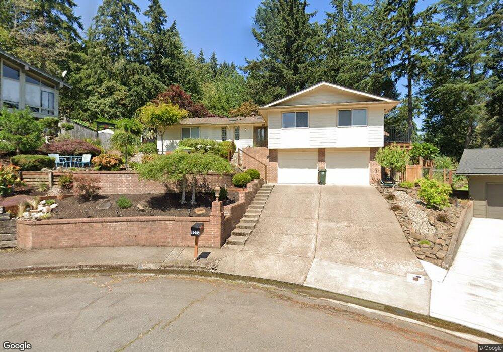
2029 Graham Dr Eugene, OR 97405
Crest Drive NeighborhoodEstimated Value: $581,000 - $705,000
3
Beds
3
Baths
1,896
Sq Ft
$329/Sq Ft
Est. Value
About This Home
This home is located at 2029 Graham Dr, Eugene, OR 97405 and is currently estimated at $624,316, approximately $329 per square foot. 2029 Graham Dr is a home located in Lane County with nearby schools including Adams Elementary School, Arts And Technology Academy At Jefferson, and Churchill High School.
Ownership History
Date
Name
Owned For
Owner Type
Purchase Details
Closed on
Mar 26, 2004
Sold by
Prasniewski Jan
Bought by
Donnelly Margaret and Donnelly Maggie
Current Estimated Value
Home Financials for this Owner
Home Financials are based on the most recent Mortgage that was taken out on this home.
Original Mortgage
$110,000
Outstanding Balance
$50,262
Interest Rate
5.57%
Mortgage Type
New Conventional
Estimated Equity
$574,054
Purchase Details
Closed on
Mar 11, 2004
Sold by
Donnelly Margaret and Donnelly Maggie
Bought by
Donnelly Margaret M and Donnelly Bridget M
Home Financials for this Owner
Home Financials are based on the most recent Mortgage that was taken out on this home.
Original Mortgage
$110,000
Outstanding Balance
$50,262
Interest Rate
5.57%
Mortgage Type
New Conventional
Estimated Equity
$574,054
Create a Home Valuation Report for This Property
The Home Valuation Report is an in-depth analysis detailing your home's value as well as a comparison with similar homes in the area
Home Values in the Area
Average Home Value in this Area
Purchase History
| Date | Buyer | Sale Price | Title Company |
|---|---|---|---|
| Donnelly Margaret | $5,000 | Western Pioneer Title Co | |
| Donnelly Margaret M | -- | Western Pioneer Title Co |
Source: Public Records
Mortgage History
| Date | Status | Borrower | Loan Amount |
|---|---|---|---|
| Open | Donnelly Margaret M | $110,000 |
Source: Public Records
Tax History Compared to Growth
Tax History
| Year | Tax Paid | Tax Assessment Tax Assessment Total Assessment is a certain percentage of the fair market value that is determined by local assessors to be the total taxable value of land and additions on the property. | Land | Improvement |
|---|---|---|---|---|
| 2025 | $5,544 | $284,567 | -- | -- |
| 2024 | $5,475 | $276,279 | -- | -- |
| 2023 | $5,475 | $268,233 | $0 | $0 |
| 2022 | $5,130 | $260,421 | $0 | $0 |
| 2021 | $4,818 | $252,836 | $0 | $0 |
| 2020 | $4,835 | $245,472 | $0 | $0 |
| 2019 | $4,670 | $238,323 | $0 | $0 |
| 2018 | $4,395 | $224,643 | $0 | $0 |
| 2017 | $4,199 | $224,643 | $0 | $0 |
| 2016 | $4,094 | $218,100 | $0 | $0 |
| 2015 | $3,977 | $211,748 | $0 | $0 |
| 2014 | $3,897 | $205,581 | $0 | $0 |
Source: Public Records
Map
Nearby Homes
- 2100 Shields Ave
- 2850 Garfield St
- 2037 Morning View Dr
- 0 Mclean Blvd Unit 24671448
- 0 Mclean Blvd Unit 697374759
- 2030 W 34th Ave
- 2720 Fillmore St
- 3046 Whitbeck Blvd
- 2203 Lorane Hwy
- 2240 W 25th Place
- 2755 Malibu Way
- 2765 Almaden St
- 2582 Terrace View Dr
- 2690 Polk St
- 2260 Orr Ln
- 2870 Hawkins Ln
- 2760 Bowmont Dr
- 2130 Grant St
- 2115 Arthur St
- 2595 Highland Oaks Dr
- 2023 Graham Dr
- 2039 Graham Dr
- 2050 W 29th Ave
- 2064 W 29th Ave
- 2019 Graham Dr
- 2055 Graham Dr
- 2015 Graham Dr
- 2030 W 29th Ave
- 3069 Soloman Loop
- 2070 Shields Ave
- 2930 Garfield St
- 2960 Garfield St
- 2060 Graham Dr
- 2030 Graham Dr
- 2080 Shields Ave
- 2065 Graham Dr
- 2910 Garfield St
- 2990 Garfield St
- 2067 W 29th Ave
- 2055 W 29th Ave