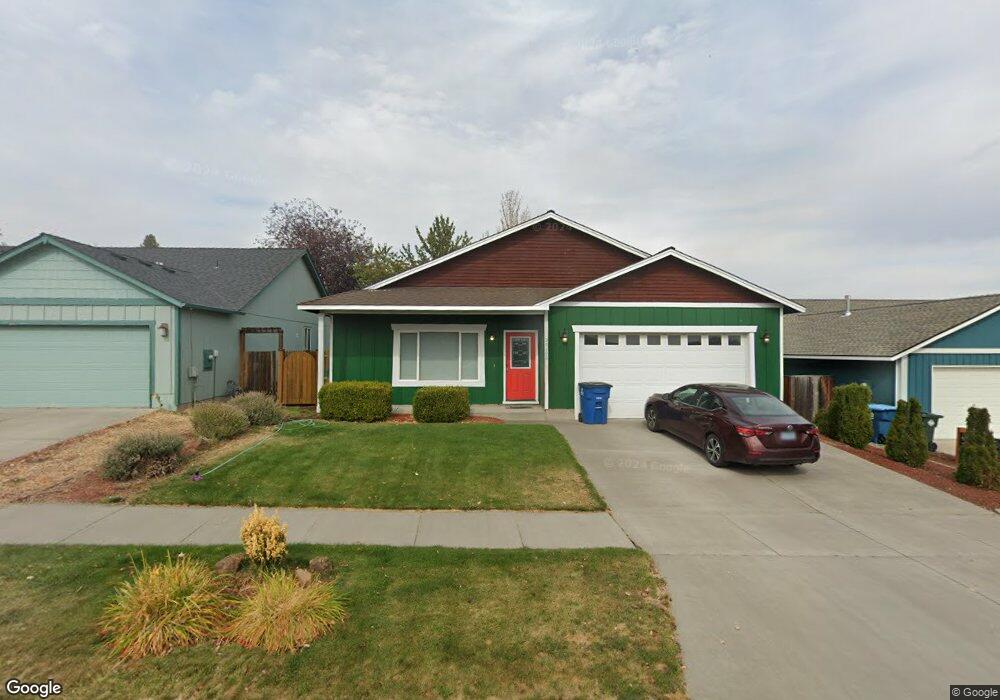
20292 Morgan Loop Bend, OR 97701
Boyd Acres NeighborhoodEstimated Value: $522,000 - $591,000
3
Beds
2
Baths
1,460
Sq Ft
$378/Sq Ft
Est. Value
About This Home
This home is located at 20292 Morgan Loop, Bend, OR 97701 and is currently estimated at $552,225, approximately $378 per square foot. 20292 Morgan Loop is a home located in Deschutes County with nearby schools including North Star Elementary School, Sky View Middle School, and Mountain View Senior High School.
Ownership History
Date
Name
Owned For
Owner Type
Purchase Details
Closed on
Aug 3, 2004
Sold by
Smigaj Adrian W and Smigaj Linda C
Bought by
Douglass William L
Current Estimated Value
Home Financials for this Owner
Home Financials are based on the most recent Mortgage that was taken out on this home.
Original Mortgage
$133,175
Outstanding Balance
$66,146
Interest Rate
6.24%
Mortgage Type
Unknown
Estimated Equity
$486,079
Create a Home Valuation Report for This Property
The Home Valuation Report is an in-depth analysis detailing your home's value as well as a comparison with similar homes in the area
Home Values in the Area
Average Home Value in this Area
Purchase History
| Date | Buyer | Sale Price | Title Company |
|---|---|---|---|
| Douglass William L | $176,900 | Amerititle |
Source: Public Records
Mortgage History
| Date | Status | Borrower | Loan Amount |
|---|---|---|---|
| Open | Douglass William L | $133,175 |
Source: Public Records
Tax History
| Year | Tax Paid | Tax Assessment Tax Assessment Total Assessment is a certain percentage of the fair market value that is determined by local assessors to be the total taxable value of land and additions on the property. | Land | Improvement |
|---|---|---|---|---|
| 2025 | $3,519 | $208,260 | -- | -- |
| 2024 | $3,386 | $202,200 | -- | -- |
| 2023 | $3,139 | $196,320 | $0 | $0 |
| 2022 | $2,928 | $185,060 | $0 | $0 |
| 2021 | $2,933 | $179,670 | $0 | $0 |
| 2020 | $2,782 | $179,670 | $0 | $0 |
| 2019 | $2,705 | $174,440 | $0 | $0 |
| 2018 | $2,628 | $169,360 | $0 | $0 |
| 2017 | $2,551 | $164,430 | $0 | $0 |
| 2016 | $2,433 | $159,650 | $0 | $0 |
| 2015 | $2,366 | $155,000 | $0 | $0 |
| 2014 | $2,296 | $150,490 | $0 | $0 |
Source: Public Records
Map
Nearby Homes
- 63264 NW Rossby St
- 63262 N West Ski Ln
- 63266 NW Ski Ln
- 63290 NW Ski Ln
- 20211 Glen Vista Rd
- 63027 Fresca St
- 3650 N Hwy 97
- 20174 Archie Briggs Rd
- 20061 Glen Vista Rd
- 20570 Fred Meyers Rd
- 20514 NE Empire Ave
- 4034 NW Northcliff
- 20528 NE Empire Ave
- 20532 NE Empire Ave
- 20534 Empire Ave
- 20530 NE Empire Ave
- 63182 Iner Loop
- 20551 Gloucester Ln
- 20560 Boyd Ct
- 63421 Vogt Rd
- 20298 Morgan Loop
- 37 Morgan Loop
- 20295 Poe Sholes Dr
- 20280 Morgan Loop
- 20291 Poe Sholes Dr
- 20297 Morgan Loop
- 20291 Morgan Loop
- 20287 Poe Sholes Dr
- 20285 Morgan Loop
- 20304 Shetland Loop
- 20304 Sheltand Loop
- 20283 Poe Sholes Dr
- 20268 Morgan Loop
- 20303 Shetland Loop
- 20305 Poe Sholes Dr
- 20296 Poe Sholes Dr
- 20292 Poe Sholes Dr
- 20294 Poe Sholes Dr
- 20262 Morgan Loop
Your Personal Tour Guide
Ask me questions while you tour the home.