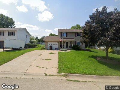
203 N Adams St Andrew, IA 52030
Estimated Value: $118,000 - $198,134
3
Beds
3
Baths
1,274
Sq Ft
$128/Sq Ft
Est. Value
About This Home
This home is located at 203 N Adams St, Andrew, IA 52030 and is currently estimated at $162,534, approximately $127 per square foot. 203 N Adams St is a home with nearby schools including Andrew Elementary School.
Ownership History
Date
Name
Owned For
Owner Type
Purchase Details
Closed on
Jun 22, 2020
Sold by
Trenkamp Carl W
Bought by
Krabbenhoft Damian M
Current Estimated Value
Home Financials for this Owner
Home Financials are based on the most recent Mortgage that was taken out on this home.
Original Mortgage
$105,600
Outstanding Balance
$95,040
Interest Rate
3.2%
Mortgage Type
New Conventional
Estimated Equity
$81,899
Purchase Details
Closed on
Jan 15, 2010
Sold by
Labrosse Guy J and Labrosse Guy J
Bought by
Trenkamp Carl W
Home Financials for this Owner
Home Financials are based on the most recent Mortgage that was taken out on this home.
Original Mortgage
$78,551
Interest Rate
5%
Mortgage Type
FHA
Create a Home Valuation Report for This Property
The Home Valuation Report is an in-depth analysis detailing your home's value as well as a comparison with similar homes in the area
Home Values in the Area
Average Home Value in this Area
Purchase History
| Date | Buyer | Sale Price | Title Company |
|---|---|---|---|
| Krabbenhoft Damian M | $132,000 | None Available | |
| Trenkamp Carl W | $80,000 | None Available |
Source: Public Records
Mortgage History
| Date | Status | Borrower | Loan Amount |
|---|---|---|---|
| Open | Krabbenhoft Damian M | $105,600 | |
| Previous Owner | Trenkamp Carl W | $116,917 | |
| Previous Owner | Trenkamp Carl W | $80,700 | |
| Previous Owner | Trenkamp Carl W | $78,551 |
Source: Public Records
Tax History Compared to Growth
Tax History
| Year | Tax Paid | Tax Assessment Tax Assessment Total Assessment is a certain percentage of the fair market value that is determined by local assessors to be the total taxable value of land and additions on the property. | Land | Improvement |
|---|---|---|---|---|
| 2024 | $2,426 | $176,500 | $10,000 | $166,500 |
| 2023 | $2,426 | $176,500 | $10,000 | $166,500 |
| 2022 | $2,106 | $140,400 | $10,000 | $130,400 |
| 2021 | $1,822 | $140,400 | $10,000 | $130,400 |
| 2020 | $1,822 | $115,300 | $10,000 | $105,300 |
| 2019 | $1,748 | $104,700 | $0 | $0 |
| 2018 | $1,682 | $104,700 | $0 | $0 |
| 2017 | $1,682 | $92,800 | $0 | $0 |
| 2016 | $1,536 | $92,800 | $0 | $0 |
| 2015 | $1,536 | $92,800 | $0 | $0 |
| 2014 | $1,692 | $85,600 | $0 | $0 |
Source: Public Records
Map
Nearby Homes
- Lot 1 E Cass St
- 11878 Iowa 62
- 8948 287th Ave
- 000 182nd Ave
- 0 Bellevue-Cascade Rd
- 911 Cardinal Dr
- 414 N Otto St
- 22477 Highway 64
- 312 N Eliza St
- 23619 Iowa 64
- 23551 274th St
- 412 E Pleasant St
- 124 E Platt St
- 311 S Matteson St
- 302 E Maple St
- 414 W Pleasant St
- 0 W Platt St
- 116 S Vermont St
- 505 S Main St
- 215 S Jones Ave
- 203 N Adams St
- 201 N Adams St
- 205 N Adams St
- 107 N Adams St
- 207 N Adams St
- 202 N Willough St
- 204 N Willough St
- 204 N Adams St
- 202 N Adams St
- 206 N Adams St
- 105 N Adams St
- 108 N Adams St
- 206 N Willough St
- 108 N Willough St
- 208 N Adams St
- 106 N Adams St
- 103 N Adams St
- 106 N Willough St
- 104 N Adams St
- 302 N Adams St