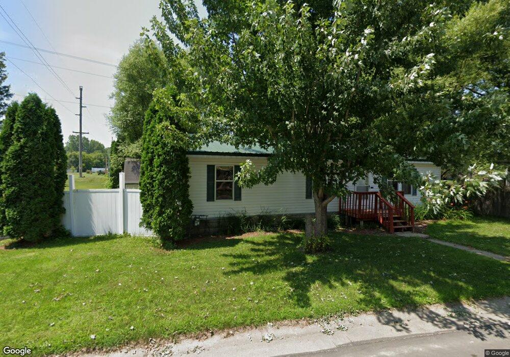
203 S Utility St Ellsworth, WI 54011
Estimated Value: $155,000 - $273,000
3
Beds
2
Baths
--
Sq Ft
13,068
Acres
About This Home
This home is located at 203 S Utility St, Ellsworth, WI 54011 and is currently estimated at $212,884. 203 S Utility St is a home located in Pierce County with nearby schools including Ellsworth High School.
Ownership History
Date
Name
Owned For
Owner Type
Purchase Details
Closed on
Dec 3, 2014
Sold by
Avery James and Avery Teresa
Bought by
Richey Heather A and Richey Evan A
Current Estimated Value
Home Financials for this Owner
Home Financials are based on the most recent Mortgage that was taken out on this home.
Original Mortgage
$82,478
Outstanding Balance
$65,852
Interest Rate
5.12%
Mortgage Type
FHA
Estimated Equity
$147,032
Purchase Details
Closed on
Feb 11, 2014
Sold by
Avery James
Bought by
The Avery Family Trust
Purchase Details
Closed on
Nov 25, 2008
Sold by
Hines Brandon S
Bought by
Avery James
Create a Home Valuation Report for This Property
The Home Valuation Report is an in-depth analysis detailing your home's value as well as a comparison with similar homes in the area
Home Values in the Area
Average Home Value in this Area
Purchase History
| Date | Buyer | Sale Price | Title Company |
|---|---|---|---|
| Richey Heather A | $84,000 | Pierce Co Abstract & Title | |
| The Avery Family Trust | $90,500 | -- | |
| Avery James | $65,000 | None Available |
Source: Public Records
Mortgage History
| Date | Status | Borrower | Loan Amount |
|---|---|---|---|
| Open | Richey Heather A | $82,478 |
Source: Public Records
Tax History Compared to Growth
Tax History
| Year | Tax Paid | Tax Assessment Tax Assessment Total Assessment is a certain percentage of the fair market value that is determined by local assessors to be the total taxable value of land and additions on the property. | Land | Improvement |
|---|---|---|---|---|
| 2024 | $2,485 | $130,800 | $25,700 | $105,100 |
| 2023 | $2,305 | $130,800 | $25,700 | $105,100 |
| 2022 | $2,031 | $130,800 | $25,700 | $105,100 |
| 2021 | $2,068 | $90,900 | $27,400 | $63,500 |
| 2020 | $2,058 | $90,900 | $27,400 | $63,500 |
| 2019 | $2,017 | $90,900 | $27,400 | $63,500 |
| 2018 | $2,050 | $90,900 | $27,400 | $63,500 |
| 2017 | $2,051 | $90,900 | $27,400 | $63,500 |
| 2016 | $2,038 | $90,900 | $27,400 | $63,500 |
| 2015 | $1,886 | $90,900 | $27,400 | $63,500 |
| 2014 | $1,768 | $90,900 | $27,400 | $63,500 |
| 2013 | $1,920 | $90,900 | $27,400 | $63,500 |
Source: Public Records
Map
Nearby Homes
- 332 Pleasant Ave
- 166 E Main St
- 146 E Main St
- 227 S Piety St
- 195 W Humble Ave
- 230 S Chestnut St
- 232 S Chestnut St
- 269 S Chestnut St
- 841 N Grant St
- 944 S Kelly Rd
- 314 N Maple St
- 829 N Grant St
- 185 S Maple St
- 883 N Grant St
- 871 N Grant St
- 893 N Grant St
- 000 S Maple St
- XXX S Maple St
- N5196 732nd St
- 000 Debra St
- 733 Campbell St
- 203 Utility St
- 204 Utility St
- 182 Utility St
- 727 Campbell St
- 727 E Campbell St
- 107 N Short St
- 175 Utility St
- 150 Utility St
- 175 S Utility St
- 721 Campbell St
- W6529 Us Highway 10
- 101 Utility St
- 809 E Main St
- W6525 Us Highway 10
- 711 E Main St
- 103 S Pond St
- 801 E Main St
- 103 County Road C
- 103 103 Co Rd C