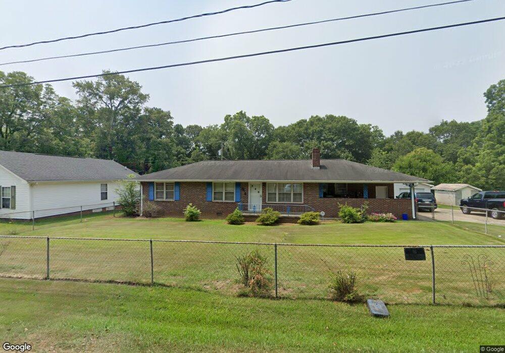
203 Simpson Dr Anderson, SC 29624
Estimated Value: $105,000 - $186,000
3
Beds
2
Baths
1,327
Sq Ft
$110/Sq Ft
Est. Value
About This Home
This home is located at 203 Simpson Dr, Anderson, SC 29624 and is currently estimated at $145,310, approximately $109 per square foot. 203 Simpson Dr is a home located in Anderson County with nearby schools including Varennes Elementary School, Robert Anderson Middle School, and Westside High School.
Ownership History
Date
Name
Owned For
Owner Type
Purchase Details
Closed on
May 8, 2025
Sold by
Mcduffie Emma Ruth
Bought by
Rollinson Edward
Current Estimated Value
Purchase Details
Closed on
Aug 17, 2018
Sold by
Estate Of Mcduffie Jerome
Bought by
Mcduffie Emma
Purchase Details
Closed on
Apr 26, 2011
Sold by
Sears Roger Lee
Bought by
Mcduffie Emma and Mcduffie Jerome
Purchase Details
Closed on
Sep 3, 2010
Sold by
Pike Roy C and Sears Roger Lee
Bought by
Sears Roger Lee and Roy C Pike Property Trust
Create a Home Valuation Report for This Property
The Home Valuation Report is an in-depth analysis detailing your home's value as well as a comparison with similar homes in the area
Home Values in the Area
Average Home Value in this Area
Purchase History
| Date | Buyer | Sale Price | Title Company |
|---|---|---|---|
| Rollinson Edward | -- | None Listed On Document | |
| Rollinson Edward | -- | None Listed On Document | |
| Mcduffie Emma | -- | None Available | |
| Mcduffie Emma | $54,000 | -- | |
| Sears Roger Lee | -- | -- |
Source: Public Records
Tax History
| Year | Tax Paid | Tax Assessment Tax Assessment Total Assessment is a certain percentage of the fair market value that is determined by local assessors to be the total taxable value of land and additions on the property. | Land | Improvement |
|---|---|---|---|---|
| 2025 | $1,176 | $3,220 | $450 | $2,770 |
| 2024 | $1,176 | $2,140 | $300 | $1,840 |
| 2023 | $56 | $2,140 | $300 | $1,840 |
| 2022 | $56 | $2,140 | $300 | $1,840 |
| 2021 | $51 | $2,090 | $270 | $1,820 |
| 2020 | $51 | $2,090 | $270 | $1,820 |
| 2019 | $51 | $3,130 | $400 | $2,730 |
| 2018 | $52 | $2,090 | $270 | $1,820 |
| 2017 | -- | $2,090 | $270 | $1,820 |
| 2016 | $61 | $2,160 | $240 | $1,920 |
| 2015 | $192 | $2,160 | $240 | $1,920 |
| 2014 | $348 | $2,160 | $240 | $1,920 |
Source: Public Records
Map
Nearby Homes
- 597 Murphy St
- 2910 Chambers Rd
- 216 Riley St
- 215 W Roosevelt Dr
- 3517 Shawnee Ave
- 220 Marlon Ave
- 510 Visage Dr
- 113 Norbert Ln
- 104 Norbert Ln
- 123 Rubin Ave Unit s A B
- 216 Pearman St
- 55 Lemans Dr
- 501 Corning St
- 118 Doris Ave
- 3508 Allston St
- 102 Westway Ct
- 508 Corning St
- 3016 S Main St
- 3812 Allston St
- 3308 New Pond Rd
- 205 Simpson Dr
- 201 Simpson Dr
- 204 Simpson Dr
- 211 Simpson Dr
- 105 Simpson Dr
- 108 Simpson Dr
- 206 Simpson Dr
- 301 Simpson Dr
- 208 Simpson Dr
- 3108 Mccollum St
- 210 Simpson Dr
- 4009 S Carolina 81
- 4006 S Main Street Extension
- 00 Riley St
- 3107 Mccollum St
- 3107 Mccollum St
- 303 Simpson Dr
- 3105 Burson Rd
- 3105 Mccollum St
- 3914 S Main Street Extension
Your Personal Tour Guide
Ask me questions while you tour the home.