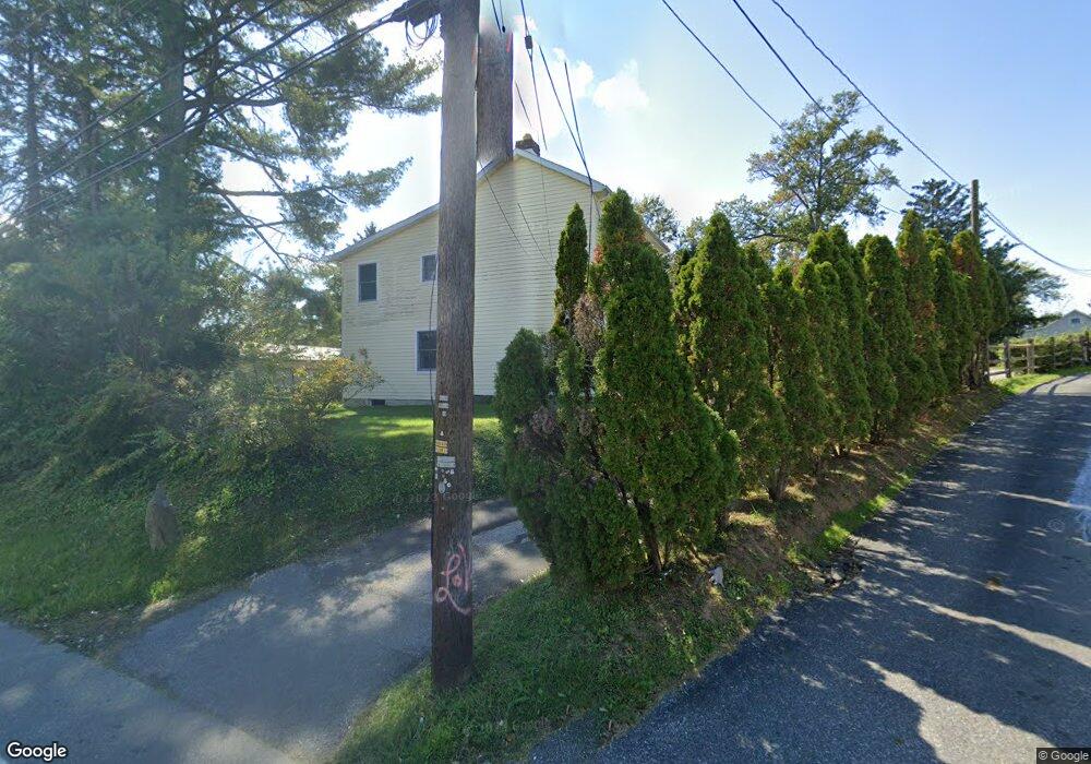
2030 Duncan Rd Wilmington, DE 19808
Estimated Value: $340,000 - $459,181
3
Beds
3
Baths
2,738
Sq Ft
$141/Sq Ft
Est. Value
About This Home
This home is located at 2030 Duncan Rd, Wilmington, DE 19808 and is currently estimated at $385,795, approximately $140 per square foot. 2030 Duncan Rd is a home located in New Castle County with nearby schools including Anna P. Mote Elementary School, Stanton Middle School, and Thomas McKean High School.
Ownership History
Date
Name
Owned For
Owner Type
Purchase Details
Closed on
Nov 7, 2006
Sold by
Cain Brian C
Bought by
Cain Brian C and Cain Donna C
Current Estimated Value
Home Financials for this Owner
Home Financials are based on the most recent Mortgage that was taken out on this home.
Original Mortgage
$87,000
Interest Rate
6.39%
Mortgage Type
New Conventional
Create a Home Valuation Report for This Property
The Home Valuation Report is an in-depth analysis detailing your home's value as well as a comparison with similar homes in the area
Home Values in the Area
Average Home Value in this Area
Purchase History
| Date | Buyer | Sale Price | Title Company |
|---|---|---|---|
| Cain Brian C | -- | First American Title Ins Co |
Source: Public Records
Mortgage History
| Date | Status | Borrower | Loan Amount |
|---|---|---|---|
| Closed | Cain Brian C | $87,000 |
Source: Public Records
Tax History Compared to Growth
Tax History
| Year | Tax Paid | Tax Assessment Tax Assessment Total Assessment is a certain percentage of the fair market value that is determined by local assessors to be the total taxable value of land and additions on the property. | Land | Improvement |
|---|---|---|---|---|
| 2024 | $2,367 | $62,400 | $15,600 | $46,800 |
| 2023 | $2,095 | $62,400 | $15,600 | $46,800 |
| 2022 | $2,109 | $62,400 | $15,600 | $46,800 |
| 2021 | $2,108 | $62,400 | $15,600 | $46,800 |
| 2020 | $2,113 | $62,400 | $15,600 | $46,800 |
| 2019 | $2,622 | $62,400 | $15,600 | $46,800 |
| 2018 | $2,069 | $62,400 | $15,600 | $46,800 |
| 2017 | $2,045 | $62,400 | $15,600 | $46,800 |
| 2016 | $1,952 | $62,400 | $15,600 | $46,800 |
| 2015 | $1,831 | $62,400 | $15,600 | $46,800 |
| 2014 | $1,698 | $62,400 | $15,600 | $46,800 |
Source: Public Records
Map
Nearby Homes
- 3810 Katherine Ave
- 13 Center Cir
- 3704 Evelyn Dr
- 3838 Eunice Ave
- 3841 Katherine Ave
- 3423 Clayton Ave
- 5 Overlook Ave
- 3419 LOT 3 Old Capitol Trail
- 3419 LOT 2 Old Capitol Trail
- 3419 LOT 4 Old Capitol Trail
- 2422 W Parris Dr
- 2608 Newport Gap Pike
- 2206 Downing Ln
- 603 Milltown Rd
- 2410 Hammond Place
- 908 Bradley Dr
- 0 Kiamensi Rd
- 2620 Maclary Dr
- 2628 Newell Dr
- 4517 Sharon Dr
- 2034 Duncan Rd
- 2036 Duncan Rd
- 2104 Grafton Dr Unit 73
- 2102 Grafton Dr Unit 78
- 2102 Grafton Dr Unit 79
- 2106 Grafton Dr Unit 70
- 2106 Grafton Dr Unit 71
- 2110 Grafton Dr Unit 64
- 2106 Grafton Dr Unit 72
- 2108 Grafton Dr Unit 67
- 2106 Grafton Dr Unit 69
- 2108 Grafton Dr Unit 68
- 2038 Duncan Rd
- 2032 Duncan Rd
- 2040 Duncan Rd
- 2116 Grafton Dr Unit 50
- 2112 Grafton Dr Unit 57
- 2114 Grafton Dr Unit 55
- 2042 Duncan Rd
- 2109 Jackson Ave