Estimated Value: $928,556 - $996,000
4
Beds
3
Baths
4,054
Sq Ft
$235/Sq Ft
Est. Value
About This Home
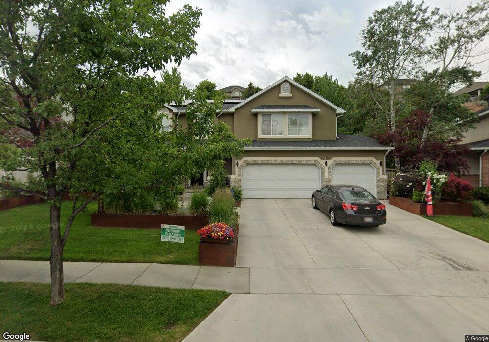
This home is located at 2030 E Candle Spruce Cove, Sandy, UT 84092 and is currently estimated at $953,389, approximately $235 per square foot. 2030 E Candle Spruce Cove is a home located in Salt Lake County with nearby schools including Granite Elementary School, Albion Middle School, and Jordan High.
Ownership History
Date
Name
Owned For
Owner Type
Purchase Details
Closed on
Feb 18, 1997
Sold by
Cranny Timothy J and Cranny Toni E
Bought by
Mcmillan Richard H and Mcmillan Lisa A
Current Estimated Value
Home Financials for this Owner
Home Financials are based on the most recent Mortgage that was taken out on this home.
Original Mortgage
$214,600
Interest Rate
7.86%
Purchase Details
Closed on
Mar 20, 1996
Sold by
Underwood Construction L C
Bought by
Cranny Timothy J and Cranny Toni E
Home Financials for this Owner
Home Financials are based on the most recent Mortgage that was taken out on this home.
Original Mortgage
$232,100
Interest Rate
7.05%
Purchase Details
Closed on
May 18, 1994
Sold by
Kfp Corp
Bought by
Underwood Construction L C
Home Financials for this Owner
Home Financials are based on the most recent Mortgage that was taken out on this home.
Original Mortgage
$214,440
Interest Rate
8.52%
Create a Home Valuation Report for This Property
The Home Valuation Report is an in-depth analysis detailing your home's value as well as a comparison with similar homes in the area
Home Values in the Area
Average Home Value in this Area
Purchase History
We collect this data history from publicly available records. To have your information removed, we recommend requesting removal directly through your county’s website.
| Date | Buyer | Sale Price | Title Company |
|---|---|---|---|
| Mcmillan Richard H | -- | -- | |
| Cranny Timothy J | -- | -- | |
| Underwood Construction L C | -- | -- |
Source: Public Records
Mortgage History
We collect this data history from publicly available records. To have your information removed, we recommend requesting removal directly through your county’s website.
| Date | Status | Borrower | Loan Amount |
|---|---|---|---|
| Closed | Mcmillan Richard H | $214,600 | |
| Previous Owner | Cranny Timothy J | $232,100 | |
| Previous Owner | Underwood Construction L C | $214,440 |
Source: Public Records
Tax History
| Year | Tax Paid | Tax Assessment Tax Assessment Total Assessment is a certain percentage of the fair market value that is determined by local assessors to be the total taxable value of land and additions on the property. | Land | Improvement |
|---|---|---|---|---|
| 2025 | $4,494 | $861,100 | $303,900 | $557,200 |
| 2024 | $4,494 | $842,400 | $292,500 | $549,900 |
| 2023 | $4,221 | $789,800 | $281,300 | $508,500 |
| 2022 | $4,108 | $756,200 | $275,800 | $480,400 |
| 2021 | $3,721 | $583,000 | $212,100 | $370,900 |
| 2020 | $3,836 | $567,200 | $212,100 | $355,100 |
| 2019 | $3,872 | $558,600 | $200,100 | $358,500 |
| 2018 | $3,639 | $549,000 | $200,100 | $348,900 |
| 2017 | $3,358 | $484,700 | $200,100 | $284,600 |
| 2016 | $3,433 | $479,000 | $180,300 | $298,700 |
| 2015 | $3,758 | $486,100 | $203,700 | $282,400 |
| 2014 | $3,479 | $442,000 | $189,300 | $252,700 |
Source: Public Records
Map
Nearby Homes
- 2014 Quartzridge Dr
- 2163 E Borg Dr
- 2196 Thistlewood Way
- 1969 E Falcon Hurst Ct
- 1822 E 9800 S
- 1788 E Tramway Dr
- 9722 S Buttonwood Cir
- 9510 S 2280 E
- 1797 Ski View Dr
- 2027 E 10095 S
- 2073 E 10095 S
- 1723 E Albury Rd
- 2098 E 10140 S
- 10150 S 2165 E
- 1758 E Abbedale Ln
- 10183 S Hickory Point Dr
- 9969 Altamont Dr
- 2257 Karalee Way
- 1682 E Sunrise Meadow Dr
- 1930 E Southbridge Way
- 2030 Candle Spruce Cove
- 2038 Candle Spruce Cove
- 2024 E Candle Spruce Cove
- 2024 Candle Spruce Cove
- 2046 E Candle Spruce Cove
- 2046 Candle Spruce Cove
- 2021 Rocklin Dr
- 2009 Rocklin Dr
- 2033 Candle Spruce Cove
- 2020 E Candle Spruce Cove
- 2020 Candle Spruce Cove
- 2041 E Candle Spruce Cove
- 2041 Candle Spruce Cove
- 2033 Rocklin Dr
- 1997 E Rocklin Dr
- 1997 Rocklin Dr
- 2049 Candle Spruce Cove
- 2054 Candle Spruce Cove
- 2054 E Candle Spruce Cove
- 2021 Candle Spruce Cove
Your Personal Tour Guide
Ask me questions while you tour the home.