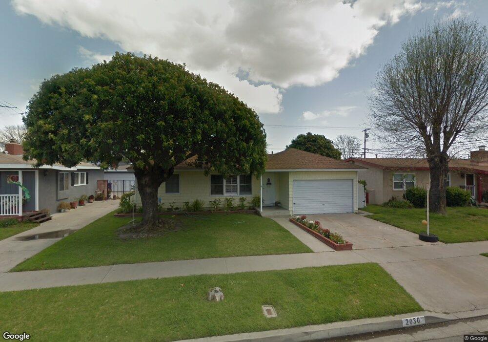
2030 Mcnab Ave Long Beach, CA 90815
Los Altos South NeighborhoodEstimated Value: $1,122,000 - $1,997,132
4
Beds
5
Baths
3,364
Sq Ft
$450/Sq Ft
Est. Value
About This Home
This home is located at 2030 Mcnab Ave, Long Beach, CA 90815 and is currently estimated at $1,514,283, approximately $450 per square foot. 2030 Mcnab Ave is a home located in Los Angeles County with nearby schools including Minnie Gant Elementary School, Stanford Middle School, and Woodrow Wilson High School.
Ownership History
Date
Name
Owned For
Owner Type
Purchase Details
Closed on
May 19, 2004
Sold by
Amiel Michael Edward and Amiel Phuong Pham
Bought by
Lugo David
Current Estimated Value
Home Financials for this Owner
Home Financials are based on the most recent Mortgage that was taken out on this home.
Original Mortgage
$330,000
Outstanding Balance
$143,775
Interest Rate
4.5%
Mortgage Type
Purchase Money Mortgage
Estimated Equity
$1,370,508
Purchase Details
Closed on
Aug 28, 1996
Sold by
Garcia Gene
Bought by
Amiel Michael Edward and Amiel Phuong Pham
Home Financials for this Owner
Home Financials are based on the most recent Mortgage that was taken out on this home.
Original Mortgage
$113,000
Interest Rate
7.5%
Create a Home Valuation Report for This Property
The Home Valuation Report is an in-depth analysis detailing your home's value as well as a comparison with similar homes in the area
Home Values in the Area
Average Home Value in this Area
Purchase History
We collect this data history from publicly available records. To have your information removed, we recommend requesting removal directly through your county’s website.
| Date | Buyer | Sale Price | Title Company |
|---|---|---|---|
| Lugo David | $463,000 | North American Title Co | |
| Amiel Michael Edward | $153,000 | Orange Coast Title |
Source: Public Records
Mortgage History
We collect this data history from publicly available records. To have your information removed, we recommend requesting removal directly through your county’s website.
| Date | Status | Borrower | Loan Amount |
|---|---|---|---|
| Open | Lugo David | $330,000 | |
| Previous Owner | Amiel Michael Edward | $113,000 |
Source: Public Records
Tax History
| Year | Tax Paid | Tax Assessment Tax Assessment Total Assessment is a certain percentage of the fair market value that is determined by local assessors to be the total taxable value of land and additions on the property. | Land | Improvement |
|---|---|---|---|---|
| 2025 | $15,643 | $1,184,582 | $526,624 | $657,958 |
| 2024 | $14,989 | $1,161,356 | $516,299 | $645,057 |
| 2023 | $14,751 | $1,138,585 | $506,176 | $632,409 |
| 2022 | $13,848 | $1,116,260 | $496,251 | $620,009 |
| 2021 | $13,582 | $1,094,373 | $486,521 | $607,852 |
| 2019 | $13,387 | $1,061,916 | $472,092 | $589,824 |
| 2018 | $12,987 | $1,041,095 | $462,836 | $578,259 |
| 2016 | $11,690 | $980,000 | $561,200 | $418,800 |
| 2015 | $8,213 | $707,910 | $408,000 | $299,910 |
| 2014 | $5,636 | $473,000 | $378,600 | $94,400 |
Source: Public Records
Map
Nearby Homes
- 1875 Mcnab Ave
- 2260 Gondar Ave
- 2031 Josie Ave
- 6135 E 23rd St
- 1817 Lave Ave
- 2335 Carfax Ave
- 2038 San Anseline Ave
- 1431 Josie Ave
- 1873 Marber Ave
- 1837 N Studebaker Rd
- 2635 Gondar Ave
- 1470 Bryant Dr E
- 1901 N Bellflower Blvd
- 5469 E Garford St
- 6544 E Willow St
- 5449 E Fairbrook St
- 6953 E Stearns St
- 2430 Marber Ave
- 1238 N Studebaker Rd
- 1931 Volk Ave
- 2040 Mcnab Ave
- 2020 Mcnab Ave
- 2031 Snowden Ave
- 2050 Mcnab Ave
- 2010 Mcnab Ave
- 2021 Snowden Ave
- 2041 Snowden Ave
- 2011 Snowden Ave
- 2051 Snowden Ave
- 2031 Mcnab Ave
- 2021 Mcnab Ave
- 2060 Mcnab Ave
- 2000 Mcnab Ave
- 2041 Mcnab Ave
- 2001 Snowden Ave
- 2061 Snowden Ave
- 6131 E Los Santos Dr
- 2051 Mcnab Ave
- 2070 Mcnab Ave
- 2061 Mcnab Ave
Your Personal Tour Guide
Ask me questions while you tour the home.