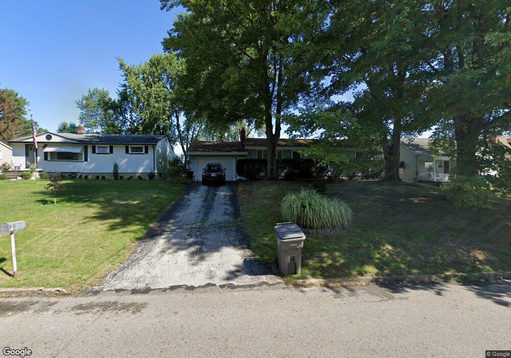
2030 Meadowbrook Ave Youngstown, OH 44514
Estimated Value: $65,000 - $116,000
3
Beds
1
Bath
1,092
Sq Ft
$91/Sq Ft
Est. Value
About This Home
This home is located at 2030 Meadowbrook Ave, Youngstown, OH 44514 and is currently estimated at $99,244, approximately $90 per square foot. 2030 Meadowbrook Ave is a home located in Mahoning County with nearby schools including Paul C. Bunn Elementary School, Chaney High School, and Summit Academy Secondary School - Youngstown.
Ownership History
Date
Name
Owned For
Owner Type
Purchase Details
Closed on
Oct 8, 1998
Sold by
Nemes David J
Bought by
Beyer Larry A and Beyer Deborah A
Current Estimated Value
Purchase Details
Closed on
Jul 20, 1995
Sold by
Demain Ann
Bought by
Nemes David J
Home Financials for this Owner
Home Financials are based on the most recent Mortgage that was taken out on this home.
Original Mortgage
$59,364
Interest Rate
7.5%
Mortgage Type
VA
Purchase Details
Closed on
Oct 7, 1993
Bought by
Demain Ann
Create a Home Valuation Report for This Property
The Home Valuation Report is an in-depth analysis detailing your home's value as well as a comparison with similar homes in the area
Home Values in the Area
Average Home Value in this Area
Purchase History
| Date | Buyer | Sale Price | Title Company |
|---|---|---|---|
| Beyer Larry A | $60,000 | -- | |
| Nemes David J | $58,200 | -- | |
| Demain Ann | -- | -- |
Source: Public Records
Mortgage History
| Date | Status | Borrower | Loan Amount |
|---|---|---|---|
| Previous Owner | Nemes David J | $59,364 |
Source: Public Records
Tax History Compared to Growth
Tax History
| Year | Tax Paid | Tax Assessment Tax Assessment Total Assessment is a certain percentage of the fair market value that is determined by local assessors to be the total taxable value of land and additions on the property. | Land | Improvement |
|---|---|---|---|---|
| 2024 | $519 | $20,670 | $2,930 | $17,740 |
| 2023 | $545 | $20,670 | $2,930 | $17,740 |
| 2022 | $542 | $17,550 | $3,020 | $14,530 |
| 2021 | $542 | $17,550 | $3,020 | $14,530 |
| 2020 | $545 | $17,550 | $3,020 | $14,530 |
| 2019 | $480 | $15,670 | $2,700 | $12,970 |
| 2018 | $485 | $15,670 | $2,700 | $12,970 |
| 2017 | $536 | $15,670 | $2,700 | $12,970 |
| 2016 | $589 | $17,870 | $2,700 | $15,170 |
| 2015 | $577 | $17,870 | $2,700 | $15,170 |
| 2014 | $573 | $17,870 | $2,700 | $15,170 |
| 2013 | $565 | $17,870 | $2,700 | $15,170 |
Source: Public Records
Map
Nearby Homes
- 2001 Brownlee Ave
- 4528 Sheridan Rd
- 2014 Country Club Ave
- 2020 Medford Ave
- 4227 Sheridan Rd
- 574 Spring St
- 1665 Wakefield Ave
- 1928 Medford Ave
- 1654 Wakefield Ave
- 1653 Brownlee Ave
- 1885 Country Club Ave
- 491 Spring St
- 1954 Everett Ave
- 0 Crescent Dr Unit 5124984
- 2007 E Midlothian Blvd
- 1646 Weston Ave
- 1560 Wakefield Ave
- 1933 Brandon Ave
- 1513 Wakefield Ave
- 1720 Sequoya Dr
- 2036 Meadowbrook Ave
- 2024 Meadowbrook Ave
- 2042 Meadowbrook Ave
- 2014 Meadowbrook Ave
- 2029 Bancroft Ave
- 2023 Bancroft Ave
- 2046 Meadowbrook Ave
- 2035 Bancroft Ave
- 2019 Bancroft Ave
- 2041 Bancroft Ave
- 2013 Bancroft Ave
- 2052 Meadowbrook Ave
- 2045 Bancroft Ave
- 2007 Bancroft Ave Unit 9
- 2002 Meadowbrook Ave
- 2051 Bancroft Ave
- 2001 Bancroft Ave
- 2031 Meadowbrook Ave
- 2023 Meadowbrook Ave
- 2030 Bancroft Ave