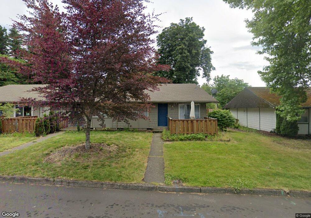
2030 N Main Ave Gresham, OR 97030
North Central NeighborhoodEstimated Value: $500,000 - $521,000
6
Beds
3
Baths
2,400
Sq Ft
$212/Sq Ft
Est. Value
About This Home
This home is located at 2030 N Main Ave, Gresham, OR 97030 and is currently estimated at $508,667, approximately $211 per square foot. 2030 N Main Ave is a home located in Multnomah County with nearby schools including Highland Elementary School, Clear Creek Middle School, and Gresham High School.
Ownership History
Date
Name
Owned For
Owner Type
Purchase Details
Closed on
Jul 23, 2010
Sold by
Federal Home Loan Mortgage Corporation
Bought by
Mees Karen
Current Estimated Value
Purchase Details
Closed on
Mar 31, 2010
Sold by
Stanley Shawn G
Bought by
Federal Home Loan Mortgage Corp
Purchase Details
Closed on
Feb 25, 2008
Sold by
Stanley Shawn
Bought by
Gresham 2000 Llc
Purchase Details
Closed on
Jul 31, 2003
Sold by
Casterline Henrikso Exchange Svc Co
Bought by
Stanley Shawn G
Home Financials for this Owner
Home Financials are based on the most recent Mortgage that was taken out on this home.
Original Mortgage
$202,350
Interest Rate
7.35%
Mortgage Type
Purchase Money Mortgage
Purchase Details
Closed on
Apr 30, 2003
Sold by
Tarlow Family Lp
Bought by
Casterlina Henriksbo Exchange Service Co
Create a Home Valuation Report for This Property
The Home Valuation Report is an in-depth analysis detailing your home's value as well as a comparison with similar homes in the area
Home Values in the Area
Average Home Value in this Area
Purchase History
| Date | Buyer | Sale Price | Title Company |
|---|---|---|---|
| Mees Karen | $179,600 | Service Link | |
| Federal Home Loan Mortgage Corp | $200,000 | Fatco | |
| Gresham 2000 Llc | $296,670 | None Available | |
| Stanley Shawn G | $213,000 | First American | |
| Casterlina Henriksbo Exchange Service Co | -- | -- |
Source: Public Records
Mortgage History
| Date | Status | Borrower | Loan Amount |
|---|---|---|---|
| Previous Owner | Stanley Shawn G | $202,350 |
Source: Public Records
Tax History
| Year | Tax Paid | Tax Assessment Tax Assessment Total Assessment is a certain percentage of the fair market value that is determined by local assessors to be the total taxable value of land and additions on the property. | Land | Improvement |
|---|---|---|---|---|
| 2025 | $5,973 | $293,510 | -- | -- |
| 2024 | $5,718 | $284,970 | -- | -- |
| 2023 | $5,209 | $276,670 | $0 | $0 |
| 2022 | $5,064 | $268,620 | $0 | $0 |
| 2021 | $4,936 | $260,800 | $0 | $0 |
| 2020 | $4,644 | $253,210 | $0 | $0 |
| 2019 | $4,523 | $245,840 | $0 | $0 |
| 2018 | $4,312 | $238,680 | $0 | $0 |
| 2017 | $4,137 | $231,730 | $0 | $0 |
| 2016 | $3,648 | $224,990 | $0 | $0 |
Source: Public Records
Map
Nearby Homes
- 349 NE 18th St
- 450 NE 22nd St
- 1783 1791 NE Beech Place
- 1035 SE 225th Ave
- 54 NW 13th St
- 535 NE 24th St
- 2730 NE Roberts Ave
- 2775 NE Linden Ave
- 660 NE 9th St
- 21532 SE Alder St
- 894 NE Linden Ave
- 0 NE 5th St
- 21033 SE Clay Ct
- 210 NE 5th St
- 210 SE 218th Ave
- 491 NE Elliott Ave
- 318 NE Roberts Ave Unit 308
- 318 NE Roberts Ave Unit 203
- 21525 SE Oak St
- 1556 NE 27th Terrace
- 2060 N Main Ave
- 2000 N Main Ave Unit 2020
- 2005 NE Roberts Ct
- 2005 NW Main
- 1905 NE Roberts Ave
- 2005 N Main Ave Unit 2015
- 65 NE 19th St
- 2140 N Main Ave
- 2025 N Main Ave
- 1915 NE Roberts Ct
- 2007 NE Roberts Ct
- 2135 N Main Ave
- 25 NW 20th St Unit 65
- 40 NE 22nd St
- 2030 NW Earl Ct
- 1870 N Main Ave
- 2145 N Main Ave
- 2009 NE Roberts Ct
- 70 NE 22nd St
- 2000 NW Earl Ct Unit 2020
Your Personal Tour Guide
Ask me questions while you tour the home.