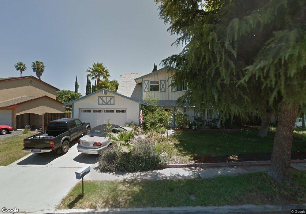
2031 Malcolm St Simi Valley, CA 93065
Central Simi Valley NeighborhoodEstimated Value: $736,627 - $792,000
4
Beds
2
Baths
1,580
Sq Ft
$490/Sq Ft
Est. Value
About This Home
This home is located at 2031 Malcolm St, Simi Valley, CA 93065 and is currently estimated at $774,907, approximately $490 per square foot. 2031 Malcolm St is a home located in Ventura County with nearby schools including Berylwood Elementary School, Hillside Middle School, and Royal High School.
Ownership History
Date
Name
Owned For
Owner Type
Purchase Details
Closed on
Dec 31, 1997
Sold by
Erro Thomas D
Bought by
Erro Jo Anne
Current Estimated Value
Purchase Details
Closed on
Oct 23, 1997
Sold by
Geier Mary G
Bought by
Stokotelny Richard M and Stokotelny Dianna M
Home Financials for this Owner
Home Financials are based on the most recent Mortgage that was taken out on this home.
Original Mortgage
$158,670
Interest Rate
7.16%
Mortgage Type
FHA
Purchase Details
Closed on
Sep 2, 1994
Sold by
Erro Jo Anne
Bought by
Erro Jo Anne
Home Financials for this Owner
Home Financials are based on the most recent Mortgage that was taken out on this home.
Original Mortgage
$50,000
Interest Rate
9.1%
Create a Home Valuation Report for This Property
The Home Valuation Report is an in-depth analysis detailing your home's value as well as a comparison with similar homes in the area
Home Values in the Area
Average Home Value in this Area
Purchase History
| Date | Buyer | Sale Price | Title Company |
|---|---|---|---|
| Erro Jo Anne | -- | Lawyers Title | |
| Stokotelny Richard M | $162,000 | Lawyers Title | |
| Geier Mary G | $81,000 | Lawyers Title | |
| Erro Jo Anne | -- | Stewart Title |
Source: Public Records
Mortgage History
| Date | Status | Borrower | Loan Amount |
|---|---|---|---|
| Previous Owner | Stokotelny Richard M | $158,670 | |
| Previous Owner | Erro Jo Anne | $50,000 |
Source: Public Records
Tax History
| Year | Tax Paid | Tax Assessment Tax Assessment Total Assessment is a certain percentage of the fair market value that is determined by local assessors to be the total taxable value of land and additions on the property. | Land | Improvement |
|---|---|---|---|---|
| 2025 | $3,488 | $258,630 | $103,448 | $155,182 |
| 2024 | $3,488 | $253,559 | $101,419 | $152,140 |
| 2023 | $3,276 | $248,588 | $99,431 | $149,157 |
| 2022 | $3,240 | $243,714 | $97,481 | $146,233 |
| 2021 | $3,196 | $238,936 | $95,570 | $143,366 |
| 2020 | $3,116 | $236,488 | $94,591 | $141,897 |
| 2019 | $2,970 | $231,852 | $92,737 | $139,115 |
| 2018 | $2,931 | $227,307 | $90,919 | $136,388 |
| 2017 | $2,855 | $222,851 | $89,137 | $133,714 |
| 2016 | $2,722 | $218,483 | $87,390 | $131,093 |
| 2015 | $2,653 | $215,203 | $86,078 | $129,125 |
| 2014 | $2,603 | $210,990 | $84,393 | $126,597 |
Source: Public Records
Map
Nearby Homes
- 2095 Morley St
- 2165 Malcolm St
- 1904 Heywood St Unit L
- 1932 Heywood St Unit B
- 1558 Ysrella Ave
- 2267 Morley St
- 2025 Royal Ave
- 1387 Cherry Ave
- 1290 Lawrence Cir
- 1755 Heywood St Unit 201
- 1763 Kearney Ave
- 2407 Elizondo Ave
- 2399 Lee St
- 2146 N Brower St
- 1805 Hillary Ct
- 2091 Marter Ave
- 2405 Lee St
- 1843 Garvin Ave
- 1091 Vallejo Ave
- 2136 Rosecrans St
- 2039 Malcolm St
- 2025 Malcolm St
- 2030 Rhoda St
- 2042 Rhoda St
- 2053 Malcolm St
- 2011 Malcolm St
- 2018 Rhoda St
- 2024 Malcolm St
- 2030 Malcolm St
- 2038 Malcolm St
- 2044 Malcolm St
- 2054 Rhoda St
- 2016 Malcolm St
- 2059 Malcolm St
- 2003 Malcolm St
- 2052 Malcolm St
- 2006 Rhoda St
- 2010 Malcolm St
- 2066 Rhoda St
- 2058 Malcolm St
Your Personal Tour Guide
Ask me questions while you tour the home.