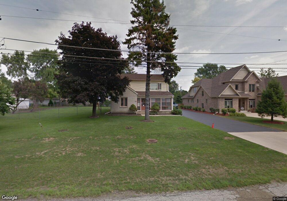
2033 Douglas Ave Des Plaines, IL 60018
Estimated Value: $449,000 - $586,000
5
Beds
2
Baths
2,183
Sq Ft
$239/Sq Ft
Est. Value
About This Home
This home is located at 2033 Douglas Ave, Des Plaines, IL 60018 and is currently estimated at $520,759, approximately $238 per square foot. 2033 Douglas Ave is a home located in Cook County with nearby schools including Plainfield Elementary School, Algonquin Middle School, and Maine West High School.
Ownership History
Date
Name
Owned For
Owner Type
Purchase Details
Closed on
Aug 11, 2000
Sold by
Hussar William and Hussar Bonnie E
Bought by
Camarillo Francisco M and Camarillo Mariza
Current Estimated Value
Home Financials for this Owner
Home Financials are based on the most recent Mortgage that was taken out on this home.
Original Mortgage
$323,000
Outstanding Balance
$112,552
Interest Rate
8.26%
Estimated Equity
$408,208
Purchase Details
Closed on
Jan 5, 1994
Sold by
Lasalle National Trust Na
Bought by
Hussar William and Hussar Bonnie E
Create a Home Valuation Report for This Property
The Home Valuation Report is an in-depth analysis detailing your home's value as well as a comparison with similar homes in the area
Home Values in the Area
Average Home Value in this Area
Purchase History
| Date | Buyer | Sale Price | Title Company |
|---|---|---|---|
| Camarillo Francisco M | $340,000 | -- | |
| Hussar William | -- | -- |
Source: Public Records
Mortgage History
| Date | Status | Borrower | Loan Amount |
|---|---|---|---|
| Open | Camarillo Francisco M | $323,000 |
Source: Public Records
Tax History
| Year | Tax Paid | Tax Assessment Tax Assessment Total Assessment is a certain percentage of the fair market value that is determined by local assessors to be the total taxable value of land and additions on the property. | Land | Improvement |
|---|---|---|---|---|
| 2025 | $8,445 | $49,000 | $14,785 | $34,215 |
| 2024 | $8,445 | $38,001 | $12,814 | $25,187 |
| 2023 | $8,898 | $38,001 | $12,814 | $25,187 |
| 2022 | $8,898 | $38,001 | $12,814 | $25,187 |
| 2021 | $9,012 | $32,648 | $16,756 | $15,892 |
| 2020 | $8,929 | $32,648 | $16,756 | $15,892 |
| 2019 | $8,949 | $36,684 | $16,756 | $19,928 |
| 2018 | $9,907 | $36,561 | $14,784 | $21,777 |
| 2017 | $9,749 | $36,561 | $14,784 | $21,777 |
| 2016 | $9,466 | $36,561 | $14,784 | $21,777 |
| 2015 | $9,548 | $34,206 | $12,813 | $21,393 |
| 2014 | $9,363 | $34,206 | $12,813 | $21,393 |
| 2013 | $9,112 | $34,206 | $12,813 | $21,393 |
Source: Public Records
Map
Nearby Homes
- 635 Birchwood Ave
- 614 Birchwood Ave
- 2323 Douglas Ave
- 815 E Oakton St Unit 311
- 664 E Oakton St
- 1596 Oxford Rd
- 1370 Fargo Ave Unit E
- 1458 Kingston Ct
- 2220 S Chestnut St
- 1080 Bogart St
- 1394 Carol Ln
- 505 Forest Ave
- 1445 Everett Ave
- 1696 S Elm St
- 1689 S Elm St
- 1205 S Wolf Rd
- 1645 Illinois St
- 674 E Algonquin Rd
- 1162 W Grant Dr
- 1738 Lunt Ave
- 2057 Douglas Ave
- 705 Howard Ave
- 2024 Westview Dr
- 2016 Westview Dr
- 2032 Westview Dr Unit 1
- 2008 Westview Dr
- 2040 Westview Dr
- 634 Birchwood Ave
- 2000 Westview Dr
- 2048 Westview Dr
- 645 Howard Ave
- 638 Birchwood Ave
- 2109 Douglas Ave
- 2056 Westview Dr
- 637 Howard Ave
- 2064 Westview Dr
- 2025 Westview Dr
- 2033 Westview Dr
- 2017 Westview Dr
- 632 Birchwood Ave
Your Personal Tour Guide
Ask me questions while you tour the home.