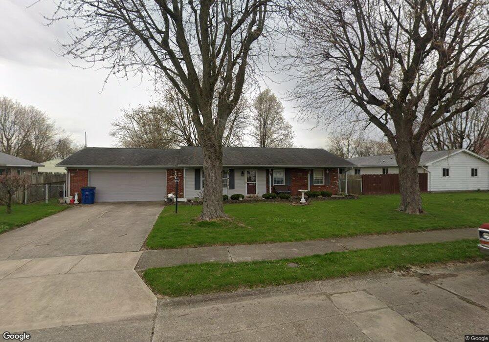
2033 W Walnut St Marion, IN 46952
Sunnywest NeighborhoodEstimated Value: $136,000 - $152,265
3
Beds
2
Baths
1,144
Sq Ft
$126/Sq Ft
Est. Value
About This Home
This home is located at 2033 W Walnut St, Marion, IN 46952 and is currently estimated at $144,316, approximately $126 per square foot. 2033 W Walnut St is a home located in Grant County with nearby schools including John W. Kendall Elementary School, Justice Thurgood Marshall Intermediate School, and John L. McCulloch Junior High School.
Ownership History
Date
Name
Owned For
Owner Type
Purchase Details
Closed on
May 3, 2018
Sold by
Rumple Jodi L
Bought by
Brankle Fred and Brankle Janet
Current Estimated Value
Purchase Details
Closed on
Jun 30, 2014
Sold by
Rumple John
Bought by
Rumple Jodi Lee
Purchase Details
Closed on
Aug 13, 2008
Sold by
Brankle Donald W and Brankle Bernadine
Bought by
Rumple John and Rumple Jodi Lee
Purchase Details
Closed on
Jun 11, 2003
Sold by
Not Provided
Bought by
Not Provided
Create a Home Valuation Report for This Property
The Home Valuation Report is an in-depth analysis detailing your home's value as well as a comparison with similar homes in the area
Home Values in the Area
Average Home Value in this Area
Purchase History
| Date | Buyer | Sale Price | Title Company |
|---|---|---|---|
| Brankle Fred | -- | -- | |
| Rumple Jodi Lee | -- | None Available | |
| Rumple John | $70,000 | -- | |
| Not Provided | $70,000 | -- |
Source: Public Records
Tax History Compared to Growth
Tax History
| Year | Tax Paid | Tax Assessment Tax Assessment Total Assessment is a certain percentage of the fair market value that is determined by local assessors to be the total taxable value of land and additions on the property. | Land | Improvement |
|---|---|---|---|---|
| 2024 | $324 | $113,300 | $15,200 | $98,100 |
| 2023 | $318 | $109,800 | $15,200 | $94,600 |
| 2022 | $312 | $95,700 | $13,400 | $82,300 |
| 2021 | $306 | $88,800 | $13,400 | $75,400 |
| 2020 | $300 | $81,100 | $13,400 | $67,700 |
| 2019 | $341 | $81,800 | $13,400 | $68,400 |
| 2018 | $1,610 | $80,500 | $12,800 | $67,700 |
| 2017 | $1,594 | $79,700 | $12,800 | $66,900 |
| 2016 | $1,624 | $81,200 | $12,800 | $68,400 |
| 2014 | $1,540 | $77,000 | $12,800 | $64,200 |
| 2013 | $1,540 | $76,200 | $12,800 | $63,400 |
Source: Public Records
Map
Nearby Homes
- 502 N Lenfesty Ave
- 304 N Norton Ave
- 1807 W Wenlock Dr
- 1805 W Wenlock Dr
- 601 N Bradner Ave
- 2200 W 2nd St
- 303 S Lenfesty Ave
- 940 N Park Ave
- 806 N Guinivere Dr
- 1534 W 2nd St
- 1807 W Westlea Dr
- 1512 W Spencer Ave
- 1436 W Spencer Ave
- 2376 W Kem Rd
- 1515 W 4th St
- 1101 W Riga Ave
- 1032 W Brandon Ave
- 1309 W 1st St
- 1018 N Lincolnshire Blvd
- 1422 W 5th St
- 323 Trook Ct
- 322 N Lenfesty Ave
- 321 Trook Ct
- 318 N Lenfesty Ave
- 319 Trook Ct
- 2032 W Walnut St
- 2028 W Walnut St
- 316 N Lenfesty Ave
- 404 N Lenfesty Ave
- 322 Trook Ct
- 2022 W Walnut St
- 317 Trook Ct
- 321 N Lenfesty Ave
- 323 N Lenfesty Ave
- 320 Trook Ct
- 319 N Lenfesty Ave
- 314 N Lenfesty Ave
- 401 N Lenfesty Ave
- 2016 W Walnut St
- 410 N Lenfesty Ave