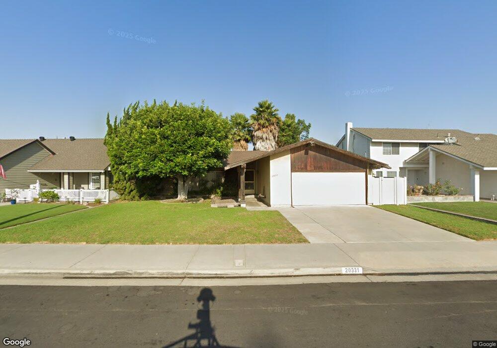
20331 Brentstone Ln Huntington Beach, CA 92646
Southeast NeighborhoodEstimated Value: $1,137,000 - $1,542,000
3
Beds
2
Baths
1,344
Sq Ft
$993/Sq Ft
Est. Value
About This Home
This home is located at 20331 Brentstone Ln, Huntington Beach, CA 92646 and is currently estimated at $1,334,510, approximately $992 per square foot. 20331 Brentstone Ln is a home located in Orange County with nearby schools including S.A. Moffett Elementary School, Isaac L. Sowers Middle School, and Edison High School.
Ownership History
Date
Name
Owned For
Owner Type
Purchase Details
Closed on
Oct 21, 1999
Sold by
Security Trust Company
Bought by
Acker Thomas W
Current Estimated Value
Create a Home Valuation Report for This Property
The Home Valuation Report is an in-depth analysis detailing your home's value as well as a comparison with similar homes in the area
Home Values in the Area
Average Home Value in this Area
Purchase History
| Date | Buyer | Sale Price | Title Company |
|---|---|---|---|
| Acker Thomas W | -- | Chicago Title Co |
Source: Public Records
Tax History Compared to Growth
Tax History
| Year | Tax Paid | Tax Assessment Tax Assessment Total Assessment is a certain percentage of the fair market value that is determined by local assessors to be the total taxable value of land and additions on the property. | Land | Improvement |
|---|---|---|---|---|
| 2025 | $2,499 | $202,051 | $99,327 | $102,724 |
| 2024 | $2,499 | $198,090 | $97,380 | $100,710 |
| 2023 | $2,438 | $194,206 | $95,470 | $98,736 |
| 2022 | $2,372 | $190,399 | $93,599 | $96,800 |
| 2021 | $2,328 | $186,666 | $91,764 | $94,902 |
| 2020 | $2,311 | $184,752 | $90,823 | $93,929 |
| 2019 | $2,285 | $181,130 | $89,042 | $92,088 |
| 2018 | $2,250 | $177,579 | $87,296 | $90,283 |
| 2017 | $2,218 | $174,098 | $85,585 | $88,513 |
| 2016 | $2,127 | $170,685 | $83,907 | $86,778 |
| 2015 | $2,104 | $168,122 | $82,647 | $85,475 |
| 2014 | $2,058 | $164,829 | $81,028 | $83,801 |
Source: Public Records
Map
Nearby Homes
- 8886 Plumas Cir Unit 1124-A
- 20258 Lantana Dr
- 20191 Imperial Cove Ln
- 20131 Crown Reef Ln
- 8856 Sutter Cir Unit 522A
- 8646 Butte Cir Unit 607E
- 8565 Trinity Cir Unit 824D
- 8856 526C Sutter
- 8932 Amador Cir Unit 1309B
- 8472 Norfolk Dr
- 20251 Lighthouse Ln
- 8777 Tulare Dr Unit 409D
- 8565 Colusa Cir Unit 906C
- 8565 Larkhall Cir Unit 804A
- 8566 Larkhall Cir Unit 808A
- 8566 Larkhall Cir Unit 809D
- 8342 Seaport Dr
- 20111 Marina Ln
- 9001 Oceanwood Dr
- 8788 Coral Springs Ct Unit 203
- 20311 Brentstone Ln
- 20341 Brentstone Ln
- 20351 Brentstone Ln
- 20301 Brentstone Ln
- 20332 Brentstone Ln
- 20322 Brentstone Ln
- 20342 Brentstone Ln
- 20312 Brentstone Ln
- 20361 Brentstone Ln
- 20291 Brentstone Ln
- 20352 Brentstone Ln
- 20302 Brentstone Ln
- 20362 Brentstone Ln
- 20281 Brentstone Ln
- 20371 Brentstone Ln
- 20292 Brentstone Ln
- 20341 Mansard Ln
- 20331 Mansard Ln
- 20351 Mansard Ln
- 20321 Mansard Ln