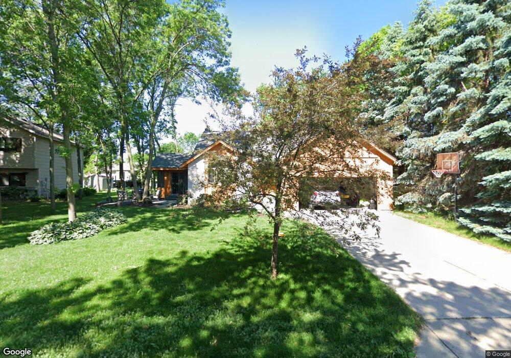
2034 Taylor Ct Northfield, MN 55057
Estimated Value: $384,000 - $412,000
3
Beds
2
Baths
2,118
Sq Ft
$187/Sq Ft
Est. Value
About This Home
This home is located at 2034 Taylor Ct, Northfield, MN 55057 and is currently estimated at $395,202, approximately $186 per square foot. 2034 Taylor Ct is a home located in Rice County with nearby schools including Bridgewater Elementary School, Northfield Middle School, and Northfield Senior High School.
Ownership History
Date
Name
Owned For
Owner Type
Purchase Details
Closed on
Feb 11, 2021
Sold by
Shroyer Landon and Shroyer Emily
Bought by
Arnold Nolan and Bringsjord Berit
Current Estimated Value
Home Financials for this Owner
Home Financials are based on the most recent Mortgage that was taken out on this home.
Original Mortgage
$248,000
Outstanding Balance
$202,360
Interest Rate
2.7%
Mortgage Type
New Conventional
Estimated Equity
$192,842
Purchase Details
Closed on
Nov 3, 2017
Sold by
Snodgrass Jon M and Snodgrass Stephanie
Bought by
Shroyer Landon and Shroyer Emily
Home Financials for this Owner
Home Financials are based on the most recent Mortgage that was taken out on this home.
Original Mortgage
$254,410
Interest Rate
3.83%
Mortgage Type
New Conventional
Purchase Details
Closed on
May 15, 2007
Sold by
Kletzin Robert W and Kletzin Sharon L
Bought by
Snodgrass Jon M
Create a Home Valuation Report for This Property
The Home Valuation Report is an in-depth analysis detailing your home's value as well as a comparison with similar homes in the area
Home Values in the Area
Average Home Value in this Area
Purchase History
| Date | Buyer | Sale Price | Title Company |
|---|---|---|---|
| Arnold Nolan | $310,000 | Knight Barry Ttl United Llc | |
| Shroyer Landon | $267,800 | Rice County Abstract & Title | |
| Snodgrass Jon M | $235,000 | -- |
Source: Public Records
Mortgage History
| Date | Status | Borrower | Loan Amount |
|---|---|---|---|
| Open | Arnold Nolan | $248,000 | |
| Previous Owner | Shroyer Landon | $254,410 |
Source: Public Records
Tax History Compared to Growth
Tax History
| Year | Tax Paid | Tax Assessment Tax Assessment Total Assessment is a certain percentage of the fair market value that is determined by local assessors to be the total taxable value of land and additions on the property. | Land | Improvement |
|---|---|---|---|---|
| 2025 | $6,092 | $363,900 | $67,200 | $296,700 |
| 2024 | $6,092 | $357,400 | $65,200 | $292,200 |
| 2023 | $5,164 | $357,400 | $65,200 | $292,200 |
| 2022 | $4,710 | $325,300 | $65,200 | $260,100 |
| 2021 | $4,540 | $290,200 | $61,300 | $228,900 |
| 2020 | $4,426 | $276,700 | $61,300 | $215,400 |
| 2019 | $4,094 | $265,000 | $59,300 | $205,700 |
| 2018 | $3,756 | $243,800 | $59,300 | $184,500 |
| 2017 | $3,360 | $221,700 | $55,300 | $166,400 |
| 2016 | $3,268 | $216,400 | $55,300 | $161,100 |
| 2015 | $3,192 | $201,800 | $55,300 | $146,500 |
| 2014 | -- | $198,600 | $55,300 | $143,300 |
Source: Public Records
Map
Nearby Homes
- 2004 Lincoln St S
- 2206 Grant Ct
- 1741 Roosevelt Dr
- 709 Carter Dr
- 2116 Park Pointe Dr
- 1819 Truman Ct
- 2200 Greenfield Dr W
- 1707 Jackson Ct
- 2220 Greenfield Dr E
- Outlot Honeylocust Dr
- 2620 Oak Lawn Dr
- 2704 Oak Lawn Dr
- 2708 Oak Lawn Dr
- 1513 Senate Ln
- 2804 Oak Lawn Dr
- 546 Cannon Way
- XXXX Division St S
- 555 Cannon Way
- 1301 Presidential Dr
- 511 French Ln
- 2100 Taylor Ct
- 2030 Taylor Ct
- 2013 Lincoln St S
- 2101 Lincoln St S
- 2009 Lincoln St S
- 2035 Taylor Ct
- 2104 Taylor Ct
- 2031 Taylor Ct
- 2105 Lincoln St S
- 2101 Taylor Ct
- 2005 2005 Lincoln-Street-s
- 2005 Lincoln St S
- 2108 Taylor Ct
- 2109 Taylor Ct
- 2016 Lincoln St S
- 2018 Lincoln St S
- 2014 Lincoln St S
- 1104 Heritage Dr
- 2012 Lincoln St S
- 2100 Lincoln St S