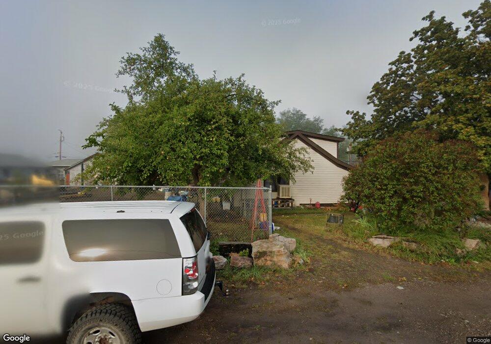
20343 E Mullan Rd Clinton, MT 59825
Clinton NeighborhoodEstimated Value: $365,350 - $581,000
4
Beds
1
Bath
1,290
Sq Ft
$366/Sq Ft
Est. Value
About This Home
This home is located at 20343 E Mullan Rd, Clinton, MT 59825 and is currently estimated at $472,588, approximately $366 per square foot. 20343 E Mullan Rd is a home located in Missoula County with nearby schools including Clinton Elementary School and Sentinel High School.
Ownership History
Date
Name
Owned For
Owner Type
Purchase Details
Closed on
May 29, 2013
Sold by
Morris Susan L
Bought by
Cleary Clayton S and Kissinger Desireh M
Current Estimated Value
Home Financials for this Owner
Home Financials are based on the most recent Mortgage that was taken out on this home.
Original Mortgage
$145,000
Interest Rate
4.5%
Mortgage Type
New Conventional
Purchase Details
Closed on
Feb 2, 2001
Sold by
Taulbee Jennifer C Lawrence
Bought by
Morris Susan Lynne
Home Financials for this Owner
Home Financials are based on the most recent Mortgage that was taken out on this home.
Original Mortgage
$94,400
Interest Rate
7.13%
Create a Home Valuation Report for This Property
The Home Valuation Report is an in-depth analysis detailing your home's value as well as a comparison with similar homes in the area
Home Values in the Area
Average Home Value in this Area
Purchase History
| Date | Buyer | Sale Price | Title Company |
|---|---|---|---|
| Cleary Clayton S | -- | None Available | |
| Morris Susan Lynne | -- | -- |
Source: Public Records
Mortgage History
| Date | Status | Borrower | Loan Amount |
|---|---|---|---|
| Previous Owner | Cleary Clayton S | $145,000 | |
| Previous Owner | Morris Susan Lynne | $94,400 | |
| Closed | Morris Susan Lynne | $23,600 |
Source: Public Records
Tax History
| Year | Tax Paid | Tax Assessment Tax Assessment Total Assessment is a certain percentage of the fair market value that is determined by local assessors to be the total taxable value of land and additions on the property. | Land | Improvement |
|---|---|---|---|---|
| 2025 | $3,593 | $345,900 | $58,545 | $287,355 |
| 2024 | $2,900 | $299,400 | $58,365 | $241,035 |
| 2023 | $3,482 | $299,400 | $58,365 | $241,035 |
| 2018 | $1,368 | $144,775 | $0 | $0 |
| 2017 | $1,378 | $144,775 | $0 | $0 |
| 2016 | $964 | $106,330 | $0 | $0 |
| 2015 | $833 | $98,570 | $0 | $0 |
| 2014 | $749 | $49,747 | $0 | $0 |
Source: Public Records
Map
Nearby Homes
- NHN Stitt St
- 11055 Silver St
- Nhn Us Highway 10 E
- Lot 13 Pamin Loop
- 22225 Wallace Creek Rd
- 12407 Hawk Ln
- 25575 Patter Spur Rd S
- Lot 15 Muddler Ct
- Lot 16 Stonefly Rd
- Lot 17 Caddisfly Ct
- Lot 12 Stonefly Rd
- Lot 11 Stonefly Rd
- Lot 9 Stonefly Rd
- 24570 Stonefly Rd
- Lot 2 Caddisfly Ct
- 14297 Caddisfly Ct
- Nhn Bonita Ranger Station Rd
- 13505 Turah Rd
- 27235 Lazy Springs Rd
- 12014 Chase Ln
- 11150 Silver St
- 11142 Silver St
- 11130 Silver St
- 20351 E Mullan Rd
- 20353 E Mullan Rd
- 11075 Gold St
- 20325 E Mullan Rd
- 11104 Silver St
- 20321 E Mullan Rd
- 11100 Copper St
- 11150 Copper St
- 19390 Clarkson Dr
- 20319 E Mullan Rd
- 20381 E Mullan Rd
- 9920 Clown Ln
- 19405 Clarkson Dr
- 19455 Clarkson Dr
- 19465 Clarkson Dr
- 19490 Clarkson Dr
- 11070 Silver St
Your Personal Tour Guide
Ask me questions while you tour the home.