J
Seller's Agent in 2025
Jennifer Viger
Market House Realty, LLC

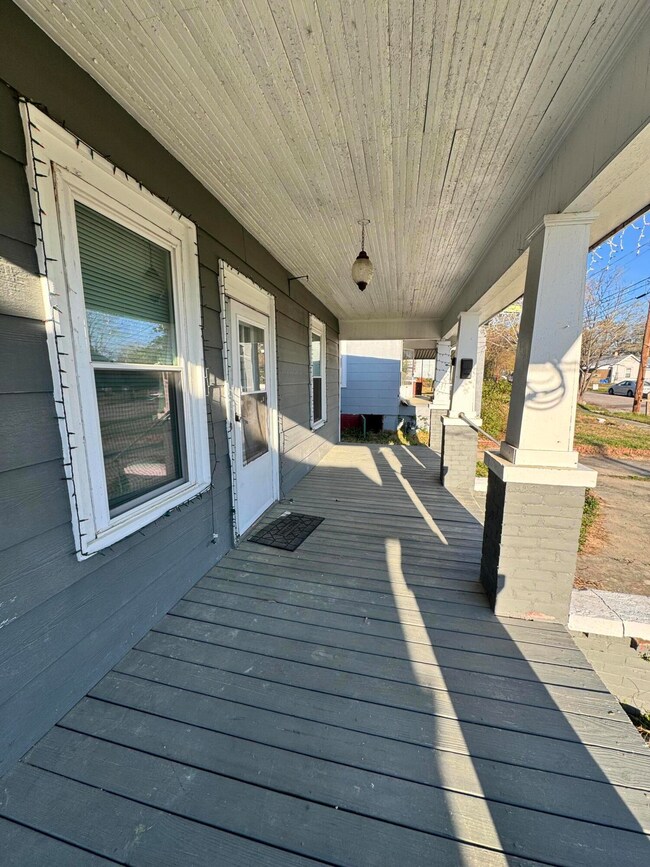

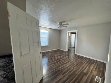

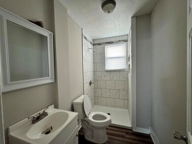
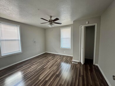
Fully renovated and ready to go, 2036 Ellis Street offers a spacious 3-bedroom, 2-bath layout with modern upgrades throughout. From fresh paint and new flooring to updated kitchen and baths, this home is move-in ready and low maintenance. Conveniently located near downtown Augusta and the medical district, it's a strong investment opportunity or great option for an owner-occupant looking for value and location.
Last Agent to Sell the Property
Jennifer Viger
Market House Realty, LLC License #333631 Listed on: 06/25/2025
Co-Listed By
Carol Dye Irwin
Market House Realty, LLC License #159591
Home Type
Single Family
Year Built
1926
Lot Details
0
| Date | Type | Sale Price | Title Company |
|---|---|---|---|
| Trustee Deed | $125,000 | -- | |
| Quit Claim Deed | -- | -- | |
| Quit Claim Deed | -- | -- | |
| Quit Claim Deed | -- | -- | |
| Quit Claim Deed | -- | -- | |
| Warranty Deed | $94,000 | None Available | |
| Deed | $21,000 | -- | |
| Deed | $65,000 | -- |
| Date | Status | Loan Amount | Loan Type |
|---|---|---|---|
| Open | $100,000 | New Conventional | |
| Previous Owner | $18,900 | Purchase Money Mortgage |
| Date | Event | Price | List to Sale | Price per Sq Ft |
|---|---|---|---|---|
| 09/23/2025 09/23/25 | Sold | $125,000 | -7.4% | $105 / Sq Ft |
| 08/23/2025 08/23/25 | Pending | -- | -- | -- |
| 06/25/2025 06/25/25 | For Sale | $135,000 | -- | $114 / Sq Ft |
| Year | Tax Paid | Tax Assessment Tax Assessment Total Assessment is a certain percentage of the fair market value that is determined by local assessors to be the total taxable value of land and additions on the property. | Land | Improvement |
|---|---|---|---|---|
| 2025 | $1,243 | $29,676 | $1,978 | $27,698 |
| 2024 | $1,243 | $23,384 | $1,978 | $21,406 |
| 2023 | $995 | $32,600 | $1,978 | $30,622 |
| 2022 | $914 | $19,727 | $1,978 | $17,749 |
| 2021 | $616 | $9,083 | $1,971 | $7,112 |
| 2020 | $678 | $11,112 | $4,000 | $7,112 |
| 2019 | $704 | $11,112 | $4,000 | $7,112 |
| 2018 | $708 | $11,112 | $4,000 | $7,112 |
| 2017 | $705 | $11,112 | $4,000 | $7,112 |
| 2016 | $705 | $11,112 | $4,000 | $7,112 |
| 2015 | $708 | $11,112 | $4,000 | $7,112 |
| 2014 | $709 | $11,112 | $4,000 | $7,112 |
J
Seller's Agent in 2025
Jennifer Viger
Market House Realty, LLC
C
Seller Co-Listing Agent in 2025
Carol Dye Irwin
Market House Realty, LLC
Source: Hive MLS
MLS Number: 543666
APN: 0351031000
Disclaimer: Certain information contained herein is derived from information provided by parties other than Homes.com. All information provided is deemed reliable, but is not guaranteed to be accurate and should be independently verified.
![]() IDX information is provided exclusively for personal, non-commercial use, and may not be used for any purpose other than to identify prospective properties consumers may be interested in purchasing.
IDX information is provided exclusively for personal, non-commercial use, and may not be used for any purpose other than to identify prospective properties consumers may be interested in purchasing.
Information is deemed reliable but not guaranteed.