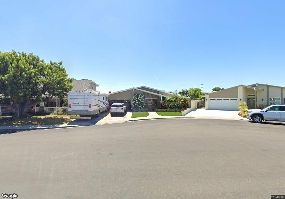
20381 Mooncrest Cir Huntington Beach, CA 92646
Southeast NeighborhoodEstimated Value: $1,436,000 - $1,591,000
3
Beds
2
Baths
1,860
Sq Ft
$815/Sq Ft
Est. Value
About This Home
This home is located at 20381 Mooncrest Cir, Huntington Beach, CA 92646 and is currently estimated at $1,516,620, approximately $815 per square foot. 20381 Mooncrest Cir is a home located in Orange County with nearby schools including Ralph E. Hawes Elementary School, Isaac L. Sowers Middle School, and Edison High School.
Ownership History
Date
Name
Owned For
Owner Type
Purchase Details
Closed on
May 24, 2014
Sold by
Stovall George M and Stovall Jan M
Bought by
The Stovall Family Trust
Current Estimated Value
Purchase Details
Closed on
Dec 9, 2003
Sold by
Stovall George M and Stovall Jan M
Bought by
Stovall Geroge M and Stovall Jan M
Home Financials for this Owner
Home Financials are based on the most recent Mortgage that was taken out on this home.
Original Mortgage
$158,500
Interest Rate
5.92%
Mortgage Type
Purchase Money Mortgage
Purchase Details
Closed on
Oct 16, 2003
Sold by
Stovall George M and Stovall Jan M
Bought by
Stovall George M and Stovall Jan M
Home Financials for this Owner
Home Financials are based on the most recent Mortgage that was taken out on this home.
Original Mortgage
$158,500
Interest Rate
5.92%
Mortgage Type
Purchase Money Mortgage
Create a Home Valuation Report for This Property
The Home Valuation Report is an in-depth analysis detailing your home's value as well as a comparison with similar homes in the area
Home Values in the Area
Average Home Value in this Area
Purchase History
| Date | Buyer | Sale Price | Title Company |
|---|---|---|---|
| The Stovall Family Trust | -- | None Available | |
| Stovall Geroge M | -- | -- | |
| Stovall George M | -- | Fidelity National Title Co | |
| Stovall George M | -- | -- |
Source: Public Records
Mortgage History
| Date | Status | Borrower | Loan Amount |
|---|---|---|---|
| Closed | Stovall George M | $158,500 |
Source: Public Records
Tax History Compared to Growth
Tax History
| Year | Tax Paid | Tax Assessment Tax Assessment Total Assessment is a certain percentage of the fair market value that is determined by local assessors to be the total taxable value of land and additions on the property. | Land | Improvement |
|---|---|---|---|---|
| 2025 | $4,678 | $396,561 | $237,547 | $159,014 |
| 2024 | $4,678 | $388,786 | $232,889 | $155,897 |
| 2023 | $4,572 | $381,163 | $228,322 | $152,841 |
| 2022 | $4,452 | $373,690 | $223,845 | $149,845 |
| 2021 | $4,370 | $366,363 | $219,456 | $146,907 |
| 2020 | $4,341 | $362,607 | $217,206 | $145,401 |
| 2019 | $4,292 | $355,498 | $212,948 | $142,550 |
| 2018 | $4,226 | $348,528 | $208,773 | $139,755 |
| 2017 | $4,171 | $341,695 | $204,680 | $137,015 |
| 2016 | $3,991 | $334,996 | $200,667 | $134,329 |
| 2015 | $3,952 | $329,965 | $197,653 | $132,312 |
| 2014 | $3,870 | $323,502 | $193,781 | $129,721 |
Source: Public Records
Map
Nearby Homes
- 20258 Lantana Dr
- 9522 Yellowstone Dr
- 20111 Marina Ln
- 20071 Moontide Cir
- 8932 Amador Cir Unit 1309B
- 20862 Lancelot Ln
- 8886 Plumas Cir Unit 1124-A
- 9001 Oceanwood Dr
- 8856 526C Sutter
- 9812 La Cresta Cir
- 9221 Belcaro Dr
- 8646 Butte Cir Unit 607E
- 9882 Hot Springs Dr
- 19901 Burnley Ln
- 9695 Adams Ave
- 19846 Lures Ln
- 20392 Redwood Ln
- 8656 Fresno Cir Unit 507C
- 9667 Durham Dr
- 20131 Crown Reef Ln
- 20391 Mooncrest Cir
- 20371 Mooncrest Cir
- 20411 Mooncrest Cir
- 20362 Mooncrest Cir
- 20382 Mooncrest Cir
- 9252 Hazelbrook Dr
- 20421 Mooncrest Cir
- 20412 Mooncrest Cir
- 9272 Hazelbrook Dr
- 20392 Harbor Isle Ln
- 20382 Harbor Isle Ln
- 20422 Mooncrest Cir
- 20381 Venus Cir
- 20341 Ramona Ln
- 20441 Mooncrest Cir
- 20402 Harbor Isle Ln
- 9282 Hazelbrook Dr
- 20362 Harbor Isle Ln
- 20391 Venus Cir
- 20371 Venus Cir