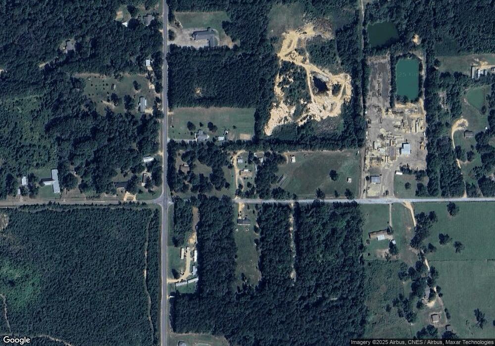
2039 Adams Rd McComb, MS 39648
Estimated Value: $106,000 - $183,000
Studio
--
Bath
128
Sq Ft
$1,129/Sq Ft
Est. Value
About This Home
This home is located at 2039 Adams Rd, McComb, MS 39648 and is currently estimated at $144,500, approximately $1,128 per square foot. 2039 Adams Rd is a home with nearby schools including Eva Gordon Lower Elementary School, Osyka Elementary School, and South Pike Junior High School.
Ownership History
Date
Name
Owned For
Owner Type
Purchase Details
Closed on
Jul 29, 2025
Sold by
Moak Brenda Belle and Wise Brandy Moak
Bought by
Montgomery Victor and Montgomery Tarika
Current Estimated Value
Purchase Details
Closed on
Jul 23, 2025
Sold by
Bass Brenda and Moak Bruce
Bought by
Montgomery Victor and Montgomery Tarika
Purchase Details
Closed on
Jul 17, 2023
Sold by
Ellis Leen F and Ellis Sylvia
Bought by
Montgomery Victor and Montgomery Tarika
Purchase Details
Closed on
Sep 4, 2018
Sold by
Bass Brenda
Bought by
Ellis Leen F and Ellis Sylvia
Purchase Details
Closed on
May 18, 2010
Sold by
Rbr Industries Llc
Bought by
Moak David
Create a Home Valuation Report for This Property
The Home Valuation Report is an in-depth analysis detailing your home's value as well as a comparison with similar homes in the area
Purchase History
| Date | Buyer | Sale Price | Title Company |
|---|---|---|---|
| Montgomery Victor | -- | None Listed On Document | |
| Montgomery Victor | -- | None Listed On Document | |
| Montgomery Victor | -- | None Listed On Document | |
| Ellis Leen F | -- | None Available | |
| Moak David | -- | None Available |
Source: Public Records
Tax History
| Year | Tax Paid | Tax Assessment Tax Assessment Total Assessment is a certain percentage of the fair market value that is determined by local assessors to be the total taxable value of land and additions on the property. | Land | Improvement |
|---|---|---|---|---|
| 2025 | $360 | $2,867 | $0 | $0 |
| 2024 | $349 | $2,708 | $0 | $0 |
| 2023 | $338 | $2,708 | $0 | $0 |
| 2022 | $335 | $2,708 | $0 | $0 |
| 2021 | $323 | $2,708 | $0 | $0 |
| 2020 | $332 | $2,717 | $0 | $0 |
| 2019 | $326 | $2,717 | $0 | $0 |
| 2018 | $473 | $4,031 | $0 | $0 |
| 2017 | $604 | $5,069 | $0 | $0 |
| 2016 | $0 | $3,380 | $0 | $0 |
| 2015 | -- | $3,401 | $0 | $0 |
| 2014 | -- | $3,401 | $0 | $0 |
| 2013 | -- | $3,272 | $0 | $0 |
Source: Public Records
Map
Nearby Homes
- X Wild Estate
- 2159 Oakdale Rd
- 0 Shady Lane Dr
- 4019 E Fernwood Rd
- 0 Old 24 Hwy
- 1047 Old Highway 24
- 1047 Lenoir Sellers Rd
- TBD Integrity Rd Lot #3
- 3092 Airport Fernwood Rd
- No Integrity Rd
- 0 Integrity Rd
- 1057 Oak Ave
- 730 Vogel St
- XXX US Highway 98
- 7153 US Highway 98
- 00 US Highway 98
- 1002 Elm Dr
- 1002 Pershing St
- 480 Universal St
- 2067 McComb Hville Rd
- 1195 Oakdale Rd
- 1030 Mandy Ln
- 1009 Mandy Ln
- 2063 Adams Rd
- 1018 Mandy Ln
- 1183 Oakdale Ave
- 1171 Oakdale Rd
- 1175 Oakdale Rd
- 2024 Oakdale Rd
- 0 Oakdale Rd
- XX Oakdale Rd
- xxxx Oakdale Rd
- 2049 Adams Rd
- 2071 Adams Rd
- 2078 Old Industrial Rd
- 2028A Oakdale Rd
- 2052 Old Industrial Rd
- 2070 Old Industrial Rd
- 2028AB Oakdale Rd
- 1024 Moonridge Ln
Your Personal Tour Guide
Ask me questions while you tour the home.
