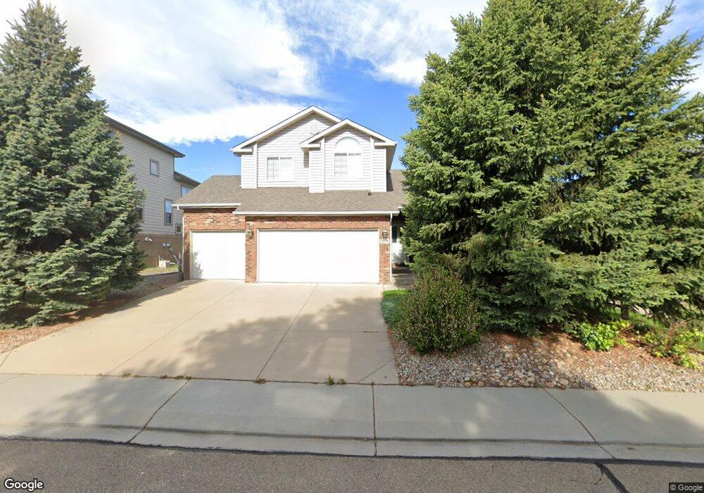
2039 Falcon Dr Longmont, CO 80503
McIntosh NeighborhoodEstimated Value: $684,361 - $732,000
3
Beds
3
Baths
2,100
Sq Ft
$337/Sq Ft
Est. Value
About This Home
This home is located at 2039 Falcon Dr, Longmont, CO 80503 and is currently estimated at $707,840, approximately $337 per square foot. 2039 Falcon Dr is a home located in Boulder County with nearby schools including Hygiene Elementary School, Westview Middle School, and Longmont High School.
Ownership History
Date
Name
Owned For
Owner Type
Purchase Details
Closed on
Jan 15, 2003
Sold by
Everett Karen E
Bought by
The Karen E Everett 2001 Revocable Trust
Current Estimated Value
Purchase Details
Closed on
Jan 13, 2003
Sold by
Wagaman Stanley W
Bought by
Everett Karen E
Purchase Details
Closed on
Aug 17, 2001
Sold by
Wagaman Stanley W and Wagaman Colene K
Bought by
Wagaman Stanley W
Home Financials for this Owner
Home Financials are based on the most recent Mortgage that was taken out on this home.
Original Mortgage
$235,300
Interest Rate
6.98%
Purchase Details
Closed on
Feb 23, 2001
Sold by
Jd Collins Construction Inc
Bought by
Wagaman Stanley W
Home Financials for this Owner
Home Financials are based on the most recent Mortgage that was taken out on this home.
Original Mortgage
$124,000
Interest Rate
6.97%
Purchase Details
Closed on
Jun 24, 1999
Sold by
Kenstep Corp
Bought by
J D Collins Construction Inc
Create a Home Valuation Report for This Property
The Home Valuation Report is an in-depth analysis detailing your home's value as well as a comparison with similar homes in the area
Home Values in the Area
Average Home Value in this Area
Purchase History
| Date | Buyer | Sale Price | Title Company |
|---|---|---|---|
| The Karen E Everett 2001 Revocable Trust | -- | -- | |
| Everett Karen E | $332,450 | -- | |
| Wagaman Stanley W | -- | -- | |
| Wagaman Stanley W | $314,630 | Land Title | |
| J D Collins Construction Inc | $53,500 | -- |
Source: Public Records
Mortgage History
| Date | Status | Borrower | Loan Amount |
|---|---|---|---|
| Previous Owner | Wagaman Stanley W | $235,300 | |
| Previous Owner | Wagaman Stanley W | $124,000 |
Source: Public Records
Tax History Compared to Growth
Tax History
| Year | Tax Paid | Tax Assessment Tax Assessment Total Assessment is a certain percentage of the fair market value that is determined by local assessors to be the total taxable value of land and additions on the property. | Land | Improvement |
|---|---|---|---|---|
| 2025 | $3,522 | $43,919 | $7,644 | $36,275 |
| 2024 | $3,522 | $43,919 | $7,644 | $36,275 |
| 2023 | $3,474 | $43,517 | $8,522 | $38,679 |
| 2022 | $3,027 | $37,537 | $6,568 | $30,969 |
| 2021 | $3,066 | $38,617 | $6,757 | $31,860 |
| 2020 | $2,619 | $34,113 | $5,434 | $28,679 |
| 2019 | $2,578 | $34,113 | $5,434 | $28,679 |
| 2018 | $2,201 | $30,370 | $5,472 | $24,898 |
| 2017 | $2,171 | $33,576 | $6,050 | $27,526 |
| 2016 | $1,893 | $27,764 | $10,348 | $17,416 |
| 2015 | $1,804 | $23,880 | $5,492 | $18,388 |
| 2014 | $2,230 | $23,880 | $5,492 | $18,388 |
Source: Public Records
Map
Nearby Homes
- 2615 Falcon Dr
- 2078 Goldfinch Ct
- 1855 Trevor Cir
- 1835 Cambridge Dr
- 1851 Trevor Cir
- 2124 Kay St
- 2634 Westlake Ct
- 2508 Danbury Dr
- 1736 Trevor Ct
- 2191 Steele St
- 2108 Tulip St
- 2911 Lakeshore Dr
- 1350 Stuart St
- 1524 Denison Cir
- 1517 Amherst Dr
- 2410 Maplewood Cir W
- 2421 Maplewood Cir W
- 1460 Belmont Dr
- 1506 Fisk Ct
- 1626 Tulip Ct