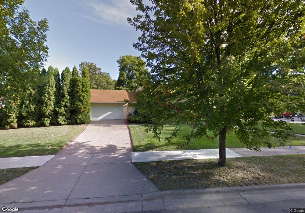
2039 Norfolk Ave Saint Paul, MN 55116
Highland Park NeighborhoodEstimated Value: $536,860 - $656,000
3
Beds
3
Baths
1,056
Sq Ft
$561/Sq Ft
Est. Value
About This Home
This home is located at 2039 Norfolk Ave, Saint Paul, MN 55116 and is currently estimated at $592,215, approximately $560 per square foot. 2039 Norfolk Ave is a home located in Ramsey County with nearby schools including Horace Mann School, Highland Park Middle School, and Highland Park Senior High.
Ownership History
Date
Name
Owned For
Owner Type
Purchase Details
Closed on
Jul 8, 2021
Sold by
Petersen Vibeke and Schaefer Karl
Bought by
Petersen Vibeke and Schaefer Karl
Current Estimated Value
Purchase Details
Closed on
Sep 7, 2016
Sold by
Natarius Eugene Michael and Natarius Marina Victoria
Bought by
Schaefer Karl and Petersen Vibeke
Home Financials for this Owner
Home Financials are based on the most recent Mortgage that was taken out on this home.
Original Mortgage
$136,000
Outstanding Balance
$63,007
Interest Rate
3.48%
Mortgage Type
New Conventional
Estimated Equity
$529,208
Create a Home Valuation Report for This Property
The Home Valuation Report is an in-depth analysis detailing your home's value as well as a comparison with similar homes in the area
Home Values in the Area
Average Home Value in this Area
Purchase History
| Date | Buyer | Sale Price | Title Company |
|---|---|---|---|
| Petersen Vibeke | -- | None Available | |
| Schaefer Karl | $377,091 | First American Title Ins Co |
Source: Public Records
Mortgage History
| Date | Status | Borrower | Loan Amount |
|---|---|---|---|
| Open | Schaefer Karl | $136,000 |
Source: Public Records
Tax History Compared to Growth
Tax History
| Year | Tax Paid | Tax Assessment Tax Assessment Total Assessment is a certain percentage of the fair market value that is determined by local assessors to be the total taxable value of land and additions on the property. | Land | Improvement |
|---|---|---|---|---|
| 2025 | $7,644 | $532,400 | $121,400 | $411,000 |
| 2023 | $7,644 | $496,600 | $121,400 | $375,200 |
| 2022 | $7,190 | $467,600 | $121,500 | $346,100 |
| 2021 | $6,772 | $444,600 | $121,500 | $323,100 |
| 2020 | $7,232 | $434,300 | $121,500 | $312,800 |
| 2019 | $6,068 | $430,800 | $121,500 | $309,300 |
| 2018 | $5,064 | $360,300 | $121,500 | $238,800 |
| 2017 | $4,302 | $313,300 | $121,500 | $191,800 |
| 2016 | $4,350 | $0 | $0 | $0 |
| 2015 | $4,238 | $272,700 | $98,700 | $174,000 |
| 2014 | $4,272 | $0 | $0 | $0 |
Source: Public Records
Map
Nearby Homes
- 1331 Murray St
- 1544 Mississippi River Blvd S
- 1920 Norfolk Ave
- 1872 Mississippi River Blvd S
- 1913 Morgan Ave
- 1166 Colette Place
- 2051 Itasca Ave
- 1800 Graham Ave Unit 334
- 1800 Graham Ave Unit 126
- 1775 Morgan Ave
- 1075 Saint Paul Ave
- 1065 Colby St
- 1068 Prior Ave S
- 896 Mississippi River Blvd S
- 878 Mississippi River Blvd S
- 2046 Montreal Ave
- 1022 Fairview Ave S
- 2135 Lower Saint Dennis Rd
- 898 Wilder St S
- 4824 E 53rd St Unit 422
- 1379 Murray St
- 1375 Murray St
- 2055 Norfolk Ave
- 2025 Norfolk Ave
- 1370 Cleveland Ave S
- 1369 Murray St
- 2050 Norfolk Ave
- 2038 Norfolk Ave
- 1392 Cleveland Ave S
- 1364 Cleveland Ave S
- 1374 Murray St
- 2015 Norfolk Ave
- 2032 Norfolk Ave
- 1361 Murray St
- 2026 Norfolk Ave
- 1368 Murray St
- 1358 Cleveland Ave S
- 2020 Norfolk Ave
- 1406 Cleveland Ave S
- 1360 Murray St