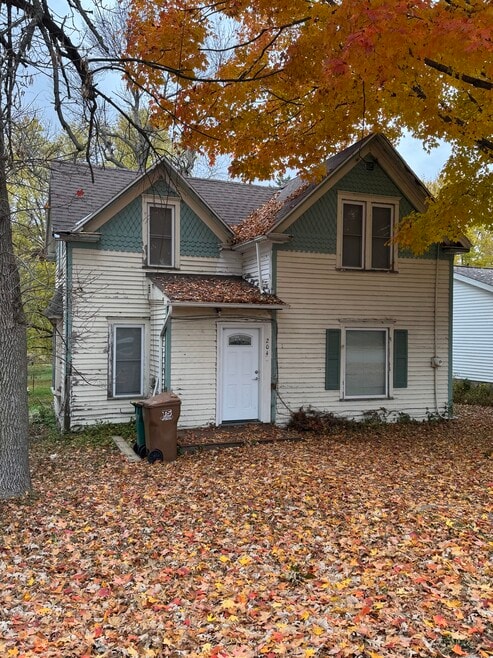
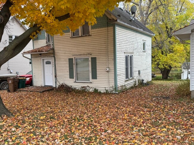
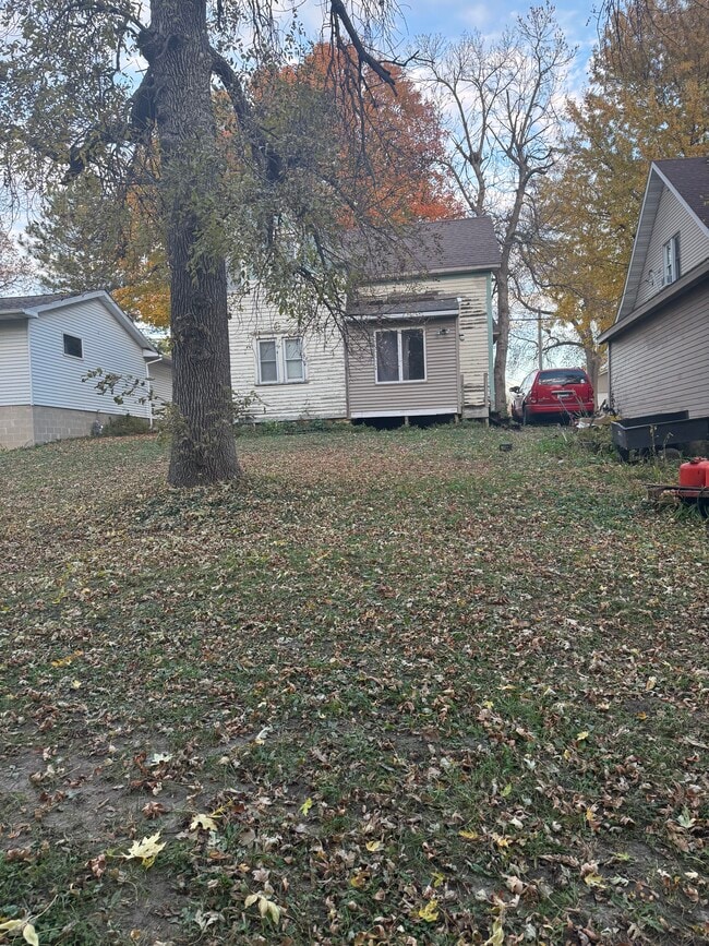
204 Independence Ave S Clarks Grove, MN 56016
About This Home
Looking for small-town living with easy access to regional amenities? This cozy, character-filled house is the perfect fit!
Property Details & Amenities
Bedrooms: 3 (Flexible layout across two stories)
Bathrooms: 1 Full Bath
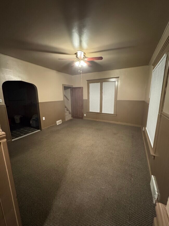
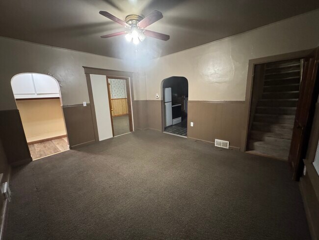
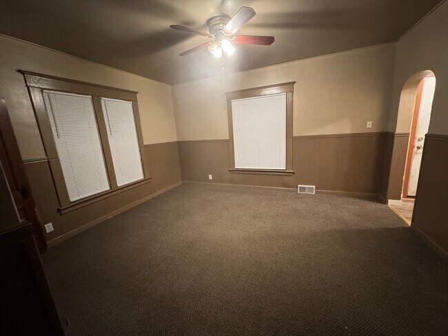
Layout: Classic two-story home, offering separation between living and sleeping areas.
Outdoor Space: Enjoy a beautiful yard featuring mature trees, providing shade and a lovely setting for outdoor activities.
Parking: Street parking only (no garage).
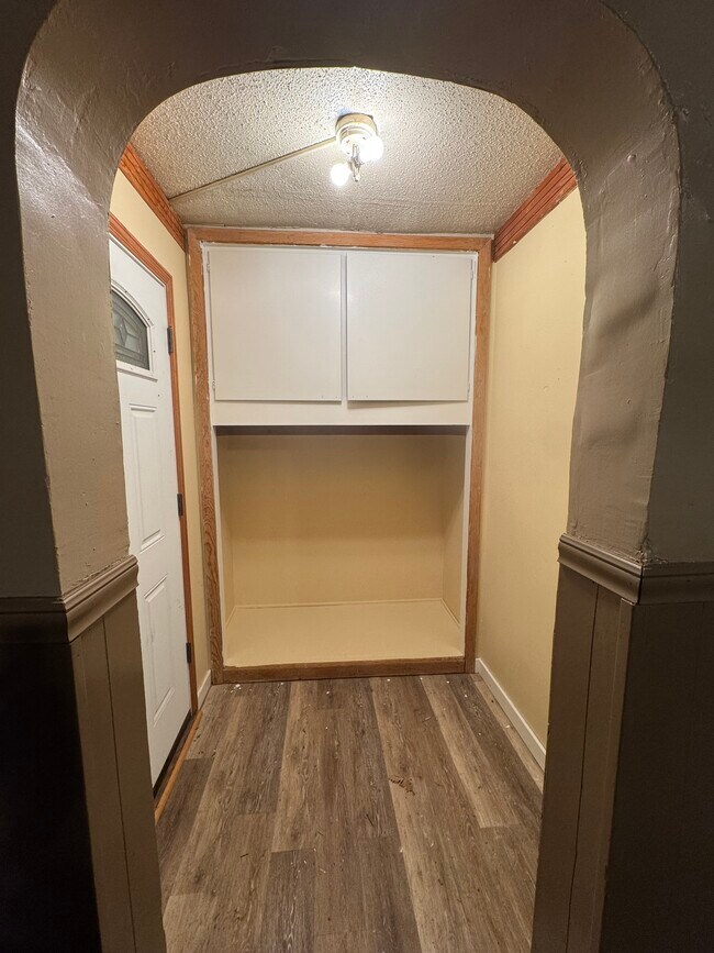
Interior Features includes a main floor bedroom, living room and a functional kitchen. Be prepared for a charming, older home feel!
Utilities: (Tenant pays for utilities such as electricity, gas. Water, sewer and trash are billed at $72 a month flat fee by the city and we add it to the rent).
Clarks Grove: Quiet Town Charm
Clarks Grove offers a peaceful, close-knit community atmosphere in southern Minnesota.
Location: Situated conveniently near I-35, providing easy travel and a manageable commute to larger areas.
Community: Known for a suburban-rural mix feel, with a strong sense of local pride.
Local Points of Interest:
The town is historically known for the Clarks Grove Cooperative Creamery, reflecting its rich agricultural heritage.
Local businesses, including veterinarian, taxidermist, bar and grill and body shops, provide neighborhood convenience.
Freeborn County: Recreation & Resources
As a resident of Freeborn County, you'll have access to the resources and activities of the surrounding area, anchored by the nearby city of Albert Lea.
Outdoor Recreation: Freeborn County boasts multiple lakes, including the large Albert Lea Lake and Fountain Lake, offering opportunities for:
Boating and Fishing
Hiking and Biking Trails
Parks and Green Spaces
Education: The area is served by local school districts, including those that offer schools like Lakeview Elementary and Albert Lea Senior High.
Convenience: The county seat, Albert Lea, is a short drive away, providing access to major amenities including:
Shopping (Grocery stores, retail)
Dining and Cafes
Medical facilities
Hotels and other services
This home offers the best of both worlds: quiet, small-town living with the resources of a larger county just minutes away.
Prairie Lakes Properties LLC is listing this property. Some of the requirements for tenants will be monthly income 3 times the rent amount of rent, minimum credit score of 600, good rental history.
Our process will follow these steps:
1. Prescreening questions
2. Showing
3. Application
4. Background Check
5. Approval
6. Move in

Map
- 199 2nd St NE
- 000 County Highway 45
- 378 Hillcrest Cir
- 77201 270th St
- 720XX 255th St
- 26444 740th Ave
- 28674 810th Ave
- 77348 325th St
- 74500 240th St
- 26795 820th Ave
- 305 1st St SW
- 309 Central Ave S
- tbd 2nd St SE
- TBD Tbd
- TBA SE 2nd
- 75976 230th St
- XXXX Bridge Ave N
- TBD Bridgeport Subdivision
- xxx Hi Tec Ave
- TBD 2709 - 2715 Bridge Ave
- 301 Giles Place
- 520 6th St S
- 524 Park Ave Unit 3
- 913 Abbott St Unit 202
- 133 W William St
- 750 E Front St
- 909 Janson St
- 1619 W Main St
- 259 Elizabeth St
- 203 SW 31st St
- 303 27th St SW
- 23868 70th St
- 704 1st Dr NW
- 300 2nd Ave SW Unit 4
- 911 5th Ave NE
- 403 12th St NE
- 225 1st St SW Unit 8
- 1999 Hartle Ave
- 201 18th St SW
- 175 18th St SW