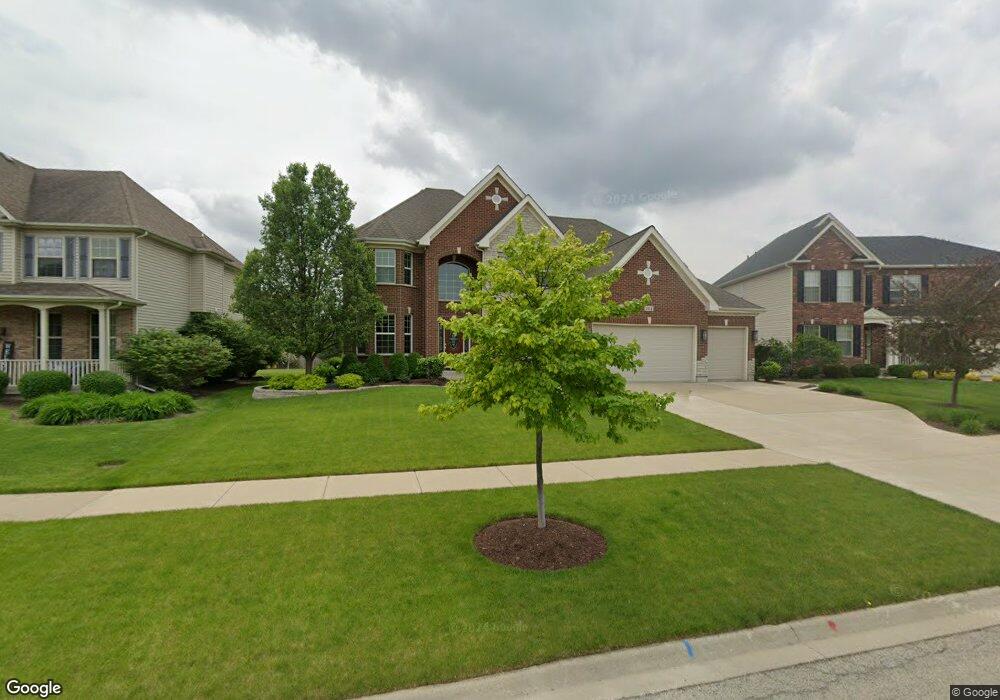
204 Redding Ct Oswego, IL 60543
South Oswego NeighborhoodEstimated Value: $615,559 - $663,000
4
Beds
3
Baths
3,523
Sq Ft
$182/Sq Ft
Est. Value
About This Home
This home is located at 204 Redding Ct, Oswego, IL 60543 and is currently estimated at $642,390, approximately $182 per square foot. 204 Redding Ct is a home located in Kendall County with nearby schools including Southbury Elementary School, Traughber Junior High School, and Oswego High School.
Ownership History
Date
Name
Owned For
Owner Type
Purchase Details
Closed on
Sep 26, 2016
Sold by
Metrou Peter N and Metrou Christine N
Bought by
Metrou Peter N and Metrou Metrou
Current Estimated Value
Purchase Details
Closed on
Oct 4, 2011
Sold by
Bank Financial Fsb
Bought by
Metrou Peter N and Metrou Christine N
Purchase Details
Closed on
Oct 1, 2011
Bought by
Metrou Peter N and Metrou Christine N
Purchase Details
Closed on
Mar 19, 2011
Sold by
Downers Grove National Bank
Bought by
Bankfinancial F S B
Purchase Details
Closed on
Dec 11, 2009
Sold by
M/S Llc
Bought by
Downers Grove National Bank
Create a Home Valuation Report for This Property
The Home Valuation Report is an in-depth analysis detailing your home's value as well as a comparison with similar homes in the area
Home Values in the Area
Average Home Value in this Area
Purchase History
| Date | Buyer | Sale Price | Title Company |
|---|---|---|---|
| Metrou Peter N | -- | Attorney | |
| Metrou Peter N | $26,000 | Chicago Title Insurance Co | |
| Metrou Peter N | $25,900 | -- | |
| Bankfinancial F S B | -- | Pro Title Group Inc | |
| Downers Grove National Bank | -- | None Available |
Source: Public Records
Mortgage History
| Date | Status | Borrower | Loan Amount |
|---|---|---|---|
| Closed | Metrou Peter N | -- |
Source: Public Records
Tax History
| Year | Tax Paid | Tax Assessment Tax Assessment Total Assessment is a certain percentage of the fair market value that is determined by local assessors to be the total taxable value of land and additions on the property. | Land | Improvement |
|---|---|---|---|---|
| 2024 | $14,887 | $190,994 | $30,192 | $160,802 |
| 2023 | $13,979 | $172,067 | $27,200 | $144,867 |
| 2022 | $13,979 | $160,811 | $25,421 | $135,390 |
| 2021 | $13,501 | $150,291 | $23,758 | $126,533 |
| 2020 | $12,830 | $141,784 | $22,413 | $119,371 |
| 2019 | $12,808 | $139,432 | $22,413 | $117,019 |
| 2018 | $12,783 | $133,889 | $21,522 | $112,367 |
| 2017 | $13,456 | $131,264 | $21,100 | $110,164 |
| 2016 | $13,579 | $130,554 | $28,522 | $102,032 |
| 2015 | $13,187 | $120,883 | $26,409 | $94,474 |
| 2014 | -- | $120,883 | $26,409 | $94,474 |
| 2013 | -- | $120,883 | $26,409 | $94,474 |
Source: Public Records
Map
Nearby Homes
- 200 Redding Ct
- 94 Templeton Dr
- 204 Dorset Ave
- 748 Juniper St
- 739 Juniper St
- 1444 Vintage Dr
- 102 Piper Glen Ave
- 202 Piper Glen Ave
- 228 Piper Glen Ave
- 226 Piper Glen Ave
- 739 Alberta Ave
- 2268 Barbera Rd
- 2249 Riesling Rd
- 612 Murdock Place
- 2319 Hirsch Dr
- 6115 Rt 34
- 382 Hemlock Ln
- 230 Piper Glen Ave
- 747 Fairfield Dr
- 731 Fairfield Dr
- 202 Redding Ct
- 206 Redding Ct
- 466 Bloomfield Cir W
- 468 Bloomfield Cir W
- 208 Redding Ct
- 200 Redding Lot#65 Ct
- 464 Bloomfield Cir W
- 470 Bloomfield Cir W
- 210 Redding Ct
- 472 Bloomfield Cir W
- 207 Redding Ct
- 203 Redding Ct
- 205 Redding Ct
- 209 Redding Ct
- 211 Redding Ct
- 474 Bloomfield Cir W
- 201 Redding Ct
- 476 Bloomfield Cir W
- 368 Bloomfield Cir E
- 582 Colchester Dr
Your Personal Tour Guide
Ask me questions while you tour the home.