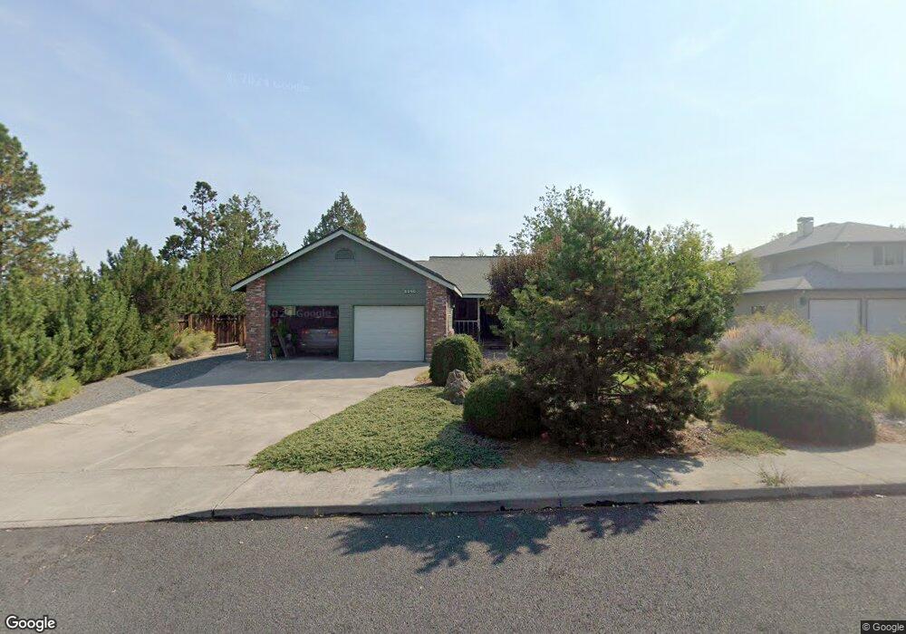
2040 NE Bluebird Ct Bend, OR 97701
Orchard District NeighborhoodEstimated Value: $621,000 - $714,000
3
Beds
2
Baths
1,550
Sq Ft
$440/Sq Ft
Est. Value
About This Home
This home is located at 2040 NE Bluebird Ct, Bend, OR 97701 and is currently estimated at $681,959, approximately $439 per square foot. 2040 NE Bluebird Ct is a home located in Deschutes County with nearby schools including Juniper Elementary School, Pilot Butte Middle School, and Bend Senior High School.
Ownership History
Date
Name
Owned For
Owner Type
Purchase Details
Closed on
Apr 24, 2012
Sold by
Ankrom Dan A and Ankrom Anne C
Bought by
Ankrom Danny Allen and Ankrom Anne C
Current Estimated Value
Purchase Details
Closed on
Sep 2, 2005
Sold by
Schroeder Merle W and Schroeder Irene D
Bought by
Ankrom Dan A and Ankrom Anne C
Home Financials for this Owner
Home Financials are based on the most recent Mortgage that was taken out on this home.
Original Mortgage
$195,000
Outstanding Balance
$102,055
Interest Rate
5.7%
Mortgage Type
Fannie Mae Freddie Mac
Estimated Equity
$579,904
Create a Home Valuation Report for This Property
The Home Valuation Report is an in-depth analysis detailing your home's value as well as a comparison with similar homes in the area
Home Values in the Area
Average Home Value in this Area
Purchase History
| Date | Buyer | Sale Price | Title Company |
|---|---|---|---|
| Ankrom Danny Allen | -- | None Available | |
| Ankrom Dan A | $280,000 | Amerititle |
Source: Public Records
Mortgage History
| Date | Status | Borrower | Loan Amount |
|---|---|---|---|
| Open | Ankrom Dan A | $195,000 |
Source: Public Records
Tax History
| Year | Tax Paid | Tax Assessment Tax Assessment Total Assessment is a certain percentage of the fair market value that is determined by local assessors to be the total taxable value of land and additions on the property. | Land | Improvement |
|---|---|---|---|---|
| 2025 | $4,765 | $282,010 | -- | -- |
| 2024 | $4,584 | $273,800 | -- | -- |
| 2023 | $4,250 | $265,830 | $0 | $0 |
| 2022 | $3,965 | $250,575 | $0 | $0 |
| 2021 | $3,971 | $243,277 | $0 | $0 |
| 2020 | $3,981 | $243,277 | $0 | $0 |
| 2019 | $3,871 | $249,630 | $0 | $0 |
| 2018 | $3,761 | $242,360 | $0 | $0 |
| 2017 | $3,651 | $235,310 | $0 | $0 |
| 2016 | $3,482 | $228,460 | $0 | $0 |
| 2015 | $3,386 | $221,810 | $0 | $0 |
| 2014 | $3,286 | $215,350 | $0 | $0 |
Source: Public Records
Map
Nearby Homes
- 2342 NE Shadow Brook Place
- 2101 NE Holliday Ave
- 1419 NE Lucinda Ct
- 1959 NE Lotus Dr
- 2523 NE Purcell Blvd
- 2739 NE Cordata
- 2561 NE Purcell Blvd
- 2224 NE Indigo Ln
- 1407 NE Talon Ct
- 2109 NE 11th Place
- 2508 NE Buckwheat Ct
- 2325 NE Wintergreen Dr
- 2667 NE Jones Rd
- 2142 NE Monterey Ave
- 2939 NE Quiet Canyon Dr
- 2640 NE 8th St
- 2917 NE Purcell Blvd
- 2170 NE 8th St
- 2394 NE Crocus Way
- 1532 NE 9th St
- 2044 NE Bluebird Ct
- 2043 NE Bluebird Ct
- 2051 NE Bluebird Ct
- 2034 NE Bluebird Ct
- 3833 NE Tellus Dr
- 3779 NE Petrosa Ave Unit 227
- 3775 NE Petrosa Ave
- 3779 NE Petrosa Ave
- 3759 NE Tellus Dr
- 2050 NE Bluebird Ct
- 2020 NE Bluebird Ct
- 1775 NE Pheasant Ln
- 2021 NE Bluebird Ct
- 2005 NE Bluebird Ct
- 2017 NE Bluebird Ct
- 1800 NE Pheasant Ln
- 2120 NE Meadow Ln
- 1774 NE Pheasant Ln
- 2142 NE Meadow Ln
