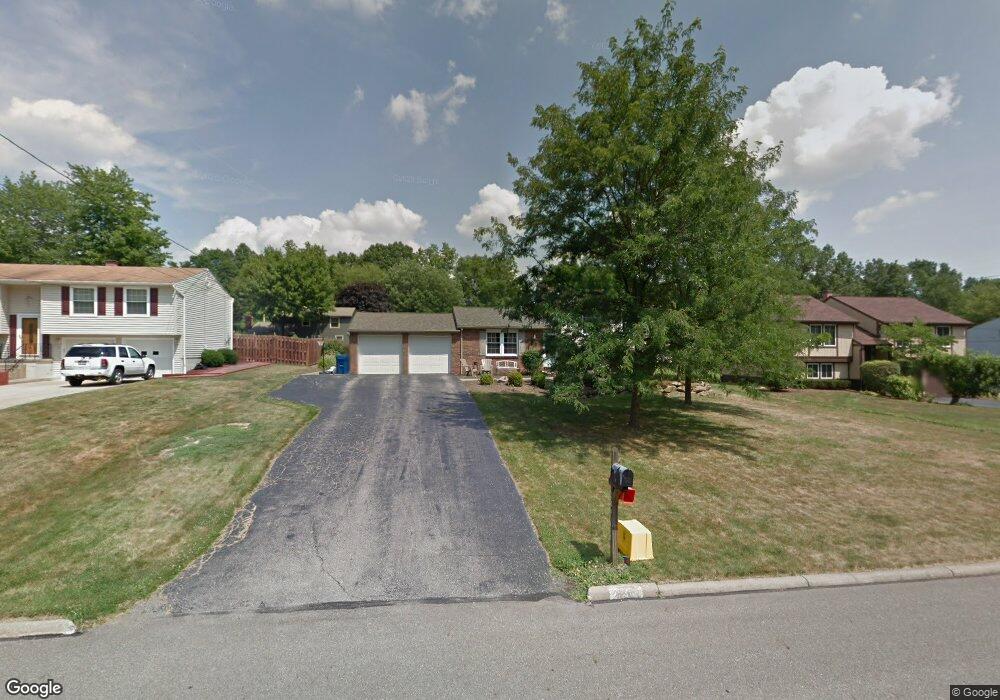
2041 Birch Trace Dr Youngstown, OH 44515
Austintown NeighborhoodEstimated Value: $202,559 - $251,000
3
Beds
1
Bath
1,520
Sq Ft
$151/Sq Ft
Est. Value
About This Home
This home is located at 2041 Birch Trace Dr, Youngstown, OH 44515 and is currently estimated at $228,890, approximately $150 per square foot. 2041 Birch Trace Dr is a home located in Mahoning County with nearby schools including Austintown Elementary School, Austintown Intermediate School, and Austintown Middle School.
Ownership History
Date
Name
Owned For
Owner Type
Purchase Details
Closed on
May 11, 2002
Sold by
Blakeman Ronald P
Bought by
Sztary Mathew E and Sztary Melanie
Current Estimated Value
Home Financials for this Owner
Home Financials are based on the most recent Mortgage that was taken out on this home.
Original Mortgage
$92,150
Outstanding Balance
$39,103
Interest Rate
7%
Estimated Equity
$189,787
Purchase Details
Closed on
Dec 15, 1995
Sold by
Skelton Lewis C
Bought by
Blakeman Ronald P and Blakeman Laura
Home Financials for this Owner
Home Financials are based on the most recent Mortgage that was taken out on this home.
Original Mortgage
$76,400
Interest Rate
7.45%
Mortgage Type
New Conventional
Purchase Details
Closed on
Jul 1, 1987
Bought by
Skelton Lewis C
Create a Home Valuation Report for This Property
The Home Valuation Report is an in-depth analysis detailing your home's value as well as a comparison with similar homes in the area
Home Values in the Area
Average Home Value in this Area
Purchase History
| Date | Buyer | Sale Price | Title Company |
|---|---|---|---|
| Sztary Mathew E | $95,000 | -- | |
| Blakeman Ronald P | $85,000 | -- | |
| Skelton Lewis C | $54,000 | -- |
Source: Public Records
Mortgage History
| Date | Status | Borrower | Loan Amount |
|---|---|---|---|
| Open | Sztary Mathew E | $92,150 | |
| Closed | Blakeman Ronald P | $76,400 |
Source: Public Records
Tax History
| Year | Tax Paid | Tax Assessment Tax Assessment Total Assessment is a certain percentage of the fair market value that is determined by local assessors to be the total taxable value of land and additions on the property. | Land | Improvement |
|---|---|---|---|---|
| 2025 | $2,675 | $55,380 | $8,790 | $46,590 |
| 2024 | $2,555 | $55,380 | $8,790 | $46,590 |
| 2023 | $2,510 | $55,380 | $8,790 | $46,590 |
| 2022 | $2,069 | $36,590 | $8,010 | $28,580 |
| 2021 | $2,071 | $36,590 | $8,010 | $28,580 |
| 2020 | $2,078 | $36,590 | $8,010 | $28,580 |
| 2019 | $2,067 | $32,970 | $7,220 | $25,750 |
| 2018 | $1,989 | $32,970 | $7,220 | $25,750 |
| 2017 | $1,975 | $32,970 | $7,220 | $25,750 |
| 2016 | $1,827 | $30,170 | $7,220 | $22,950 |
| 2015 | $1,771 | $30,170 | $7,220 | $22,950 |
| 2014 | $1,779 | $30,170 | $7,220 | $22,950 |
| 2013 | $1,759 | $30,170 | $7,220 | $22,950 |
Source: Public Records
Map
Nearby Homes
- 2063 Woodland Trace
- 4829 New Rd
- 2351 Birch Trace Dr
- 4656 Pinegrove Ave
- 1707 Westhampton Dr
- 2612 Frostwood Dr
- 4614 Deopham Green Dr
- 1540 Pimlico Dr
- 1556 Pimlico Dr Unit 15
- 325 S Inglewood Ave
- 3313 Starwick Dr
- 5362 Willow Crest Ave
- 0 Collingwood Place
- 4888 Shadow Oak Dr
- 4828 Shadow Oak Dr
- 4876 Shadow Oak Dr
- 5365 Oakcrest Ave
- 285 Aldrich Rd
- 4314 Kerrybrook Dr
- 238 Aldrich Rd
- 2011 Birch Trace Dr
- 2071 Birch Trace Dr
- 2038 Woodland Trace
- 2014 Woodland Trace
- 1981 Birch Trace Dr
- 2101 Birch Trace Dr
- 2062 Woodland Trace
- 2040 Birch Trace Dr
- 1990 Woodland Trace
- 2070 Birch Trace Dr
- 2010 Birch Trace Dr
- 2086 Woodland Trace
- 1951 Birch Trace Dr
- 2131 Birch Trace Dr
- 2100 Birch Trace Dr
- 1980 Birch Trace Dr
- 1966 Woodland Trace
- 2110 Woodland Trace
- 2130 Birch Trace Dr
- 1950 Birch Trace Dr
Your Personal Tour Guide
Ask me questions while you tour the home.