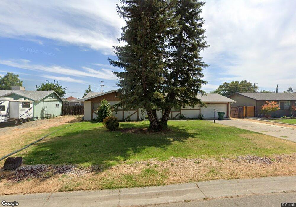
2041 Colusa St Corning, CA 96021
Estimated Value: $240,000 - $321,000
3
Beds
2
Baths
1,191
Sq Ft
$232/Sq Ft
Est. Value
About This Home
This home is located at 2041 Colusa St, Corning, CA 96021 and is currently estimated at $275,973, approximately $231 per square foot. 2041 Colusa St is a home located in Tehama County with nearby schools including Woodson Elementary School, Maywood Middle School, and Corning High School.
Ownership History
Date
Name
Owned For
Owner Type
Purchase Details
Closed on
Oct 15, 2020
Sold by
Landis Gary and Landis Shirley J
Bought by
Landis Gary W and Landis Shirley J
Current Estimated Value
Purchase Details
Closed on
Sep 20, 2007
Sold by
Winfield Ulysses Grant and Ott Brenda G
Bought by
Landis Gary and Landis Shirley J
Home Financials for this Owner
Home Financials are based on the most recent Mortgage that was taken out on this home.
Original Mortgage
$110,000
Outstanding Balance
$69,644
Interest Rate
6.57%
Mortgage Type
Seller Take Back
Estimated Equity
$206,329
Create a Home Valuation Report for This Property
The Home Valuation Report is an in-depth analysis detailing your home's value as well as a comparison with similar homes in the area
Home Values in the Area
Average Home Value in this Area
Purchase History
| Date | Buyer | Sale Price | Title Company |
|---|---|---|---|
| Landis Gary W | -- | None Available | |
| Landis Gary | $150,000 | Northern California Title Co |
Source: Public Records
Mortgage History
| Date | Status | Borrower | Loan Amount |
|---|---|---|---|
| Open | Landis Gary | $110,000 |
Source: Public Records
Tax History Compared to Growth
Tax History
| Year | Tax Paid | Tax Assessment Tax Assessment Total Assessment is a certain percentage of the fair market value that is determined by local assessors to be the total taxable value of land and additions on the property. | Land | Improvement |
|---|---|---|---|---|
| 2025 | $586 | $56,298 | $7,309 | $48,989 |
| 2023 | $575 | $54,114 | $7,026 | $47,088 |
| 2022 | $567 | $53,054 | $6,889 | $46,165 |
| 2021 | $546 | $52,014 | $6,754 | $45,260 |
| 2020 | $552 | $51,481 | $6,685 | $44,796 |
| 2019 | $530 | $50,472 | $6,554 | $43,918 |
| 2018 | $530 | $49,483 | $6,426 | $43,057 |
| 2017 | $527 | $48,513 | $6,300 | $42,213 |
| 2016 | $492 | $47,563 | $6,177 | $41,386 |
| 2015 | -- | $46,850 | $6,085 | $40,765 |
| 2014 | $480 | $45,933 | $5,966 | $39,967 |
Source: Public Records
Map
Nearby Homes
- 1980 Colusa St
- 342 Rio Vista Ct
- 1938 Colusa St
- 2098 North St
- 272 Rio Bravo Ct
- 330 Houghton Ave
- 2480 Houghton Ave
- 1013 Toomes Ave
- 2018 Donnovan Ave
- 1547 Blackburn Ave
- 1419 Yolo St
- 311 6th St
- 1414 Marin St
- 1495 South St
- 0 Toomes Ave Unit SN24222817
- 818 6th St
- 305 5th St
- 1195 West St
- 1560 Highway 99 W
- 1162 5th Ave
- 2027 Colusa St
- 2055 Colusa St
- 2036 Dolla Ct
- 2026 Dolla Ct
- 2046 Dolla Ct
- 2067 Colusa St
- 510 Toomes Ave
- 2016 Dolla Ct
- 2056 Dolla Ct
- 2036 Colusa St
- 2026 Colusa St
- 2054 Colusa St
- 2066 Dolla Ct
- 2006 Dolla Ct
- 2083 Colusa St
- 2066 Colusa St
- 2008 Colusa St
- 423 Rio Del Rey Ct
- 422 Rio Del Rey Ct
- 520 Toomes Ave