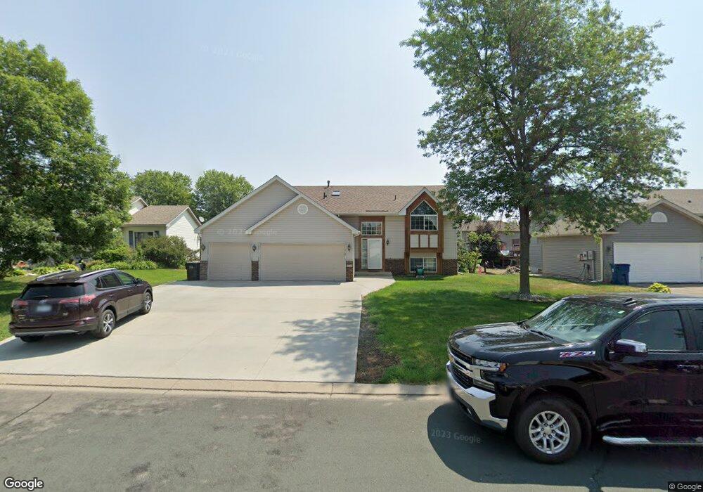
2041 Pheasant Run St Shakopee, MN 55379
Estimated Value: $415,522 - $447,000
4
Beds
2
Baths
2,492
Sq Ft
$174/Sq Ft
Est. Value
About This Home
This home is located at 2041 Pheasant Run St, Shakopee, MN 55379 and is currently estimated at $433,381, approximately $173 per square foot. 2041 Pheasant Run St is a home located in Scott County with nearby schools including Sun Path Elementary School, Shakopee West Middle School, and Shakopee Senior High School.
Ownership History
Date
Name
Owned For
Owner Type
Purchase Details
Closed on
May 31, 2002
Sold by
Slipher David W and Slipher Mary L
Bought by
Goodrum Timothy J and Goodrum Maria J
Current Estimated Value
Purchase Details
Closed on
Jul 7, 1999
Sold by
Pheasant Run Of Shakopee L L P
Bought by
Key-Land Homes
Create a Home Valuation Report for This Property
The Home Valuation Report is an in-depth analysis detailing your home's value as well as a comparison with similar homes in the area
Home Values in the Area
Average Home Value in this Area
Purchase History
| Date | Buyer | Sale Price | Title Company |
|---|---|---|---|
| Goodrum Timothy J | $234,900 | -- | |
| Key-Land Homes | $43,900 | -- |
Source: Public Records
Mortgage History
| Date | Status | Borrower | Loan Amount |
|---|---|---|---|
| Closed | Key-Land Homes | -- |
Source: Public Records
Tax History Compared to Growth
Tax History
| Year | Tax Paid | Tax Assessment Tax Assessment Total Assessment is a certain percentage of the fair market value that is determined by local assessors to be the total taxable value of land and additions on the property. | Land | Improvement |
|---|---|---|---|---|
| 2025 | $3,940 | $379,700 | $141,400 | $238,300 |
| 2024 | $3,920 | $383,200 | $141,400 | $241,800 |
| 2023 | $4,176 | $368,800 | $135,900 | $232,900 |
| 2022 | $3,816 | $384,600 | $154,500 | $230,100 |
| 2021 | $3,392 | $306,700 | $122,000 | $184,700 |
| 2020 | $3,682 | $299,100 | $117,000 | $182,100 |
| 2019 | $3,728 | $286,200 | $104,000 | $182,200 |
| 2018 | $3,788 | $0 | $0 | $0 |
| 2016 | $3,680 | $0 | $0 | $0 |
| 2014 | -- | $0 | $0 | $0 |
Source: Public Records
Map
Nearby Homes
- 2052 Wilhelm Ct
- 2777 Pampas Ct
- 2518 Green Ash Ave
- 2529 Green Ash Ave
- Berkley Plan at Arbor Bluff - Venture Collection
- 2551 Aspen Ct
- Clark Plan at Arbor Bluff - Venture Collection
- 2548 Aspen Ct
- Itasca Plan at Arbor Bluff - Landmark Collection
- Sequoia Plan at Arbor Bluff - Venture Collection
- Markham Plan at Arbor Bluff - Venture Collection
- 2340 Rock Elm Rd
- Lewis Plan at Arbor Bluff - Landmark Collection
- McKinley Plan at Arbor Bluff - Landmark Collection
- 2584 Aspen Ct
- 2606 Green Ash Ave
- Marquette Plan at Arbor Bluff - Venture Collection
- 2689 Aspen Dr
- Sinclair Plan at Arbor Bluff - Landmark Collection
- Burnham Plan at Arbor Bluff - Venture Collection
- 2035 Pheasant Run St
- 2047 Pheasant Run St
- 2034 Blue Jay St
- 2024 Blue Jay St
- 2029 Pheasant Run St
- 2053 Pheasant Run St
- 2044 Blue Jay St
- 2014 Blue Jay St
- 2044 Pheasant Run St
- 2038 Pheasant Run St
- 2050 Pheasant Run St
- 2032 Pheasant Run St
- 2025 Pheasant Run St
- 2054 Blue Jay St
- 2059 Pheasant Run St
- 2004 Blue Jay St
- 2056 Pheasant Run St
- 2028 Pheasant Run St
- 2021 Pheasant Run St
- 2062 Pheasant Run St