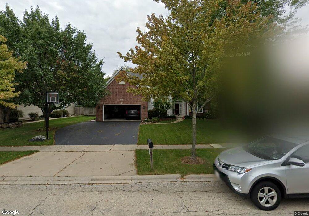
2041 Tunbridge Trail Algonquin, IL 60102
Estimated Value: $544,000 - $599,007
About This Home
This home is located at 2041 Tunbridge Trail, Algonquin, IL 60102 and is currently estimated at $569,752, approximately $192 per square foot. 2041 Tunbridge Trail is a home located in McHenry County with nearby schools including Westfield Community School, Kenneth E Neubert Elementary School, and Harry D Jacobs High School.
Ownership History
We collect this data history from publicly available records. To have your information removed, we recommend requesting removal directly through your county’s website.
Purchase Details
Home Financials for this Owner
Home Financials are based on the most recent Mortgage that was taken out on this home.Purchase Details
Home Financials for this Owner
Home Financials are based on the most recent Mortgage that was taken out on this home.Purchase History
We collect this data history from publicly available records. To have your information removed, we recommend requesting removal directly through your county’s website.
| Date | Buyer | Sale Price | Title Company |
|---|---|---|---|
| $320,000 | Baird & Warner Ttl Svcs Inc | ||
| $262,500 | -- | ||
| $65,000 | -- |
Mortgage History
We collect this data history from publicly available records. To have your information removed, we recommend requesting removal directly through your county’s website.
| Date | Status | Borrower | Loan Amount |
|---|---|---|---|
| Open | $255,000 | ||
| Previous Owner | $145,000 |
Tax History
We collect this data history from publicly available records. To have your information removed, we recommend requesting removal directly through your county’s website.
| Year | Tax Paid | Tax Assessment Tax Assessment Total Assessment is a certain percentage of the fair market value that is determined by local assessors to be the total taxable value of land and additions on the property. | Land | Improvement |
|---|---|---|---|---|
| 2024 | $13,324 | $178,323 | $32,925 | $145,398 |
| 2023 | $12,681 | $159,487 | $29,447 | $130,040 |
| 2022 | $9,664 | $118,686 | $36,540 | $82,146 |
| 2021 | $9,279 | $110,570 | $34,041 | $76,529 |
| 2020 | $9,038 | $106,656 | $32,836 | $73,820 |
| 2019 | $9,820 | $117,940 | $31,428 | $86,512 |
| 2018 | $9,336 | $108,952 | $29,033 | $79,919 |
| 2017 | $9,126 | $102,640 | $27,351 | $75,289 |
| 2016 | $8,967 | $96,267 | $25,653 | $70,614 |
| 2013 | -- | $95,039 | $23,931 | $71,108 |
Map
- 2161 Burnham Ct
- 2067 Peach Tree Ln Unit 4115
- 1713 Edgewood Dr
- 1141 Millcreek Ln
- 1141 Stonegate Rd
- 750 Majestic Dr
- 1111 Saint Andrews Ct Unit 282
- 1940 Waverly Ln
- 1721 Dorchester Ave
- 811 Westbury Dr
- 1610 Hartley Dr
- 2071 Waverly Ln Unit 4391
- 731 Roaring Brook Ln
- 11905 Kingston Place
- 1601 Millbrook Dr Unit 4
- 1181 Glenmont St
- 14 Hampton Ct
- 1071 Glenmont St
- 2616 Christie Dr Unit 1
- 1197 Glenmont St
- 2060 Tunbridge Trail
- 2070 Tunbridge Trail
- 2050 Tunbridge Trail
- 2051 Robinwood Dr
- 2061 Robinwood Dr
- 2040 Tunbridge Trail
- 2041 Robinwood Dr
- 2080 Tunbridge Trail
- 2041 Tunbridge Trail
- 1345 Tunbridge Trail
- 2031 Tunbridge Trail
- 2051 Tunbridge Trail
- 2031 Robinwood Dr
- 1335 Tunbridge Trail
- 2021 Tunbridge Trail
- 2061 Tunbridge Trail
- 2030 Tunbridge Trail
- 2021 Robinwood Dr
- 2011 Tunbridge Trail
- 2070 Carlisle St
Ask me questions while you tour the home.