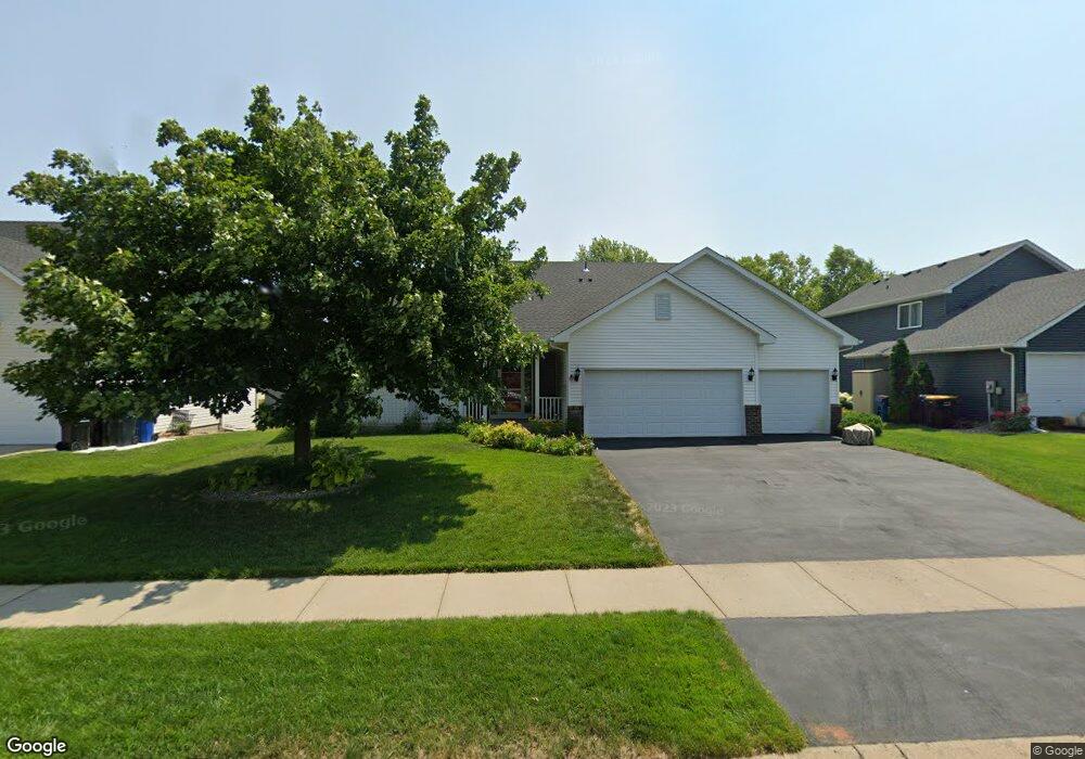
2041 Williams St Shakopee, MN 55379
Estimated Value: $426,000 - $490,000
4
Beds
3
Baths
1,466
Sq Ft
$313/Sq Ft
Est. Value
About This Home
This home is located at 2041 Williams St, Shakopee, MN 55379 and is currently estimated at $458,736, approximately $312 per square foot. 2041 Williams St is a home located in Scott County with nearby schools including Sun Path Elementary School, Shakopee West Middle School, and Shakopee Senior High School.
Ownership History
Date
Name
Owned For
Owner Type
Purchase Details
Closed on
Jul 1, 2009
Sold by
Hulskoher Dannon W and Hulskoher Amy L
Bought by
Bramhurst Christopher L and Bremhurst Kristine M
Current Estimated Value
Purchase Details
Closed on
Jun 27, 2002
Sold by
Severson Homes Inc
Bought by
Hulskotter Dannon W
Purchase Details
Closed on
Jan 25, 2002
Sold by
Ryan Real Estate Co
Bought by
Severson Homes Inc
Purchase Details
Closed on
Jan 22, 2002
Sold by
Pheasant Run Of Shakopee Ii Inc
Bought by
Ryan Real Estate Co
Create a Home Valuation Report for This Property
The Home Valuation Report is an in-depth analysis detailing your home's value as well as a comparison with similar homes in the area
Home Values in the Area
Average Home Value in this Area
Purchase History
| Date | Buyer | Sale Price | Title Company |
|---|---|---|---|
| Bramhurst Christopher L | $267,800 | -- | |
| Hulskotter Dannon W | $278,132 | -- | |
| Severson Homes Inc | $70,900 | -- | |
| Ryan Real Estate Co | $61,900 | -- |
Source: Public Records
Tax History
| Year | Tax Paid | Tax Assessment Tax Assessment Total Assessment is a certain percentage of the fair market value that is determined by local assessors to be the total taxable value of land and additions on the property. | Land | Improvement |
|---|---|---|---|---|
| 2025 | $4,504 | $429,100 | $145,100 | $284,000 |
| 2024 | $4,408 | $433,100 | $145,100 | $288,000 |
| 2023 | $4,638 | $411,500 | $134,200 | $277,300 |
| 2022 | $4,292 | $424,900 | $152,500 | $272,400 |
| 2021 | $3,822 | $341,800 | $122,000 | $219,800 |
| 2020 | $4,174 | $333,100 | $117,000 | $216,100 |
| 2019 | $4,286 | $320,200 | $104,000 | $216,200 |
| 2018 | $4,090 | $0 | $0 | $0 |
| 2016 | $3,982 | $0 | $0 | $0 |
| 2014 | -- | $0 | $0 | $0 |
Source: Public Records
Map
Nearby Homes
- 2354 Ponds Way
- 2542 Mathias Rd
- 2577 Green Ash Ave
- 2468 Valley View Rd
- 2554 Green Ash Ave
- 2578 Green Ash Ave
- 2566 Green Ash Ave
- 2542 Green Ash Ave
- 2530 Green Ash Ave
- 2584 Aspen Ct
- 2697 Aspen Dr
- 2624 Aspen Dr
- 2642 Aspen Dr
- 2660 Aspen Dr
- 2694 Aspen Dr
- 1976 Alden Ave
- 3432 Baneberry Cir
- 2397 Rock Elm Rd
- 1832 Alden Ave
- 2113 Sandhill Dr
- 2033 Williams St
- 2049 Williams St
- 2042 Ormond Dr
- 2034 Ormond Dr
- 2025 Williams St
- 2057 Williams St
- 2050 Ormond Dr
- 2038 Williams St
- 2026 Ormond Dr
- 2030 Williams St
- 2058 Ormond Dr
- 2046 Williams St
- 2017 Williams St
- 2065 Williams St
- 2022 Williams St
- 2054 Williams St
- 2018 Ormond Dr
- 2066 Ormond Dr
- 2014 Williams St
- 2062 Williams St
Your Personal Tour Guide
Ask me questions while you tour the home.