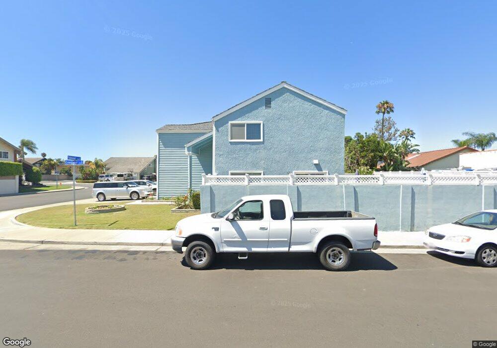
20412 Tideland Ln Huntington Beach, CA 92646
Southeast NeighborhoodEstimated Value: $1,606,000 - $1,835,968
5
Beds
4
Baths
2,570
Sq Ft
$681/Sq Ft
Est. Value
About This Home
This home is located at 20412 Tideland Ln, Huntington Beach, CA 92646 and is currently estimated at $1,751,242, approximately $681 per square foot. 20412 Tideland Ln is a home located in Orange County with nearby schools including Ralph E. Hawes Elementary School, Isaac L. Sowers Middle School, and Edison High School.
Ownership History
Date
Name
Owned For
Owner Type
Purchase Details
Closed on
Oct 12, 2006
Sold by
Howerton Jon R and Howerton Carol J
Bought by
Howerton Jon R and Howerton Carol J
Current Estimated Value
Purchase Details
Closed on
Jul 11, 2006
Sold by
Howerton Jon R and Howerton Carol J
Bought by
Howerton Jon R and Howerton Carol J
Purchase Details
Closed on
Aug 12, 1994
Sold by
Howerton Jon R and Howerton Carol J
Bought by
Howerton Jon R and Howerton Carol J
Create a Home Valuation Report for This Property
The Home Valuation Report is an in-depth analysis detailing your home's value as well as a comparison with similar homes in the area
Home Values in the Area
Average Home Value in this Area
Purchase History
| Date | Buyer | Sale Price | Title Company |
|---|---|---|---|
| Howerton Jon R | -- | None Available | |
| Howerton Jon R | -- | None Available | |
| Howerton Jon R | -- | -- |
Source: Public Records
Tax History Compared to Growth
Tax History
| Year | Tax Paid | Tax Assessment Tax Assessment Total Assessment is a certain percentage of the fair market value that is determined by local assessors to be the total taxable value of land and additions on the property. | Land | Improvement |
|---|---|---|---|---|
| 2025 | $8,560 | $762,759 | $522,212 | $240,547 |
| 2024 | $8,560 | $747,803 | $511,972 | $235,831 |
| 2023 | $8,367 | $733,141 | $501,934 | $231,207 |
| 2022 | $8,147 | $718,766 | $492,092 | $226,674 |
| 2021 | $7,995 | $704,673 | $482,443 | $222,230 |
| 2020 | $7,942 | $697,448 | $477,496 | $219,952 |
| 2019 | $7,846 | $683,773 | $468,133 | $215,640 |
| 2018 | $7,724 | $670,366 | $458,954 | $211,412 |
| 2017 | $7,621 | $657,222 | $449,955 | $207,267 |
| 2016 | $7,281 | $644,336 | $441,133 | $203,203 |
| 2015 | $7,211 | $634,658 | $434,507 | $200,151 |
| 2014 | $7,059 | $622,226 | $425,995 | $196,231 |
Source: Public Records
Map
Nearby Homes
- 9522 Yellowstone Dr
- 20111 Marina Ln
- 20071 Moontide Cir
- 20258 Lantana Dr
- 20862 Lancelot Ln
- 9812 La Cresta Cir
- 9882 Hot Springs Dr
- 20392 Redwood Ln
- 8932 Amador Cir Unit 1309B
- 9695 Adams Ave
- 19901 Burnley Ln
- 9667 Durham Dr
- 9001 Oceanwood Dr
- 8886 Plumas Cir Unit 1124-A
- 19846 Lures Ln
- 9594 Pettswood Dr Unit 4
- 8856 Sutter Cir Unit 522A
- 9221 Belcaro Dr
- 19854 Leighton Ln
- 8856 526C Sutter
- 20392 Tideland Ln
- 20411 Bluffwater Cir
- 20391 Bluffwater Cir
- 9422 Coastland Dr
- 9392 Cliffwood Dr
- 9432 Coastland Dr
- 20411 Tideland Ln
- 20372 Tideland Ln
- 20381 Bluffwater Cir
- 9442 Coastland Dr
- 20421 Tideland Ln
- 9401 Cliffwood Dr
- 9382 Cliffwood Dr
- 20452 Tideland Ln
- 20371 Bluffwater Cir
- 9391 Cliffwood Dr
- 9452 Coastland Dr
- 20441 Tideland Ln
- 20412 Anchor Cir
- 20412 Bluffwater Cir