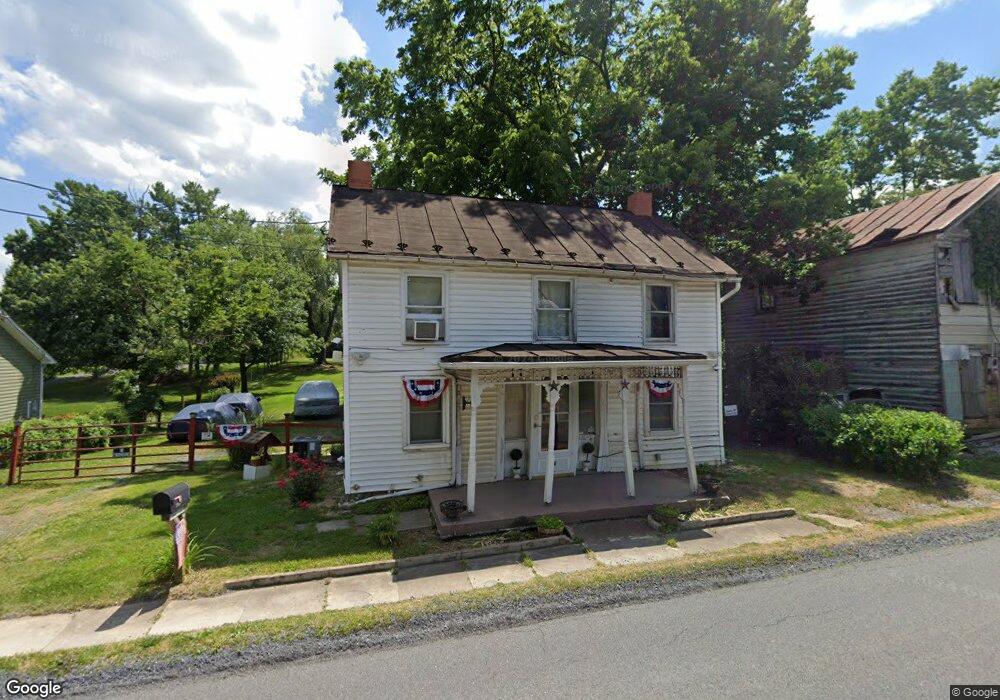
2042 Brucetown Rd Clear Brook, VA 22624
Estimated Value: $199,939 - $302,000
2
Beds
1
Bath
1,044
Sq Ft
$241/Sq Ft
Est. Value
About This Home
This home is located at 2042 Brucetown Rd, Clear Brook, VA 22624 and is currently estimated at $251,985, approximately $241 per square foot. 2042 Brucetown Rd is a home located in Frederick County with nearby schools including Stonewall Elementary School, James Wood Middle School, and James Wood High School.
Ownership History
Date
Name
Owned For
Owner Type
Purchase Details
Closed on
Aug 16, 2005
Sold by
Mcinturff Jamie
Bought by
Mcinturff Jamie
Current Estimated Value
Home Financials for this Owner
Home Financials are based on the most recent Mortgage that was taken out on this home.
Original Mortgage
$112,000
Outstanding Balance
$59,401
Interest Rate
5.81%
Mortgage Type
New Conventional
Estimated Equity
$192,584
Purchase Details
Closed on
Dec 5, 2002
Sold by
William Shmidheiser I I I
Bought by
Goodman T P
Home Financials for this Owner
Home Financials are based on the most recent Mortgage that was taken out on this home.
Original Mortgage
$25,000
Interest Rate
6.34%
Mortgage Type
Construction
Create a Home Valuation Report for This Property
The Home Valuation Report is an in-depth analysis detailing your home's value as well as a comparison with similar homes in the area
Home Values in the Area
Average Home Value in this Area
Purchase History
| Date | Buyer | Sale Price | Title Company |
|---|---|---|---|
| Mcinturff Jamie | -- | -- | |
| Goodman T P | $26,000 | -- |
Source: Public Records
Mortgage History
| Date | Status | Borrower | Loan Amount |
|---|---|---|---|
| Open | Mcinturff Jamie | $112,000 | |
| Previous Owner | Goodman T P | $25,000 |
Source: Public Records
Tax History Compared to Growth
Tax History
| Year | Tax Paid | Tax Assessment Tax Assessment Total Assessment is a certain percentage of the fair market value that is determined by local assessors to be the total taxable value of land and additions on the property. | Land | Improvement |
|---|---|---|---|---|
| 2025 | $803 | $167,260 | $93,000 | $74,260 |
| 2024 | $337 | $132,200 | $74,500 | $57,700 |
| 2023 | $674 | $132,200 | $74,500 | $57,700 |
| 2022 | $716 | $117,300 | $68,500 | $48,800 |
| 2021 | $716 | $117,300 | $68,500 | $48,800 |
| 2020 | $683 | $111,900 | $68,500 | $43,400 |
| 2019 | $683 | $111,900 | $68,500 | $43,400 |
| 2018 | $647 | $106,000 | $68,500 | $37,500 |
| 2017 | $636 | $106,000 | $68,500 | $37,500 |
| 2016 | $558 | $93,000 | $56,000 | $37,000 |
| 2015 | $521 | $93,000 | $56,000 | $37,000 |
| 2014 | $269 | $91,300 | $56,000 | $35,300 |
Source: Public Records
Map
Nearby Homes
- 1781 Brucetown Rd
- 136 Shady Creek Rd
- 214 Walnut Dr
- Lot 9B Slate Ln
- 265 Slate Ln
- Lot 9A Slate Ln
- 0 Martinsburg Pike Unit VAFV2012476
- 0 Martinsburg Pike Unit VAFV2013398
- Lot 6 Gun Club Rd
- Lot 5 Gun Club Rd
- Lot 4 Gun Club Rd
- Lot 3 Gun Club Rd
- 7.3 Hopewell Ln
- 6.34 Hopewell Ln
- 13.64 Hopewell Ln
- 962 Wadesville Rd
- 4231 Martinsburg Pike
- 309 Gun Club Rd
- 4462 Martinsburg Pike
- 724 Jordan Springs Rd
- 2034 Brucetown Rd
- 2048 Brucetown Rd
- 2035 Brucetown Rd
- 2021 Brucetown Rd
- 2047 Brucetown Rd
- 2054 Brucetown Rd
- 2055 Brucetown Rd
- 2020 Brucetown Rd
- 2015 Brucetown Rd
- 2073 Brucetown Rd
- 116 Country Ln
- 117 Country Ln
- 2082 Brucetown Rd
- 2075 Brucetown Rd
- 2083 Brucetown Rd
- 2001 Brucetown Rd
- 2088 Brucetown Rd
- 2019 Brucetown Rd
- 164 Sir Johns Rd
- 2077 Brucetown Rd