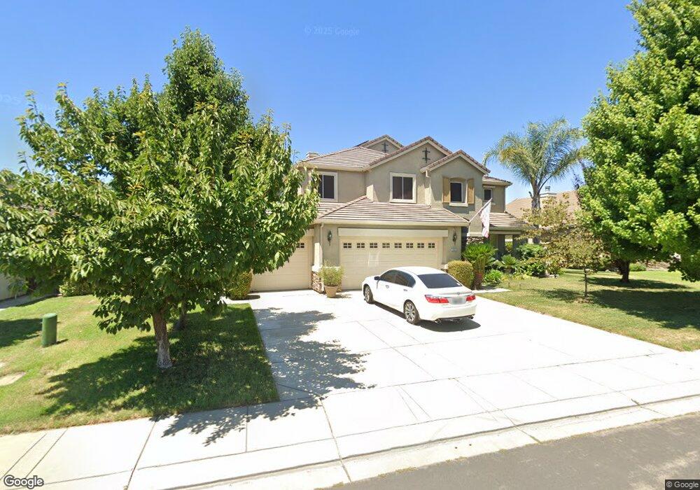
2043 Derrick Ave Manteca, CA 95337
Estimated Value: $533,000 - $811,000
4
Beds
4
Baths
3,351
Sq Ft
$215/Sq Ft
Est. Value
About This Home
This home is located at 2043 Derrick Ave, Manteca, CA 95337 and is currently estimated at $720,872, approximately $215 per square foot. 2043 Derrick Ave is a home located in San Joaquin County with nearby schools including Walter Woodward Elementary School, Manteca High School, and St. Anthony's Catholic School.
Ownership History
Date
Name
Owned For
Owner Type
Purchase Details
Closed on
Feb 6, 2004
Sold by
Atherton Boyce Development Co Llc
Bought by
Lyon Stephen T and Lyon Jolynda L
Current Estimated Value
Home Financials for this Owner
Home Financials are based on the most recent Mortgage that was taken out on this home.
Original Mortgage
$100,000
Interest Rate
5.82%
Mortgage Type
Purchase Money Mortgage
Create a Home Valuation Report for This Property
The Home Valuation Report is an in-depth analysis detailing your home's value as well as a comparison with similar homes in the area
Purchase History
| Date | Buyer | Sale Price | Title Company |
|---|---|---|---|
| Lyon Stephen T | $419,500 | Placer Title Company |
Source: Public Records
Mortgage History
| Date | Status | Borrower | Loan Amount |
|---|---|---|---|
| Closed | Lyon Stephen T | $100,000 |
Source: Public Records
Tax History
| Year | Tax Paid | Tax Assessment Tax Assessment Total Assessment is a certain percentage of the fair market value that is determined by local assessors to be the total taxable value of land and additions on the property. | Land | Improvement |
|---|---|---|---|---|
| 2025 | $7,470 | $596,143 | $177,714 | $418,429 |
| 2024 | $7,287 | $584,455 | $174,230 | $410,225 |
| 2023 | $7,206 | $572,996 | $170,814 | $402,182 |
| 2022 | $7,109 | $561,762 | $167,465 | $394,297 |
| 2021 | $7,038 | $550,748 | $164,182 | $386,566 |
| 2020 | $6,786 | $545,102 | $162,499 | $382,603 |
| 2019 | $6,706 | $534,414 | $159,313 | $375,101 |
| 2018 | $6,626 | $523,937 | $156,190 | $367,747 |
| 2017 | $5,822 | $449,000 | $134,000 | $315,000 |
| 2016 | $5,400 | $413,000 | $123,000 | $290,000 |
| 2014 | $4,865 | $379,000 | $113,000 | $266,000 |
Source: Public Records
Map
Nearby Homes
- 864 Heartland Dr
- 2317 Mathar Dr
- 1773 Lana Way
- 1076 Balzo St
- 2365 Beardsley Ave
- 837 Grafton St
- 2377 Beardsley Ave
- 935 Mono St
- 806 Mono St
- 1175 Miel St
- 1271 Veteran St
- 1807 Birdie Ave
- 607 Mono St
- 2446 Paramount Ln
- 390 Munter St
- 1502 Churcher Dr
- 215 Generations Ct
- 277 Fragrance St
- 1589 Friendly St
- 2299 Bharvani Ave
- 2035 Derrick Ave
- 2055 Derrick Ave
- 2046 Brennan Place
- 2038 Brennan Place
- 2058 Brennan Place
- 2023 Derrick Ave
- 2042 Derrick Ave
- 2054 Derrick Ave
- 2036 Derrick Ave
- 2026 Brennan Place
- 2073 Derrick Ave
- 2066 Derrick Ave
- 2024 Derrick Ave
- 2072 Brennan Ln
- 920 Heartland Dr
- 908 Heartland Dr
- 2074 Derrick Ave
- 955 Athens Ct
- 2081 Derrick Ave
- 2025 Brennan Place
Your Personal Tour Guide
Ask me questions while you tour the home.