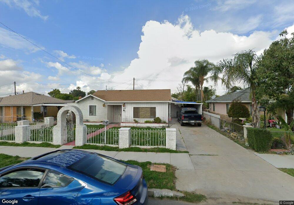
2043 Ohio Ave Colton, CA 92324
Estimated Value: $350,000 - $463,000
3
Beds
2
Baths
1,287
Sq Ft
$321/Sq Ft
Est. Value
About This Home
This home is located at 2043 Ohio Ave, Colton, CA 92324 and is currently estimated at $413,763, approximately $321 per square foot. 2043 Ohio Ave is a home located in San Bernardino County with nearby schools including William Mckinley Elementary School, Colton Middle School, and Colton High School.
Ownership History
Date
Name
Owned For
Owner Type
Purchase Details
Closed on
Oct 24, 2023
Sold by
Herrera Flores Manuel
Bought by
Flores Manuel Herrera and Gonzales Dora Ann
Current Estimated Value
Home Financials for this Owner
Home Financials are based on the most recent Mortgage that was taken out on this home.
Original Mortgage
$100,000
Outstanding Balance
$98,056
Interest Rate
7.18%
Mortgage Type
New Conventional
Estimated Equity
$315,707
Purchase Details
Closed on
Jan 27, 2022
Sold by
Felix Joe H and Felix Georgia M
Bought by
Florez Manuel
Purchase Details
Closed on
May 13, 2021
Sold by
Ramirez Jaime and Ramirez Carmen
Bought by
Ramirez Jaime and Ramirez Maria Carmen
Create a Home Valuation Report for This Property
The Home Valuation Report is an in-depth analysis detailing your home's value as well as a comparison with similar homes in the area
Home Values in the Area
Average Home Value in this Area
Purchase History
| Date | Buyer | Sale Price | Title Company |
|---|---|---|---|
| Flores Manuel Herrera | -- | Atlas Title | |
| Florez Manuel | $285,000 | Orange Coast Title | |
| Ramirez Jaime | -- | None Available |
Source: Public Records
Mortgage History
| Date | Status | Borrower | Loan Amount |
|---|---|---|---|
| Open | Flores Manuel Herrera | $100,000 |
Source: Public Records
Tax History Compared to Growth
Tax History
| Year | Tax Paid | Tax Assessment Tax Assessment Total Assessment is a certain percentage of the fair market value that is determined by local assessors to be the total taxable value of land and additions on the property. | Land | Improvement |
|---|---|---|---|---|
| 2025 | $3,607 | $302,444 | $90,733 | $211,711 |
| 2024 | $3,607 | $296,514 | $88,954 | $207,560 |
| 2023 | $3,530 | $290,700 | $87,210 | $203,490 |
| 2022 | $1,326 | $111,463 | $22,969 | $88,494 |
| 2021 | $1,351 | $109,278 | $22,519 | $86,759 |
| 2020 | $1,356 | $108,157 | $22,288 | $85,869 |
| 2019 | $1,318 | $106,036 | $21,851 | $84,185 |
| 2018 | $1,295 | $103,957 | $21,423 | $82,534 |
| 2017 | $1,248 | $101,919 | $21,003 | $80,916 |
| 2016 | $1,278 | $99,920 | $20,591 | $79,329 |
| 2015 | $1,236 | $98,419 | $20,282 | $78,137 |
| 2014 | $1,192 | $96,491 | $19,885 | $76,606 |
Source: Public Records
Map
Nearby Homes
- 1948 Hunter Rd
- 472 Mill St
- 548 Julie St
- 583 Gray St
- 1736 Pennsylvania Ave
- 1813 Michigan St
- 660 Avenida Capistrano
- 1666 Bryn Mawr Ct
- 201 S Pennsylvania Ave
- 201 S Pennsylvania Ave Unit 1
- 1953 N 8th St
- 1705 Jeryl Ave
- 1844 Alston Ave
- 323 Whipple Mountain Rd
- 813 Johnston St
- 205 Whipple Mountain Rd
- 151 S Muscott St
- 730 W Citrus St
- 410 E Citrus St
- 1765 Alston Ave
- 2053 Ohio Ave
- 2035 Ohio Ave
- 2061 Ohio Ave
- 2025 Ohio Ave
- 2044 Maryland Ave
- 2036 Maryland Ave
- 2054 Maryland Ave
- 2069 Ohio Ave
- 2017 Ohio Ave
- 2026 Maryland Ave
- 2062 Maryland Ave
- 2044 Ohio Ave
- 2054 Ohio Ave
- 2036 Ohio Ave
- 2018 Maryland Ave
- 2070 Maryland Ave
- 2079 Ohio Ave
- 2007 Ohio Ave
- 2062 Ohio Ave
- 2026 Ohio Ave