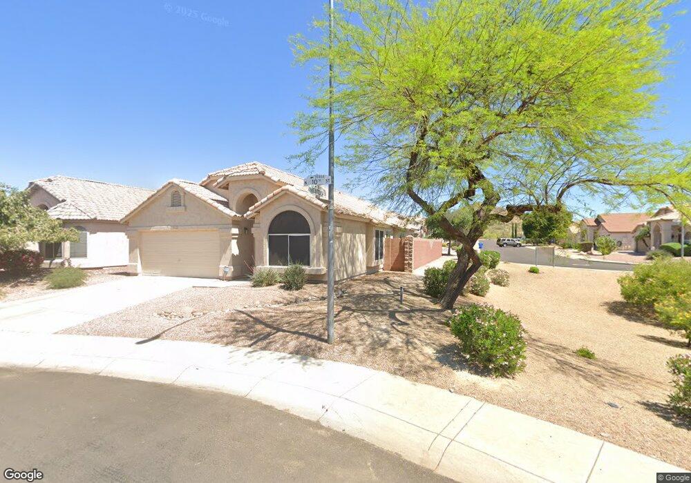
20433 N 10th St Phoenix, AZ 85024
North Deer Valley NeighborhoodEstimated Value: $470,423 - $550,000
--
Bed
2
Baths
1,810
Sq Ft
$290/Sq Ft
Est. Value
About This Home
This home is located at 20433 N 10th St, Phoenix, AZ 85024 and is currently estimated at $524,106, approximately $289 per square foot. 20433 N 10th St is a home located in Maricopa County with nearby schools including Esperanza Elementary School, Deer Valley Middle School, and Barry Goldwater High School.
Ownership History
Date
Name
Owned For
Owner Type
Purchase Details
Closed on
Oct 29, 2014
Sold by
Ferino Paul K
Bought by
Ferino Paul K and The Ferino Living Trust
Current Estimated Value
Purchase Details
Closed on
Feb 24, 2000
Sold by
D R Horton Inc
Bought by
Ferino Paul K
Home Financials for this Owner
Home Financials are based on the most recent Mortgage that was taken out on this home.
Original Mortgage
$119,450
Outstanding Balance
$40,104
Interest Rate
8.16%
Mortgage Type
New Conventional
Estimated Equity
$484,002
Create a Home Valuation Report for This Property
The Home Valuation Report is an in-depth analysis detailing your home's value as well as a comparison with similar homes in the area
Home Values in the Area
Average Home Value in this Area
Purchase History
| Date | Buyer | Sale Price | Title Company |
|---|---|---|---|
| Ferino Paul K | -- | None Available | |
| Ferino Paul K | $151,353 | Century Title Agency |
Source: Public Records
Mortgage History
| Date | Status | Borrower | Loan Amount |
|---|---|---|---|
| Open | Ferino Paul K | $119,450 |
Source: Public Records
Tax History Compared to Growth
Tax History
| Year | Tax Paid | Tax Assessment Tax Assessment Total Assessment is a certain percentage of the fair market value that is determined by local assessors to be the total taxable value of land and additions on the property. | Land | Improvement |
|---|---|---|---|---|
| 2025 | $2,140 | $24,608 | -- | -- |
| 2024 | $2,082 | $23,437 | -- | -- |
| 2023 | $2,082 | $39,480 | $7,890 | $31,590 |
| 2022 | $2,005 | $28,510 | $5,700 | $22,810 |
| 2021 | $2,094 | $26,430 | $5,280 | $21,150 |
| 2020 | $2,056 | $24,630 | $4,920 | $19,710 |
| 2019 | $1,993 | $23,460 | $4,690 | $18,770 |
| 2018 | $1,923 | $22,400 | $4,480 | $17,920 |
| 2017 | $1,857 | $20,650 | $4,130 | $16,520 |
| 2016 | $1,752 | $19,670 | $3,930 | $15,740 |
| 2015 | $1,564 | $18,260 | $3,650 | $14,610 |
Source: Public Records
Map
Nearby Homes
- 922 E Blackhawk Dr
- 20631 N 9th St
- 20616 N 8th St
- 20826 N 10th St
- 758 E Irma Ln
- 1023 E Escuda Dr
- 1313 E Piute Ave
- 1041 E Wickieup Ln
- 1500 E Wahalla Ln Unit W3
- 19440 N 12th St
- 1034 E Sequoia Dr
- 1623 E Runion Dr
- 19601 N 7th St Unit 1024
- 19601 N 7th St Unit 2089
- 19601 N 7th St Unit 1070
- 19601 N 7th St Unit 1056
- 19601 N 7th St Unit 1036
- 19601 N 7th St Unit 2026
- 1741 E Ross Ave
- 1362 E Wickieup Ln
- 20437 N 10th St
- 1014 E Montoya Ln
- 20441 N 10th St
- 20443 N 10th St
- 936 E Montoya Ln
- 1018 E Montoya Ln
- 1013 E Montoya Ln
- 935 E Montoya Ln
- 1103 E Mohawk Dr
- 932 E Montoya Ln
- 20449 N 10th St
- 1017 E Montoya Ln
- 1022 E Montoya Ln
- 933 E Montoya Ln
- 1011 E Mohawk Dr
- 1107 E Mohawk Dr
- 928 E Montoya Ln
- 1021 E Montoya Ln
- 929 E Montoya Ln
- 1007 E Mohawk Dr