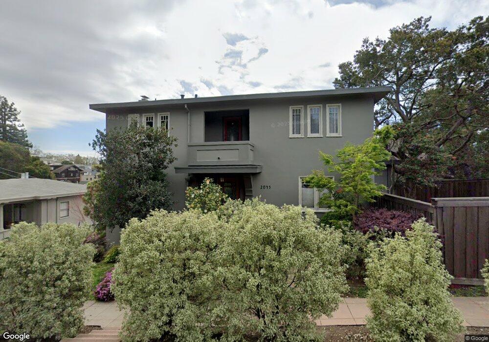
2045 Del Norte St Berkeley, CA 94707
Berkeley Hills NeighborhoodEstimated Value: $1,791,000 - $1,982,000
4
Beds
2
Baths
2,162
Sq Ft
$857/Sq Ft
Est. Value
About This Home
This home is located at 2045 Del Norte St, Berkeley, CA 94707 and is currently estimated at $1,853,008, approximately $857 per square foot. 2045 Del Norte St is a home located in Alameda County with nearby schools including Cragmont Elementary School, Berkeley Arts Magnet at Whittier School, and Washington Elementary School.
Ownership History
Date
Name
Owned For
Owner Type
Purchase Details
Closed on
Apr 10, 2012
Sold by
Wong Sheri Glucoft
Bought by
Wong Sheri Glucoft and Sheri Glucoft Wong Living Trus
Current Estimated Value
Purchase Details
Closed on
Apr 28, 2010
Sold by
Wong Sheri Glucoft and Sheri Glucoft Wong Living Trus
Bought by
Wong Sheri Glucoft
Purchase Details
Closed on
Jun 9, 2006
Sold by
Wong Sheri Glucoft
Bought by
Wong Sheri Glucoft and Sheri Glucoft Wong Living Trus
Create a Home Valuation Report for This Property
The Home Valuation Report is an in-depth analysis detailing your home's value as well as a comparison with similar homes in the area
Home Values in the Area
Average Home Value in this Area
Purchase History
| Date | Buyer | Sale Price | Title Company |
|---|---|---|---|
| Wong Sheri Glucoft | -- | None Available | |
| Wong Sheri Glucoft | -- | None Available | |
| Wong Sheri Glucoft | -- | None Available |
Source: Public Records
Tax History Compared to Growth
Tax History
| Year | Tax Paid | Tax Assessment Tax Assessment Total Assessment is a certain percentage of the fair market value that is determined by local assessors to be the total taxable value of land and additions on the property. | Land | Improvement |
|---|---|---|---|---|
| 2025 | $10,755 | $461,556 | $156,185 | $312,371 |
| 2024 | $10,755 | $452,369 | $153,123 | $306,246 |
| 2023 | $10,449 | $450,361 | $150,120 | $300,241 |
| 2022 | $10,351 | $434,532 | $147,177 | $294,355 |
| 2021 | $10,330 | $425,876 | $144,292 | $288,584 |
| 2020 | $9,669 | $428,437 | $142,812 | $285,625 |
| 2019 | $9,153 | $420,037 | $140,012 | $280,025 |
| 2018 | $8,934 | $411,804 | $137,268 | $274,536 |
| 2017 | $8,609 | $403,729 | $134,576 | $269,153 |
| 2016 | $8,209 | $395,814 | $131,938 | $263,876 |
| 2015 | $8,065 | $389,869 | $129,956 | $259,913 |
| 2014 | $7,893 | $382,233 | $127,411 | $254,822 |
Source: Public Records
Map
Nearby Homes
- 1130 Oxford St
- 1149 Amador Ave
- 1124 Walnut St
- 826 Indian Rock Ave
- 1141 Oxford St
- 971 Santa Barbara Rd
- 815 Spruce St
- 1866 Tacoma Ave
- 1300 Martin Luther King Junior Way
- 1098 Euclid Ave
- 1850 Berryman St
- 962 Regal Rd
- 1175 Colusa Ave
- 715 Santa Barbara Rd
- 1614 Posen Ave
- 1136 Keith Ave
- 1444 Walnut St
- 1730 San Lorenzo Ave
- 1626 Hopkins St
- 1512 Walnut St
- 1 The Circle
- 2039 Del Norte St
- 1011 Fountain Walk
- 1998 Marin Ave
- 2021 Del Norte St
- 2000 Los Angeles Ave
- 2031 Del Norte St
- 2019 Del Norte St
- 2001 Los Angeles Ave
- 2015 Del Norte St
- 2007 Los Angeles Ave
- 1994 Marin Ave
- 2014 Los Angeles Ave
- 2011 Los Angeles Ave
- 2006 Marin Ave
- 1990 Marin Ave
- 2007 Marin Ave
- 1992 Los Angeles Ave
- 2034 Del Norte St
- 2015 Los Angeles Ave