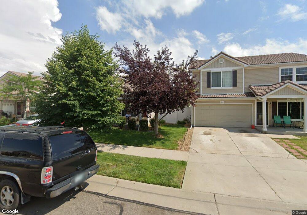
20466 Robins Dr Denver, CO 80249
Green Valley Ranch NeighborhoodEstimated Value: $439,000 - $461,000
2
Beds
3
Baths
1,574
Sq Ft
$287/Sq Ft
Est. Value
About This Home
This home is located at 20466 Robins Dr, Denver, CO 80249 and is currently estimated at $451,166, approximately $286 per square foot. 20466 Robins Dr is a home located in Denver County with nearby schools including Pitt-Waller K-8 School, McGlone Academy, and Marie L. Greenwood Academy.
Ownership History
Date
Name
Owned For
Owner Type
Purchase Details
Closed on
Nov 21, 2005
Sold by
Oakwood Homes Llc
Bought by
Graham Corine and Graham Hattie Mae
Current Estimated Value
Home Financials for this Owner
Home Financials are based on the most recent Mortgage that was taken out on this home.
Original Mortgage
$193,510
Outstanding Balance
$103,612
Interest Rate
6.06%
Mortgage Type
FHA
Estimated Equity
$347,554
Create a Home Valuation Report for This Property
The Home Valuation Report is an in-depth analysis detailing your home's value as well as a comparison with similar homes in the area
Home Values in the Area
Average Home Value in this Area
Purchase History
| Date | Buyer | Sale Price | Title Company |
|---|---|---|---|
| Graham Corine | $196,300 | Town & Country Title Service |
Source: Public Records
Mortgage History
| Date | Status | Borrower | Loan Amount |
|---|---|---|---|
| Open | Graham Corine | $193,510 |
Source: Public Records
Tax History
| Year | Tax Paid | Tax Assessment Tax Assessment Total Assessment is a certain percentage of the fair market value that is determined by local assessors to be the total taxable value of land and additions on the property. | Land | Improvement |
|---|---|---|---|---|
| 2025 | $3,788 | $34,440 | $4,720 | $4,720 |
| 2024 | $3,788 | $29,610 | $800 | $28,810 |
| 2023 | $3,646 | $29,610 | $800 | $28,810 |
| 2022 | $3,203 | $24,060 | $4,030 | $20,030 |
| 2021 | $2,959 | $24,760 | $4,150 | $20,610 |
| 2020 | $3,119 | $23,540 | $4,150 | $19,390 |
| 2019 | $3,070 | $23,540 | $4,150 | $19,390 |
| 2018 | $2,579 | $19,050 | $2,570 | $16,480 |
| 2017 | $3,200 | $19,050 | $2,570 | $16,480 |
| 2016 | $2,515 | $15,190 | $2,484 | $12,706 |
| 2015 | $2,463 | $15,190 | $2,484 | $12,706 |
| 2014 | $1,811 | $11,460 | $2,388 | $9,072 |
Source: Public Records
Map
Nearby Homes
- 20476 Robins Dr
- 20242 E 55th Place
- 5541 Killarney Ct
- 5571 Killarney St
- 20691 Randolph Place
- 5663 Kirk Ct
- 5655 N Killarney Ct
- 5686 N Killarney Ct
- 5688 N Killarney Ct
- 5802 N Perth St
- 5785 N Jericho Way
- 20384 E 53rd Dr
- 20017 March Dr
- 20701 E 52nd Ave
- 5520 Liverpool St
- 20553 E 57th Ave
- 20291 E 57th Ave
- 20231 E 57th Ave
- 20211 E 57th Ave
- 5559 Gibraltar St
- 20456 Robins Dr
- 20486 Robins Dr
- 20455 55th Place
- 20455 E 55th Place
- 20465 55th Place
- 20475 55th Place
- 20477 Robins Dr
- 20485 55th Place
- 20485 E 55th Place
- 20487 Robins Dr
- 20496 Robins Dr
- 20467 Robins Dr
- 20457 Robins Dr
- 20495 55th Place
- 20495 E 55th Place
- 0 Robins Unit 1079164
- 20497 Robins Dr
- 5553 Jebel Ct
- 20506 Robins Dr
- 20445 E 55th Place
Your Personal Tour Guide
Ask me questions while you tour the home.