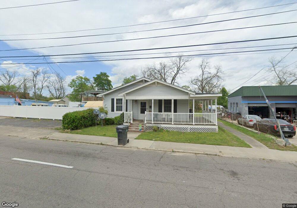
2047 Broad St Augusta, GA 30904
West End NeighborhoodEstimated Value: $120,000
3
Beds
2
Baths
1,760
Sq Ft
$68/Sq Ft
Est. Value
About This Home
This home is located at 2047 Broad St, Augusta, GA 30904 and is currently estimated at $120,000, approximately $68 per square foot. 2047 Broad St is a home located in Richmond County with nearby schools including Lamar Elementary School, W.S. Hornsby Elementary School, and Johnson Magnet.
Ownership History
Date
Name
Owned For
Owner Type
Purchase Details
Closed on
Jul 10, 2015
Sold by
Fulcher David M
Bought by
Mcnair Linda Faye
Current Estimated Value
Purchase Details
Closed on
May 13, 1988
Sold by
Earle T W
Bought by
Mcnair Linda Faye
Purchase Details
Closed on
May 1, 1988
Sold by
Earle T W
Bought by
Mcnair Linda Faye
Create a Home Valuation Report for This Property
The Home Valuation Report is an in-depth analysis detailing your home's value as well as a comparison with similar homes in the area
Home Values in the Area
Average Home Value in this Area
Purchase History
| Date | Buyer | Sale Price | Title Company |
|---|---|---|---|
| Mcnair Linda Faye | -- | -- | |
| Mcnair Linda Faye | -- | -- | |
| Mcnair Linda Faye | $24,000 | -- | |
| Mcnair Linda Faye | $24,000 | -- |
Source: Public Records
Tax History Compared to Growth
Tax History
| Year | Tax Paid | Tax Assessment Tax Assessment Total Assessment is a certain percentage of the fair market value that is determined by local assessors to be the total taxable value of land and additions on the property. | Land | Improvement |
|---|---|---|---|---|
| 2025 | $2,340 | $44,822 | $5,924 | $38,898 |
| 2024 | $2,340 | $45,150 | $5,924 | $39,226 |
| 2023 | $2,051 | $51,811 | $5,924 | $45,887 |
| 2022 | $1,923 | $39,060 | $5,924 | $33,136 |
| 2021 | $1,555 | $18,918 | $5,924 | $12,994 |
| 2020 | $1,392 | $18,918 | $5,924 | $12,994 |
| 2019 | $1,088 | $18,918 | $5,924 | $12,994 |
| 2018 | $1,094 | $18,918 | $5,924 | $12,994 |
| 2017 | $983 | $18,918 | $5,924 | $12,994 |
| 2016 | $983 | $18,918 | $5,924 | $12,994 |
| 2015 | $988 | $18,918 | $5,924 | $12,994 |
| 2014 | $989 | $18,918 | $5,924 | $12,994 |
Source: Public Records
Map
Nearby Homes
- 2025 Ellis St
- 2021 Ellis St
- 2048 Edgar St
- 1918 Division St Unit 3
- 1918 Division St
- 2100 Lake Ave
- 1968 Battle Row
- 1916 Battle Row
- 542 Hickman Rd
- 1918 Walker St
- 1916 Walker St
- 1929 Watkins St
- 608 Eve St
- 1836 Greene St
- 1915 Watkins St
- 501 Milledge Rd Unit 14C
- 501 Milledge Rd Unit 9A
- 501 Milledge Rd Unit 18B
- 605 Eve St
- 1827 Hicks St