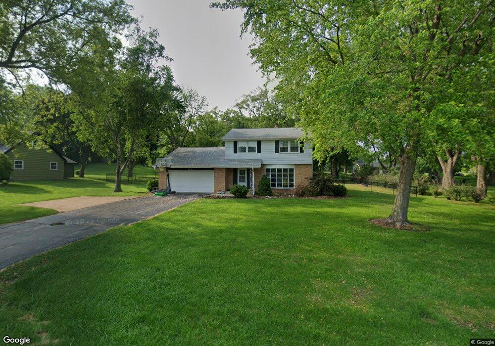
20470 Davidson Rd Waukesha, WI 53186
Brookfield Town NeighborhoodEstimated Value: $444,000 - $461,000
4
Beds
2
Baths
1,876
Sq Ft
$241/Sq Ft
Est. Value
About This Home
This home is located at 20470 Davidson Rd, Waukesha, WI 53186 and is currently estimated at $451,708, approximately $240 per square foot. 20470 Davidson Rd is a home located in Waukesha County with nearby schools including Hillcrest Elementary School, Horning Middle School, and South High School.
Ownership History
Date
Name
Owned For
Owner Type
Purchase Details
Closed on
Aug 27, 2020
Sold by
Oshtourage Properties Llc
Bought by
Netterfield Brian J
Current Estimated Value
Home Financials for this Owner
Home Financials are based on the most recent Mortgage that was taken out on this home.
Original Mortgage
$318,250
Outstanding Balance
$282,426
Interest Rate
2.9%
Mortgage Type
New Conventional
Estimated Equity
$169,282
Purchase Details
Closed on
Jun 5, 2019
Sold by
Reed Klawein Heidi S
Bought by
Oshtourage Properties Llc
Create a Home Valuation Report for This Property
The Home Valuation Report is an in-depth analysis detailing your home's value as well as a comparison with similar homes in the area
Home Values in the Area
Average Home Value in this Area
Purchase History
| Date | Buyer | Sale Price | Title Company |
|---|---|---|---|
| Netterfield Brian J | $335,000 | None Available | |
| Oshtourage Properties Llc | $205,600 | None Available |
Source: Public Records
Mortgage History
| Date | Status | Borrower | Loan Amount |
|---|---|---|---|
| Open | Netterfield Brian J | $318,250 |
Source: Public Records
Tax History Compared to Growth
Tax History
| Year | Tax Paid | Tax Assessment Tax Assessment Total Assessment is a certain percentage of the fair market value that is determined by local assessors to be the total taxable value of land and additions on the property. | Land | Improvement |
|---|---|---|---|---|
| 2024 | $3,211 | $340,500 | $80,400 | $260,100 |
| 2023 | $3,231 | $340,500 | $80,400 | $260,100 |
| 2022 | $3,414 | $340,500 | $80,400 | $260,100 |
| 2021 | $3,691 | $288,300 | $67,000 | $221,300 |
| 2020 | $3,340 | $257,300 | $67,000 | $190,300 |
| 2019 | $3,414 | $257,300 | $67,000 | $190,300 |
| 2018 | $3,099 | $236,400 | $63,700 | $172,700 |
| 2017 | $3,472 | $236,400 | $63,700 | $172,700 |
| 2016 | $2,946 | $213,800 | $63,700 | $150,100 |
| 2015 | $2,970 | $213,800 | $63,700 | $150,100 |
| 2014 | $3,217 | $213,800 | $63,700 | $150,100 |
| 2013 | $3,217 | $212,300 | $63,700 | $148,600 |
Source: Public Records
Map
Nearby Homes
- 745 Hi Ridge Ave
- Lt1 Davidson Rd
- 935 Auburn Ct
- 21525 Belgren Rd
- 1405 S Westwoods Rd
- 1701 S Lilly Ln
- Lt2 Downie Rd
- 2423 Kossow Rd
- 19125 Hi View Dr Unit 125
- 655 Mac Henry Cir Unit B
- 165 Aerie Cir Unit 104
- 165 Aerie Cir Unit 105
- 165 Aerie Cir Unit 102
- 18625 Emerald Cir Unit G
- 18740 Emerald Cir Unit E
- 18525 Emerald Cir
- 18705 Follett Dr
- 950 N Barker Rd
- 2215 Avalon Dr
- 18600 Brookfield Lake Dr Unit 53
- 20510 Davidson Rd
- 20420 Davidson Rd
- 20550 Davidson Rd
- 20525 Catskill Rd
- 20475 Rip Van Winkle Dr
- 20360 Davidson Rd
- 20425 Rip Van Winkle Dr
- 20420 Rip Van Winkle Dr
- 20490 Rip Van Winkle Dr
- 20575 Catskill Rd
- 20590 Catskill Rd
- 20385 Scarlet Hawthorne Rd
- 20615 Catskill Rd
- 20630 Catskill Rd
- 20330 Davidson Rd
- 20655 Catskill Rd
- 585 Rip Van Winkle Dr
- 580 Rip Van Winkle Dr
- 20290 Linden Ln
- 540 Catskill Rd