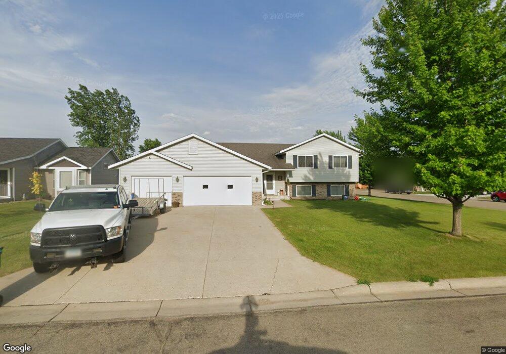
2049 Harbour Oak Dr SE Owatonna, MN 55060
Estimated Value: $350,384 - $396,000
5
Beds
3
Baths
2,786
Sq Ft
$135/Sq Ft
Est. Value
About This Home
This home is located at 2049 Harbour Oak Dr SE, Owatonna, MN 55060 and is currently estimated at $377,096, approximately $135 per square foot. 2049 Harbour Oak Dr SE is a home located in Steele County with nearby schools including Lincoln Elementary School, Owatonna Middle School, and Owatonna Senior High School.
Ownership History
Date
Name
Owned For
Owner Type
Purchase Details
Closed on
Sep 13, 2019
Sold by
Sands Ashley N and Sands Joshua A
Bought by
Boland Jeff
Current Estimated Value
Home Financials for this Owner
Home Financials are based on the most recent Mortgage that was taken out on this home.
Original Mortgage
$244,530
Outstanding Balance
$214,627
Interest Rate
3.7%
Mortgage Type
New Conventional
Estimated Equity
$162,469
Purchase Details
Closed on
Jul 6, 2017
Sold by
Knudson Matthew W and Schwichtenberg Nikkole
Bought by
Sands Joshua A and Sands Ashley N
Home Financials for this Owner
Home Financials are based on the most recent Mortgage that was taken out on this home.
Original Mortgage
$227,735
Interest Rate
3.89%
Mortgage Type
FHA
Purchase Details
Closed on
Oct 2, 2013
Sold by
Knudson Matthew W and Knudson Erin R
Bought by
Knudson Matthew W
Purchase Details
Closed on
Sep 7, 2007
Sold by
Partners
Bought by
Knudson Matthew W and Knudson Erin R
Home Financials for this Owner
Home Financials are based on the most recent Mortgage that was taken out on this home.
Original Mortgage
$29,140
Interest Rate
6.63%
Mortgage Type
Unknown
Create a Home Valuation Report for This Property
The Home Valuation Report is an in-depth analysis detailing your home's value as well as a comparison with similar homes in the area
Home Values in the Area
Average Home Value in this Area
Purchase History
| Date | Buyer | Sale Price | Title Company |
|---|---|---|---|
| Boland Jeff | $257,400 | North American Title | |
| Sands Joshua A | $229,900 | North American Title | |
| Knudson Matthew W | -- | -- | |
| Knudson Matthew W | $194,278 | North American Title Company | |
| Partners | -- | North American Title Company |
Source: Public Records
Mortgage History
| Date | Status | Borrower | Loan Amount |
|---|---|---|---|
| Open | Boland Jeff | $244,530 | |
| Previous Owner | Sands Joshua A | $227,735 | |
| Previous Owner | Knudson Matthew W | $29,140 | |
| Previous Owner | Knudson Matthew W | $155,420 |
Source: Public Records
Tax History Compared to Growth
Tax History
| Year | Tax Paid | Tax Assessment Tax Assessment Total Assessment is a certain percentage of the fair market value that is determined by local assessors to be the total taxable value of land and additions on the property. | Land | Improvement |
|---|---|---|---|---|
| 2025 | $4,458 | $321,500 | $51,800 | $269,700 |
| 2024 | $4,566 | $313,000 | $49,500 | $263,500 |
| 2023 | $4,576 | $310,200 | $46,400 | $263,800 |
| 2022 | $4,050 | $296,400 | $44,100 | $252,300 |
| 2021 | $3,862 | $239,022 | $42,336 | $196,686 |
| 2020 | $3,764 | $226,380 | $42,630 | $183,750 |
| 2019 | $3,406 | $212,660 | $37,338 | $175,322 |
| 2018 | $3,298 | $205,506 | $37,338 | $168,168 |
| 2017 | $3,458 | $199,136 | $33,712 | $165,424 |
| 2016 | $3,370 | $183,260 | $33,712 | $149,548 |
| 2015 | -- | $0 | $0 | $0 |
| 2014 | -- | $0 | $0 | $0 |
Source: Public Records
Map
Nearby Homes
- 2104 Harbour Oak Dr SE
- 632 17th St SE
- 2205 4th Ave SE
- 725 Escalade Ln SE
- 506 15th St SE
- 805 22nd St SE
- 763 16th St SE
- 2100 Richway Ln SE
- 855 22nd St SE
- 609 13th St SE
- 829 Escalade Ln SE
- 859 Escalade Ln SE
- 865 Escalade Ln SE
- 2080 La Casa Ln SE
- 633 11th St SE
- 2463 Austin Rd
- 1212 S Grove Ave
- 1120 Esther Ln
- 317 Havana Rd
- 203 E Mckinley St
- 2057 Harbour Oak Dr SE
- 618 Birchwood Ln SE
- 625 Birchwood Ln SE
- 607 Birchwood Ln SE
- 2065 Harbour Oak Dr SE
- 2095 Harbour Oak Dr SE
- 2048 Harbour Oak Dr SE
- 2056 Harbour Oak Dr SE
- 623 Birchwood Ln SE
- 2103 Harbour Oak Dr SE
- 2032 Harbour Oak Dr SE
- 2064 Harbour Oak Dr SE
- 2017 Harbour Oak Dr SE
- 631 Birchwood Ln SE
- 2024 Harbour Oak Dr SE
- 2147 Harbour Oak Dr SE
- 2139 Harbour Oak Dr SE
- 2088 Harbour Oak Dr SE
- 2016 Harbour Oak Dr SE
- 2131 Harbour Oak Dr SE